
On a gray day with drifting flurries, Mark Klim and I made a bushwhack
traverse over this low but rugged neighbor of Welch and Dickey
Mountains, enjoying some fine views along the way.
From
the Welch-Dickey trailhead we followed the Brown Ash Swamp Mountain
Bike Trail (which was once the Dickey Notch [hiking] Trail) into Dickey
Notch, the scenic gap between Dickey and Cone Mountains. Several small
beaver ponds are strung along the floor of the notch.

Mark surveys the northernmost pond.

Blowdown from the October 30 storm. The notch must have been like a wind tunnel.

Fine hardwood forest and rock scenery along the trail.
Bushwhacking through open hardwoods to the saddle between Cone Mountain and its northern spur.

Bear nest in a beech tree. It's not a nest in the sense that a bear lives there. The bear gathers branches and feeds on beech nuts.

Massive twin oaks.

Looking up at Cone Mountain from the ledgy knob of the northern spur.

Peering out from a clifftop on the brink of Dickey Notch.

Nice hardwoods on the saddle.

An old bear tree.

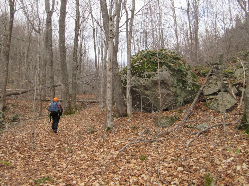
We climbed past this enormous rock in the forest.

The view from the top of the rock.

A steep climb brought us up onto the main mass of Cone Mountain.

Looking back.

The best viewpoint on Cone Mountain is this lichen-festooned ledge at the top of its steep north face. (As always, we placed steps carefully to minimize trampling.) This spot provides a sweeping view of the many southern spurs of Mt. Tecumseh.

Ledgy Fisher Mountain with West Tecumseh, Mt. Tecumseh and Green Mountain beyond. The remote Shattuck Brook valley is to the right of Fisher.


Looking down on the knob of Cone's northern spur.

The wide-spreading ridges of Sandwich Dome.

We
bushwhacked south up the ridge to this ledge near the summit of Cone
Mountain. This is one of the finest examples of cairn art we've seen.
The ledginess of Cone Mountain is the legacy of an intense forest fire
in the area around 1820.

This higher perspective added Mt. Whiteface to the view.

Another angle on Sandwich.

Mark signed us in at the summit register for this 2000-footer.

From the summit we followed an obscure and rough path down the ridge to Cone Pond, passing this south-viewing ledge along the way.

We took a break on this wonderful ledge on the shore of Cone Pond, which looked almost frozen enough to walk upon. (We did not test the ice.) For many years this pond and its watershed have been intensively studied by U.S. Forest Service scientists. It is highly acidic and reportedly supports no fish life.

The tops of Welch and Dickey can be seen by the outlet at the south end of the pond. From here we fashioned a curving and sometimes scrappy bushwhack route on WMNF land down to Orris Road, south of the Welch-Dickey trailhead, getting out just before dark.

No comments:
Post a Comment