
MOUNT CRESCENT/POND OF SAFETY LOOP: 7/12/16
On a very warm and sunny Tuesday I enjoyed a 10-mile loop through the hinterlands of the Crescent Range in Randolph. The route followed wild trails with lots of interesting scenery and not a single hiker encountered along the way. All of these Crescent Range paths are trails maintained by the excellent Randolph Mountain Club.
I started at this kiosk at the new trailhead parking area at the end of Randolph Hill Road, in the 10,000 acre-Randolph Community Forest.

I started out by crossing the old Jimtown Logging Road, which can be used as a shortcut between several trails when doing loop hikes.

The new Peek Path connects the trailhead with the Mount Crescent Trail and Cook Path. It is named for early Randolph trail-builder William H. Peek, and is just as he would have liked it, rough and rocky.

I followed the Peek Path over to the Cook Path (named for Eugene B. Cook, another famed trail builder), passing this view of the Carters from the top of a logging cut.

Castleview Rock, accessed by a short scramble, is one of many interesting features found along the paths of Randolph. Tree growth has mostly obscured the view.

The upper part of the Mount Crescent Trail is steep, wild and wonderful.

Fern glade on a shoulder of Mount Crescent.

This rather tricky scramble leads up to the south viewpoint atop Mount Crescent.

This sun-warmed ledge gazes across to the Northern Presidentials.

Mounts Madison, Adams and Jefferson.

Mount Jefferson and the long ridge leading down over the Castles to Mount Bowman.

The bumpy Howker Ridge is perhaps the most interesting route to Mount Madison.

King Ravine and Mount Adams.
The new 9th edition of the Randolph Paths guidebook was released early this month.

Beautiful fir woods on the summit crest.

A real treat on Mount Crescent is the unusual northerly view.

A longtime personal favorite, this spot offers a marvelous panorama of the Pliny and Pilot Ranges in The Kilkenny.

Here you can follow the route of the Kilkenny Ridge Trail, which traverses some of the most beautiful woods in the Whites.

A closer look, stretching from Mount Pliny across to The Horn.

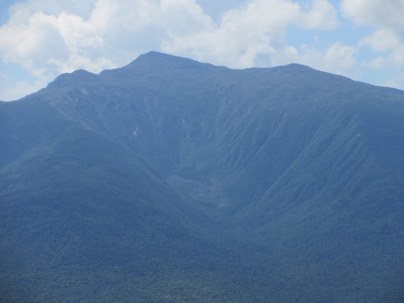
The wild, trailless Black Crescent Mountain.

A few years ago John "1 Happy Hiker" Compton and I snowshoe-bushwhacked to the talus slope seen in the center. A very neat spot.

Parting shot. It was hard to leave, but I had 8 miles to go.

Nice walking on the Crescent Ridge Trail.

From the ridge I made a long down-and-up loop to the lovely Pond of Safety using the Underhill Path and Four Soldiers Path. I had first walked these when they were nearing completion by RMC in 2002. It was time for a return visit.

Wild and lush.

Down near the bottom, sedges have taken over where the trail passes through an extensive wetland area.

A meadowy wetland.

A fairly rough (though recently upgraded) Forest Service road leads to a parking area just above the Pond of Safety. From the parking area a new graded accessible path leads down to the shore.

The path ends at this picturesque spot. Here I encountered the only two people of the day, who had driven their jeep to the pond. Unfortunately they had two aggressive dogs who the owner couldn't, or wouldn't, control, so I didn't stay long here. Not what I was hoping for after hiking five miles to the pond!

A half-mile obscure fisherman's path/bushwhack combo brought me around to the northeast shore of the pond, where there are watery views of the Crescent Range and Northern Presidentials.

I worked around to a spot where all three Northern Peaks were visible. The name "Pond of Safety" dates back to the American Revolution, when four soldiers of the Continental Army who were unjustly accused of desertion sought refuge at this lonely backwater.

A scenic backdrop for two guys fishing in a rowboat.

The shoreside opening where I stayed for a while.

On the way back, a found a vista of Mount Crescent, from where I had looked down on the pond earlier in the day.

Much of the Crescent Range is visible here.

The loop junction on the way back from the pond.

The 3.8-mile Four Soldiers Path offers mostly easy-graded walking back over the flank of the Crescent Range, but it does present an intermittent quarter-mile of this - totally overgrown areas that were salvage-logged after the devastating 1998 ice storm.

Not a good section to walk through on a wet day!

A giant yellow birch near the crest of the ridge.

After lumbering in the early 1900s, this spot atop the ridge provided a unique vista of Mount Washington's summit just peering over Edmands Col. There's no view here anymore.

Not far below, though, a side path leads to this look at the Northern Peaks.

Mount Jefferson displaying the headwall of Castle Ravine and the Castellated Ridge.

Mount Adams and the great scoop of King Ravine.

One final framed view from a rock farther down the trail, wrapping up a rewarding day on the Randolph paths.

Excellent posting, Steve, about an area that is less-visited, probably in large part due to the very popular Presidential Range being literally right across the street! Your text and photos do a great job of providing the recognition that the Crescent Range unquestionably deserves.
ReplyDeleteAnd finally, yes I fondly remember our snowshoe bushwhacking adventure several years ago to the talus field on Black Crescent Mountain.
John
Thank you, John! Yes, the Crescent Range is, and perhaps always will be, a "local's favorite." Incidentally, a 2782-ft. spur SW of Mt. Randolph has been christened "Mt. Lowe" on the new RMC map. And they are planning to open a trail to an old crystal mine farther west along the range, maybe this summer.
DeleteSteve