
FRANKENSTEIN CLIFF/RIPLEY FALLS LOOP: 7/5/16
Valley trails opened in recent years by Crawford Notch State Park staff now make it possible to do a loop hike to Frankenstein Cliff and Ripley Falls with just a wee bit of road walking. On this late afternoon/evening ramble on a hot (but not too humid) day, I started at the Frankenstein Trestle historic marker and followed a quarter-mile of Rt. 302, the Frankenstein Cutoff, Frankenstein Cliff Trail, Falcon Cliff side trail, Arethusa-Ripley Falls Trail, Ethan Pond Trail, the road down to Rt. 302, Webster Cliff Trail, Saco River Trail, Maggie's Run, and Maggie's Extension. The loop is a bit under 8 miles with 1900 ft. of elevation gain. It offers a fine variety of scenery. Kudos to park manager John Dickerman (Mike's brother) and his staff for developing this great trail system in the Notch!
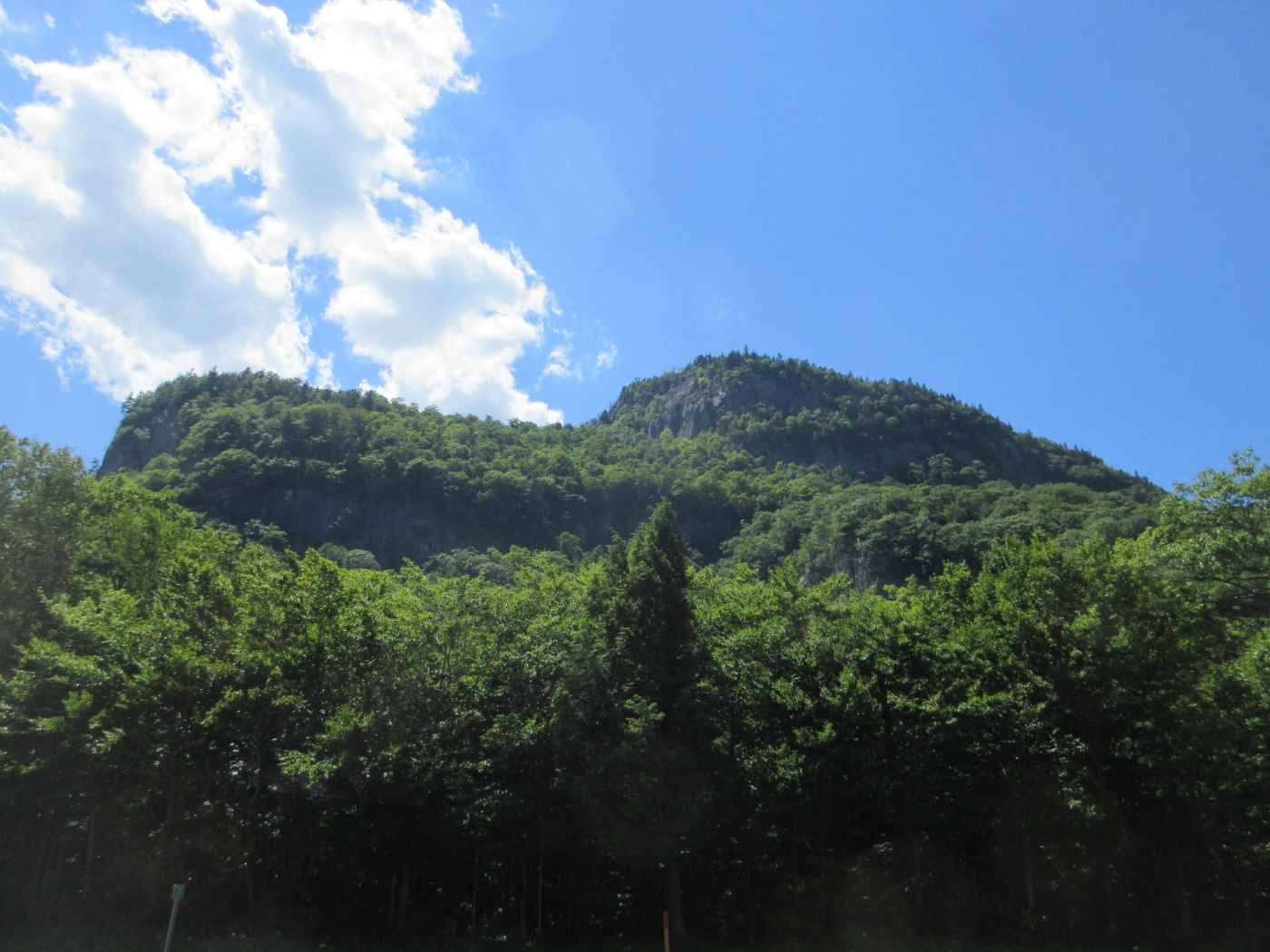
You get this view of Frankenstein Cliff from Rt. 302 by the entrance to the Dry River Campground.
This short new trail connects Rt. 302 near Dry River Campground with the Frankenstein Cliff Trail.

This sign marks where a former link trail came up a steep slope from Rt. 302.

The Frankenstein Cliff Trail passes under Frankenstein Trestle. A beaten path leading up to it will tempt hikers, but trespassing on it is illegal and dangerous.

The first of two rock faces that tower above the Frankenstein Cliff Trail.

The second rock face.

The trail is gravelly and slippery along the steep climb under the cliffs. Better for ascent than descent.

Window view from the base of the second rock face, to Mount Resolution, Crawford Dome and Mount Crawford.

The main outlook (elevation 2150 ft.) atop Frankenstein Cliff overlooks the Saco River valley. On the floor of the valley are the Saco River, Rt. 302 and the railroad.

Nearby Mount Bemis, with the glint of Arethusa Falls at the head of the Bemis Brook valley.

A serious dropoff in front.

Stairs, Resolution and Crawford.

Mount Resolution displays some of its gravel patches.

Farther up the trail, a 0.2 mile side path climbs up and around to "Falcon Cliff," elevation 2400 ft.


The Saco valley from a higher perspective.

Bear, Chocorua through Bear Notch, Bartlett Haystack, Paugus, Tremont, and Passaconaway just peeking out.


Mount Washington and the headwall of Oakes Gulf from a trailside ledge at the "summit" of Frankenstein Cliff.

Mount Isolation and the various humps of Mount Davis.

Nice state park trail signs.

The Arethusa-Ripley Falls Trail traverses a wild plateau behind Frankenstein Cliff.

The trail is narrow and rooty as it clings to a steep sidehill descending towards Ripley Falls.

The ledge steps in the center allow (careful) access to the broad ledges at the top of Ripley Falls. The ledge slabs were dry today, but could be hazardous if wet.

Looking down from the top of Ripley Falls.

A cascade and pool on Avalanche Brook above the falls.

Webster Cliffs from the top of the falls.

Even with low water, Ripley is impressive.

Bridge over the Saco River on the Webster Cliff Trail.

In 2007-2008 the AMC 4000-Footer Club donated $14,000 for the construction of this bridge in memory of the one of the club's founders.

Stillwater on the Saco River.

Frankenstein Cliff seen across a large beaver meadow near the Saco River Trail.

Fern glade at the edge of the meadow. There is a fine stand of mature hardwood behind the meadow.

Silhouette of Mount Willey from the far end of the meadow.

The last link in the loop, completed by headlamp, followed Maggie's Run and the new Maggie's Extension on a scenic route alongside the Saco River.

No comments:
Post a Comment