
CARR MOUNTAIN WATERFALLS: 5/6/16
This Friday was a two-part hiking day: after doing a five-hour trail work trip on the Hurricane Trail at the base of Mount Moosilauke, I drove over to Warren for a late afternoon/evening adventure. I took the Carr Mountain Trail and a spur to Waternomee Falls, then bushwhacked up Clifford Brook to several more waterfalls and features described by writers in the late 1800s.
Here is the 100-foot waterbar on my adopted section of the Hurricane Trail (between Gorge Brook Trail and the Carriage Road).When building drainages, the Dartmouth Outing Club goes all out!

It's trout lily season in the hardwoods!

Beautiful spring scene along the Hurricane Trail, which in this section follows an old road roughed out by the Dartmouth Outing Club in the 1930s for access to the Ravine Camp from the Carriage Road.

A beech blowdown before...

...and after.

It's the last season for the old Ravine Lodge, which will be torn down and rebuilt starting this fall.

Carr Mountain from Rt. 25 in Warren. The ravine I explored is in the center-left.

A quarter mile above its start on Clifford Brook Road, the Carr Mountain Trail crosses a field by a house, with the mountain in sight ahead.

A different kind of historic artifact. Also a geocache site.

The start of the spur trail to Waternomee Falls, a mile up the Carr Mountain Trail.

A fine cascade at the spur trail's crossing of the south branch of Clifford Brook. I found another geocache here.

Waternomee Falls, seen from a spot just off the end of the spur path. Still another cache to find. From here I bushwhacked up along Clifford Brook, slowly and carefully due to rocks and holes in places.

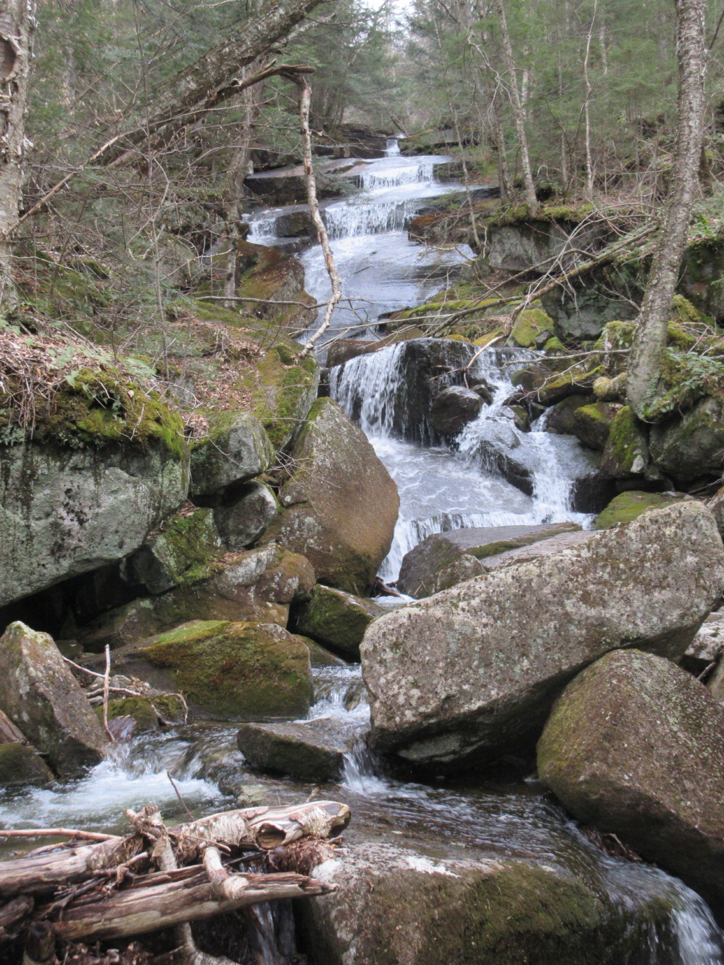
The next cascades upstream.

"Bear Slide Cascade," a name that appeared in an 1888 article by J.H. Hillman that was reprinted in historian Robert Averill's The Moosilauke Reader, Vol. Two. Maybe my all-time favorite waterfall moniker. During their exploration, Hillman's friend slipped and "came uncomfortably near taking a slide as some careless bear is imagined to have done."

Another angle.

Relaxing briefly at the top of the cascade.

This may be what was called "Middle Cascades" by William Little in his 1870 History of Warren.

Next I came to the base of the biggest waterfall, called both "Hurricane Falls" and "Silver Cascades."
Presumably this is what J.H. Hillman called "Diamond Rock."

Higher up I found a perch with a close view of the main drop of Hurricane Falls. I had done this bushwhack on a hot, humid day in 2008 when the flow was meager. The falls were much more impressive today.

Looking down on Diamond Rock.

A bird's-eye view.

This might have been J.H. Hillman's "Table Rock."

At the top is a cascade that might be what writers called "Wolf's-Head Falls."

A view from the top. The combined Hurricane-Wolf's Head Falls drop a good 150 ft. in elevation.

Lingering ice in a crevice.

The cascades kept coming.

This pothole was called "Diana's Wash Bowl." Supposedly surveyor Benjamin Leavitt stopped by here in 1765 when laying out the town boundary for Warren.

This might be the "curious grotto" that Hillman called "Devil's Den."

I continued up to "The Harrows," where two branches of the brook join. In their 1880s exploration, J.H. Hillman and friend continued up along the left branch of the brook for a rough bushwhack up to the top of Carr Mountain.

Here I exited the ravine and bushwacked down a broad ridge through open hardwoods, passing this interesting boulder.

The downhill bushwhacking was excellent, far easier than the gnarly terrain in the ravine.

A cascade on the south branch of Clifford Brook, perhaps there are more along this stream for another exploration.

No comments:
Post a Comment