
MEANDERING ABOVE HOBBITLAND: 11/9/15
I spent a sunny afternoon bushwhacking around the area above Champney and Pitcher Falls and the cliffs called "Hobbitland" by rock climbers. On these northern slopes of Mount Chocorua I found views and some very interesting water and rock features. Late in the morning I set off on the Champney Falls Trail.

A view of Champney Brook along the trail.

Fine rock step work at the junction with the lower end of the falls loop trail, 1.4 miles from the trailhead.

The falls loop passes this nice cascade and pool before reaching Champney Falls.

The lower drop of Champney Falls.

The thin veil of Pitcher Falls plunges into its flume.

After following a climber's path for a short distance, I began bushwhacking above the top of Pitcher Falls, with a look up at the steep slope of Hobbitland.

This rock face borders the brook above Pitcher Falls.

A hint of a rainbow in an upper cascade.

The brook slides over a big slab here.

I climbed steeply up the slope above that cascade.

Rugged terrain in here.

Looking down a waterslide.

A glimpse of the main Hobbitland cliff.

Man and dog, nose-to-nose.
Whacking through scrubby hardwood growth to the crest of the ridge.

I visited a few view spots on the knob above Champney Falls and Hobbitland, including this one with a peek into the upper basin of Champney Brook.

Looking up at the Three Sisters ridge.

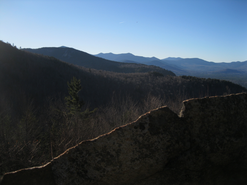
This open ledge area was my main objective, and it held some real surprises. From the top was a view out to Mount Carrigain, the Hancocks, and other peaks to the north and west.

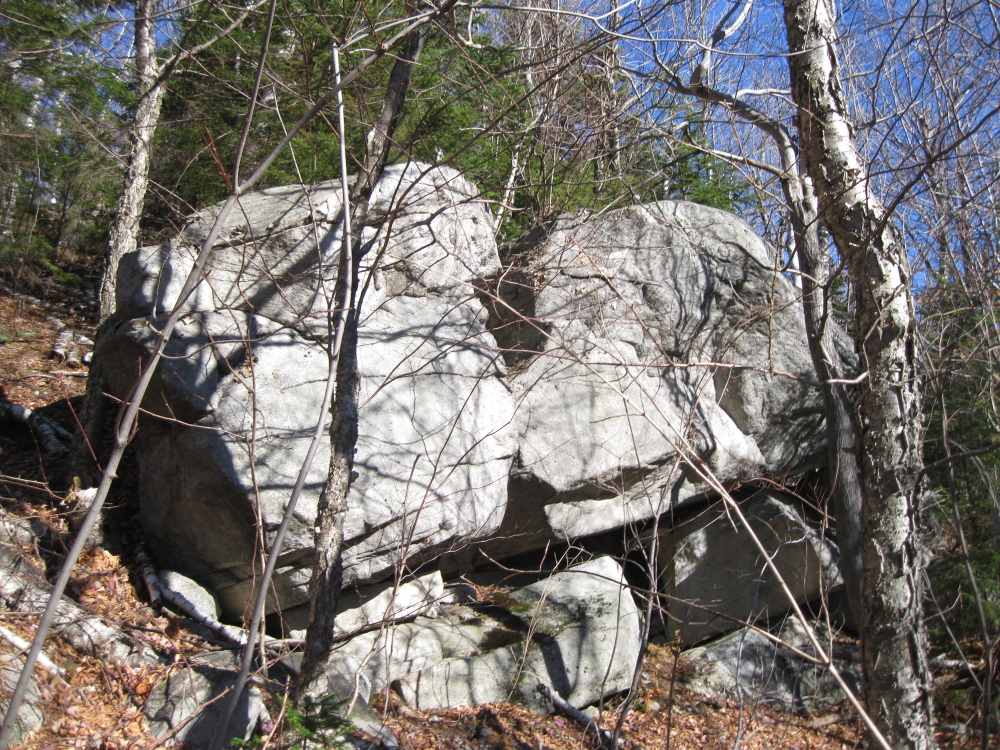
I knew there would be views, but what I didn't expect was an amazing complex of huge, frost-riven rocks and deep, shadowy crevices.

This one goes way down.

An airy rock island with its own mini-forest.

The westward view.
Peering down into the largest crevice.

I bushwhacked down and around and walked into the big crevice.

The floor of the crevice.

End of the line for this one.

A little hardwood plateau at the base of the ledges.

Jagged rocks a-plenty.

Heading into another deep cut.

A narrow passageway.


Rock pillars.

I climbed to a higher ledge, with a good view to Passaconaway and Tripyramid.

Looking northeast to Mount Washington.

Northward vista to Mount Tremont and the Nancy Range.

From a ledge on the SE side of the knob, a look at Blue Mountain, another spur of Chocorua, seen across the basin of Steam Mill Brook.

Late light on the Sisters.

On the bushwhack back to the trail, I passed this cascade and pool on the Pitcher Falls brook. It was another interesting day spent exploring the diverse terrain of the Sandwich Range.

I really enjoyed this post. I find rock formations, glacial erratics, and frost broken rock to be very interesting. Looks like a great day.
ReplyDeleteThanks, Nick. The jagged rocks and deep crevices at this ledge were an unexpected treat.
DeleteSteve
Very nice Steve. I think you may know I went up in there a couple years ago. I didn't know it was called "Hobbitland". I also just kept going higher to look for more views. The "Views Whore" in me won out over the "Explorer". Looks like that was a mistake. :( Very cool stuff.
ReplyDeleteThanks for sharing,
Joe
Hi Joe,
DeleteJust looked at your excellent 2014 report. You took the direct route! I'd been up on that knob a couple times before but had never gone down to the ledge area with the crevices. The view on that upper ledge (with the fire ring( has grown up since the 90s, as has the view on the ledge on the south side, which 10 years ago had a clearer view of Blue Mountain across the Steam Mill Brook basin. Lots of places to explore in that area!
Steve