
SABBADAY FALLS & BOULDER LOOP: 10/17/14
My brother Drew and sister-in-law Kate were up for a visit, and after some morning rain we headed across the Kancamagus Highway for two short hikes and their introduction to geocaching. We stopped at the Sugar Hill Overlook for the day's first cache and admired the view of Green's Cliff.

Kate taking in the vista after snagging her first cache.

Potash Mountain and Mt. Passaconaway.

Then it was on to Sabbaday Falls, where Drew takes a look at the lower pool.

A vintage interpretive sign.

After 2 1/2" of rain the previous day, the falls were roaring.

Looking through the spray.

The logbook from one of two caches we found above the falls.

Sabbaday Brook, above the falls.

Our turnaround point was the trail's first crossing of the brook, 0.7 mile from the trailhead.

Next we headed east to the Boulder Loop Trail, a great three-mile circuit hike with wonderful views at the top. On the lower part we climbed on a golden carpet.

There is lots of interesting rock scenery on this trail.

The woods were glowing!

Taking in the first view over the Swift River valley, with White Ledge in the distance.

This is one of the best hikes in the Whites for late-season foliage.

Looking ahead to the upper cliffs.

A serious dropoff to the talus at the base of this cliff.

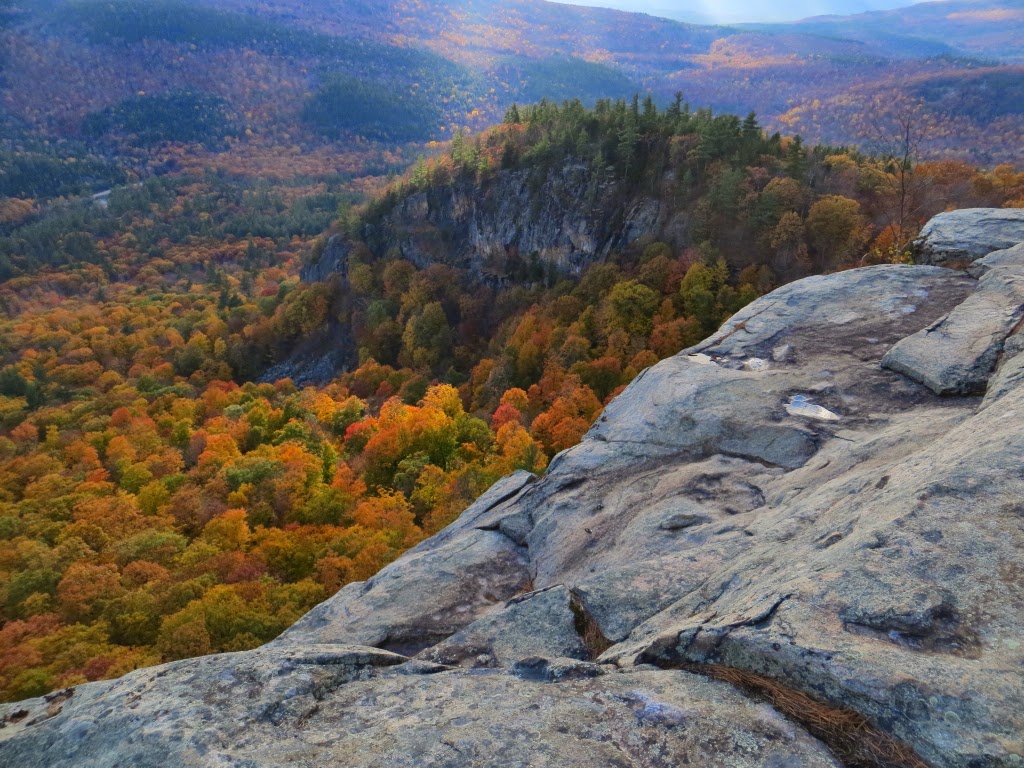
The view from the upper cliffs, reached by a 0.15 mile spur trail.

Drew & Kate enjoying a glorious October afternoon.

From behind the cliffs, a view of Middle and South Moat.


Looking back to the lower cliff we were on earlier.
Profile of the backlit Sandwich Range.

Drew & Kate at a neat boulder formation along the bottom of the return loop. Near here was the sixth geocache we found along the Boulder Loop Trail. What a fun hike!

PASSACONAWAY CUTOFF & NANAMOCOMUCK SLIDE: 10/20/14
A few days later I headed up for a fall maintenance trip on Passaconaway Cutoff, the adopted trail of the Four Thousand Footer Committee. The main task today was hoeing out the 45 or so drainages along the 1.7 mile trail. On this lower hardwood section there was still some late beech color.

A cascade on the west branch of Oliverian Brook, a break spot a little more than halfway through the trail.

Looking up the west branch, which an older route of the trail followed more closely from here up to the Square Ledge Trail.

It was a clear and crisp October day, so upon finishing the drainage work at 3:00, I opted to continue 0.3 mile up the Square Ledge Trail to enjoy a view from the slide on the north side of Nanamocomuck Peak.

Along the way the trail passes through the site of a remote logging camp of the Conway Lumber Company in the early 1900s. There are still a few artifacts scattered about, including this sled runner.

Perhaps these were pieces of an old wood stove? Please remember that it is illegal (and unfair to fellow explorers) to remove such artifacts from the National Forest.

The trail runs right along the base of the slide.

A very short scramble up the right side of the slide rewards with a fine view to the north.

Hedgehog Mountain and the East Ledges, with Mt. Washington in the distance between Mt. Tremont and Bartlett Haystack.

The Wildcats and Carter Dome through Bear Notch.

Looking up at a steep shoulder of Mt. Passaconaway. As I was relaxing here, I was joined by Ira Orenstein, Karen Bloom, and their son, avid hikers from New York and longtime customers at my store, who were coming down from Mt. Passaconaway. We hung out for a while, then enjoyed a nice hike out together, the last mile by headlamp.

No comments:
Post a Comment