
PISGAH STATE PARK: 4/29/14
On a raw spring day I made the long drive down to the far southwestern corner of NH to check some trails in Pisgah State Park. At 13,000 acres this relatively unknown park is the largest property in the state park system. It's a gem, with beautiful hemlock forests, many ponds and wetlands, and the scenic Pisgah Ridge with several ledge viewpoints. There's somewhere around 60 miles of trail in the park, many of which are old woods roads that double as snowmobile trails (and, in a few cases, as ATV trails); others are narrower footways that are restricted to foot travel only. A variety of shorter and longer loop hikes can be fashioned from the trail system.
I parked at the major Kilburn Road trailhead on Route 63 a couple miles south of Chesterfield village. New kiosks have been placed here and at several other Pisgah trailheads.

I walked in 0.8 mi. on Kilburn Road and turned left onto a woods road shown as the "Town Forest Trail" on the trail map displayed on the state park website. I thought we might add this to our trail descriptions in the AMC Southern New Hampshire Trail Guide. But this sign at the start of the trail did not bode well.

The "Town Forest Trail" was a clear wood road for 0.7 mile, but then it became extremely obscure and nearly impossible to discern. I ended up following a succession of vague paths, passing by this interesting formation, and ended up at the junction of the Baker Pond and Pisgah Ridge Trails.

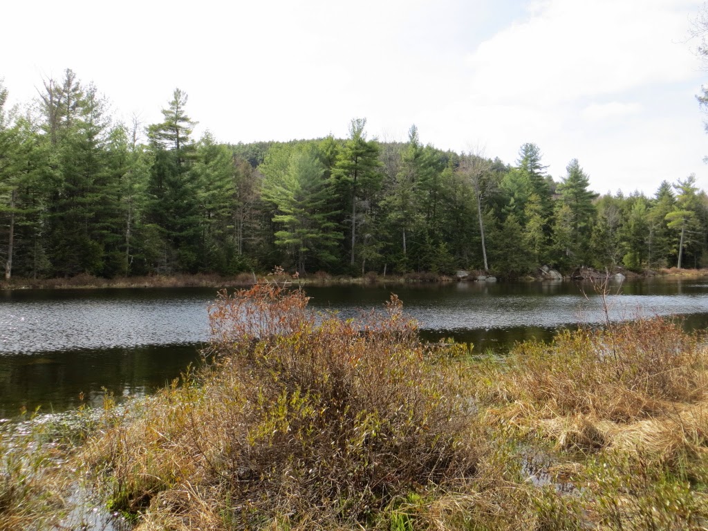
Side paths off the Baker Pond Trail provided nice views of this backcountry beauty.


Another objective of today's trek was to visit a new lean-to, completed just last December by the Friends of Pisgah (FOP), a volunteer group that does most of the trail maintenance in the park. (Pisgah has historically been starved for state funding, and has no full-time, year-round staff.) The lean-to is located on a parcel owned by FOP just outside the park. It took some wandering and sleuthing, but eventually I found a roughed-out, flagged access path to the lean-to leaving a snowmobile spur loop off the Davis Hill Trail.

It's a nicely built shelter on the west slope of Hubbard Hill. The hope is that backpackers will use it while traversing the Wantastiquet-Monadnock Greenway across southwestern New Hampshire.

Kim Nilsen of Cohos Trail fame was involved with this project, and I believe he designed the cool-looking privy.

From the lean-to I followed a flagged path up to the west-facing vista on a short loop off the Hubbard Hill Trail. This view has grown up considerably since I last saw it 10 years ago, though Stratton Mountain can still be seen.

A rustic seat is provided at the vista. Coming down off the easy-graded vista loop a momentary lapse of attention led to a sudden tumble and a sprained left ankle. It's disconcerting how easily and quickly this can happen. I took it slow for the remaining 7 miles of my 11 3/4 mile loop. Luckily most of the Pisgah trails are gentle in nature, with generally decent footing.

I descended the Baker Pond Trail and turned south onto the Reservoir Trail, one of the woods road type of route.

I was looking forward to a visit to North Round Pond, located on a spur off the Reservoir Trail.

I was not disappointed. This is a quiet, secluded beauty spot. Tree Sawllows were swarming above the water, and from the woods behind the shore I heard my first Black-throated Green Warbler of the spring.

Farther down the Reservoir Trail a side path led to the shore of a nameless, lovely pond, with the ridge of Mt. Pisgah peering over in back.
A longer view down the pond.

By the north end of Pisgah Reservoir I turned onto the Pisgah Ridge Trail, the best hiking route in the park.

This quickly passed a view of the northern arm of the reservoir.

An inviting path paraellelling the shore of the reservoir.

Then the trail climbs up the low ridge, at first shadowing a mossy stream.

Open hemlock forests are the rule at Pisgah, even up on the ridge.

The first viewpoint heading north is called "Parker's Perch."

It's a nice open east-facing ledge. Unfortunately clouds had settled atop the summit of Mt. Monadnock, seen in the distance on the left.

It was a raw, chilly day, but comfortable enough to sit for at least one boot shot.

To the south was the far end of Pisgah Reservoir.

The trail continued over a knoll and down to a hardwood col.

More hemlocks coming down off the wooded summit of Mt. Pisgah (1329 ft.).

The next knob along the ridge is ledgy with pines.

I soon came to the "Mount Pisgah Vista."

Hikers have built some creative cairns here.

This spot has views both east to Monadnock...

...and west to southern Vermont.

I could faintly make out Haystack Mountain and Mount Snow.

Some type of mountain laurel [?] beyond the vista.

Nice Pisgah State Park trail sign.

On the way out, I followed a side path to a pretty view of the north part of Kilburn Pond, perhaps the finest water body in the park. Pisgah State Park is a true New Hampshire treasure.

I have only been to Pisgah once, to run the 50k trail race in September, and it was an amazing place. Hard to believe that a patk that big can be a hidden gem!
ReplyDeleteHi Kevin - It is a really neat place, and has a "big park" feel. I guess its out-of-the-way location keeps it relatively "unknown."
DeleteSteve
Ouch! Hope that ankle is feeling better, Steve.
ReplyDeleteThanks, Steve - it's getting there. Went on a short hike Friday and planning another one later this afternoon.
DeleteSteve