
...in a nearly snow-free first half of the month.
#1) PEMI TRAIL
A pleasant three-mile loop in Franconia Notch from Lafayette Campground to Profile Lake, returning via the bike path.

About 0.3 mi. north of the campground the Pemi Trail passes by beaver meadows with neat views up to the Cannon Cliffs. What a wild scene this would have been before there was a road through the Notch.
 The Pemi Trail provides mostly nice easy walking, the downside being the constant roar of traffic from the adjacent Franconia Notch Parkway (I-93).
 The Pemigewasset River, a short distance south of Profile Lake.
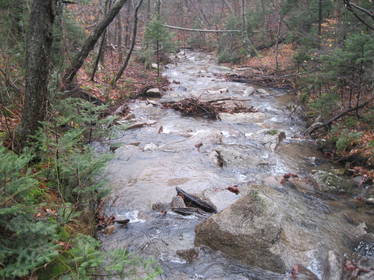 Beaver dam at Profile Lake outlet.
 Profile Lake from the west shore.
 Eagle Cliff looms through the mist.
 Looking up at Eagle Pass, the deep cut between Eagle Cliff and a western shoulder of Mt. Lafayette.
 Looking SE to the Old Bridle Path ridge.
 Nearly full view of Eagle Cliff.
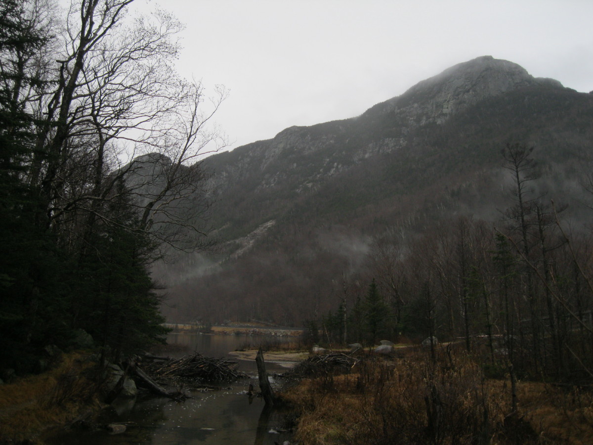 This boulder broke off from the Cannon Cliffs in 1997 and came to rest right at the edge of the bike path.
 No one else was on the bike path on this dreary midweek day.
Misty view of a beaver meadow.

#2) FOREST DISCOVERY TRAIL
This graded gravel path provides an easy 1 1/2 mile double loop, with a bit of climbing, off the Kanc Highway next to Big Rock Campground. Along the way are a number of Forest Service interpretive panels about forest ecology and various timber harvest techniques.
 The scenic highlight is near the high point of the trail, where there is a neat view of the Osceola Range from a brushy clearcut opening.
 The main summit, with the Split Cliff seen below and the top of the huge 1995 dogleg slide visible on the right.
 East Osceola, an interesting-looking peak from this angle.
 A view of part of Scar Ridge, with the main summit on the R and sharp Middle Scar in the center. The bump to the L of Middle Scar has an excellent outlook ledge looking SE, well worth the short detour for bushwhackers traversing all the Scar Ridge peaks.
 A loop off the main part of the Discovery Trail leads across a bridge over a small brook and through a softwood area.
 One of the interpretive panels along the Discovery Trail.
#3) BALCH HILL
This 956-ft. hill, which has an open grassy top, is contained within a small Natural Area just outside of downtown Hanover. It has a fairly extensive trail network and is a favorite local walk. I did a quick one-mile loop over the summit from a parking area at the junction of Grasse Rd. and Trescott Rd.
 The Grasse Road Trail provides an easy route to the top.
At the open summit there's a single tree, and when I arrived there was a Dartmouth student seated on a bench reading a book. Looks like a very peaceful spot for a snooze on a warm summer day.
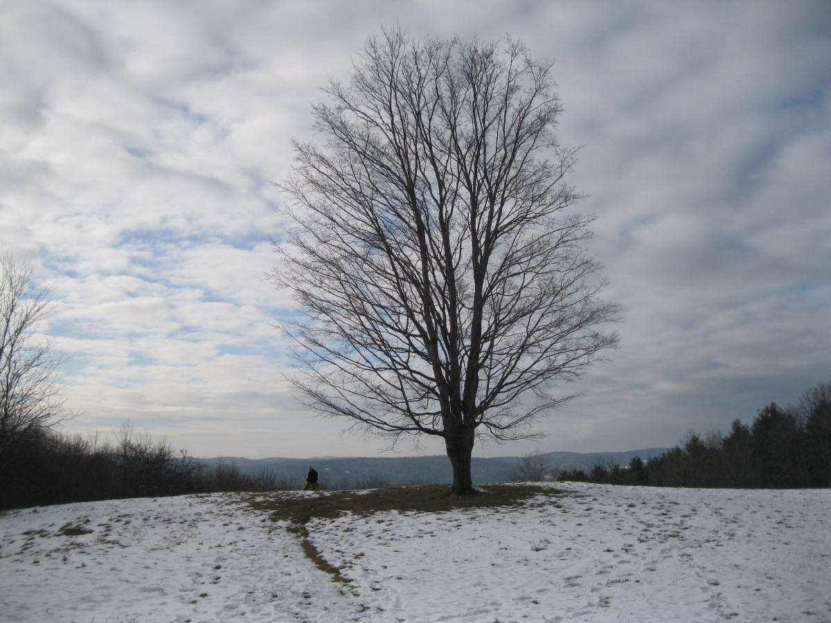 The primary view is to the west. You can see Killington and Shrewsbury Peaks peering over the nearer ridge, but they are not visible in this picture - too hazy.
 Mt. Ascutney can be seen through a gap in the trees to the SW.
 Looking east through another gap, South Moose Mountain, on the outskirts of Hanover and traversed by the Appalachian Trail, is visible.
 A neat tree-lined stone wall along the trail.
 After the short hike, Carol and I took a stroll around downtown Hanover, walking across the beautiful town common.
 We also visited the offices of the Dartmouth Outing Club in Robinson Hall. The place was pretty quiet as the students were gone for Christmas break, but we had a nice chat with the lady in the office and walked around the halls, absorbing a bit of the DOC mystique. The Appalachian Trail passes by along the streets just south of here, but I forgot to get a photo of a white-blazed light pole!
Nice series of reports, Steve! I wholeheartedly agree with your ruminations in the first part of your report about how wild-looking the scenery must have been in the Franconia Notch before there was a road through it.
ReplyDeleteJohn
What a great way to show that hikes need to be neither long nor steep to provide great interest and beautiful surroundings. Franconia Notch has always been my favorite location in the Whites and this helps to show why. Thanks for taking us along Steve.
ReplyDeleteMark
Thanks, guys - I'm learning to appreciate the short walks more!
ReplyDeleteSteve
Any recommendations on a route with as little pain as possible to bag Middle Scar Ridge?
ReplyDeleteHi Raymond,
ReplyDeleteI've only done Middle Scar as part of summer and winter traverses, have never made a direct ascent. The route from Little East Pond would be short but steep and most likely quite thick. If you could get across the Hancock Branch, it might be interesting to follow the long northern ridge that leads up to Middle Scar. Looks like a very steep pitch getting up to the flat shoulder at 3000 ft.
Steve
Thanks, Steve. I think I’ve been to the true West summit from the Kanc (this was before it had a canister — it was a broad, flat area with a herd path running down its middle), and I made it to the canister from Little East Pond, and I reached Southeast Scar twice before finally bagging East Scar, but I can’t imagine myself ever attempting a traverse, so I’ll just have to make a direct stab at Middle one of these days.
ReplyDeleteGood images Steve
ReplyDelete