
The long ridge of Moose Mountain is a prominent landmark in the town of Hanover and is the first peak climbed by the northbound Appalachian Trail after it enters New Hampshire. The AT runs over both South Moose (2293 ft.) and North Moose (2313 ft.), providing a very pleasant wooded ridge walk and a few partial views. Though far from spectacular, this mountain has a special charm, and I count the Moose ridge walk as one of my favorite AT sections in New Hampshire.
The photo below shows Moose Mountain as viewed from the Lambert Ridge Trail on Smarts Mountain to the north. South Moose is on the L, North Moose on the R.

Part of my reason for a return to Moose was to check out the Nat Thompson Trail, a new route opened by the Dartmouth Outing Club in 2010. It was named in memory of a son of Class of '66 Dartmouth grad Ted Thompson, and was opened with assistance from the Thompson family. I was alerted to this trail in a "redlining" trail report I received last fall from John Gutowski (who, along with his wife, June Rogier, just completed the White Mountain 4000-footer "Grid," or 48 X 12, on Easter Sunday -- congrats!!). John sent a photo showing a sign for this trail along the AT near the summit of South Moose. Only one reference could be found on the web, which indicated that it started at the DOC's Class of '66 Lodge at the western base of the mountain.
After negotiating some muddy back roads, I parked at the AT trailhead on Three Mile Rd. and started up from the south end of the Moose Mountain Trail.
 The trail descended to a crossing of Mink Brook.
 I soon turned L on the Fred Harris Trail, which is an old woods road, and then R on the access trail leading to the Class of '66 Lodge.
 This beautiful structure is available for rental by Dartmouth-affiliated groups only.
 The trail starts behind the L side of the lodge.
 After a short, stiff climb it joins an old woods road that was formerly part of a DOC-maintained backcountry ski loop. It being prime mud season, this part of the trail was very wet. I was pushing the trail-checking season a little on the early side.
A brook ran down a hardwood valley along the L side of the trail.
 The DOC put some serious rockwork into the construction of this trail.
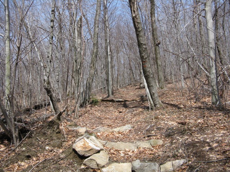 The upper slopes of Moose Mountain were hit hard by an ice storm this March, and there were dozens and dozens of limbs and small trees down across the trails.
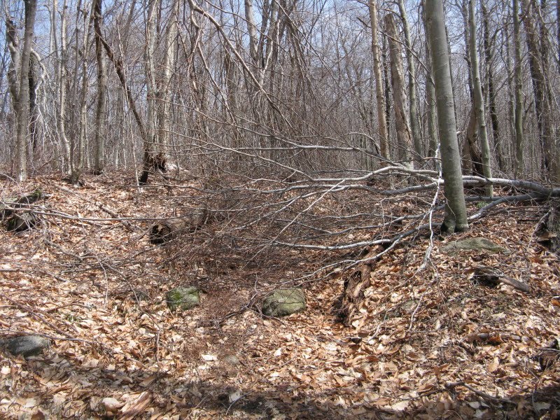 The trail met the AT a short distance north of the clearing near the summit of South Moose. By measuring wheel, distance for the Nat Thompson Trail was 1.2 mi., and total distance from the trailhead was 2.0 mi.
 The elevation given on the sign at the clearing is actually about 70 ft. low.
The top of South Moose was the site of a tragic airplane crash in 1968. The summit was cleared as part of the rescue effort. The area is still open, but the views have become more restricted over the years. The small open view looks towards the south end of Goose Pond and out to Ragged Mountain.
 After a late lunch, I headed north on the Moose Mountain Trail, bound for the summit of North Moose. Appropriately, there were moose tracks along the route.
 In the col between South and North Moose, the trail crossed the historic Old Wolfeboro Road, which was once maintained by DOC as part of a 15-mi. route called the Clark Pond Loop.
 A short distance farther along the AT, a side loop path leads to the Moose Mountain Shelter and tent sites.
 This shelter was built in 2003, replacing an older structure down on the east side of the mountain along the old Clark Pond Loop.
The privy is......airy.
 Back on the AT, new log steps at a wet area that provides the water source for the shelter.
 The mile and a half walk to the summit of North Moose is at mostly easy grades, with good footing, in a ridgetop hardwood forest.
 This ridge walk is my favorite part of the Moose Mountain Trail.
 North Moose has two summit knobs. On the flat, spruce-wooded southern knob, old snow lingered in the woods.
 More ice damage along the trail.
 There were some old black cherry trees (I believe) up here.
 Near the top of the slightly higher northern knob of North Moose, quartzite ledges to the L of the trail provided a fine resting spot and a partial view out to Vermont. The south knob of North Moose can be seen through the branches on the L.
North of the summit (the high point is to the R, or east of the trail), I made a very short bushwhack to a favorite spot on the steep eastern edge of the ridge where a wide view can be enjoyed.
 From here you look out over an expanse of remote, lightly-settled country, all the way across to Mt. Cardigan (seen on the R).
Goose Pond is to the SE.
 Looking NE, the great bulk of Smarts Mountain dominates the view. Winslow Ledge is in front on the R, and Carr Mountain is in back on the far R.
 About 0.3 mi. farther north, a similar view (shown below) is available adjacent to the trail, but I didn't have time to go out there today. Here, Holt's Ledge is added to the vista on the L.
There are some neat old weather-beaten trees up on this ridge.
 This picturesque leaner is beside the trail on the east side.
 Heading back down the ridge to the south, the late afternoon sun was lighting up the hardwoods.
 This tiny pondlet near the trail was still locked in snow and ice.
 Along the way I bushwhacked to a ledge with a good view of Cardigan.
 Evening light on top of South Moose.
 I descended from South Moose via the Moose Mountain Trail/AT, which passes through some fine hardwood forest as it gets down into the valley. It was another good day on one of my favorite small mountains. To visit both South and North Moose from the Three-Mile Rd. trailhead is about 8 mi. round trip with 1800 ft. of elevation gain.
A fun report of a neat little mountain! I once was the adopter for the AT from Three Mile Rd to the summit of S. Moose. North of the summit of S. Moose about 100-200 ft,not too far from the trail on the east side, there is a small clearing with views all the way to Washington, which is a favorite place to go on a clear day.
ReplyDeleteHi Jason,
ReplyDeleteThat must have been a nice section to maintain. Is that clearing a grassy little spot with a bit of ledge?
Steve
Actually, the Class of '66 Lodge is available (with reservations) to the general community!
ReplyDeletehttp://www.dartmouth.edu/~doc/cabins/classof66lodge/
Glad to see people are using the Nat Thompson Trail!
-Dartmouth '11
yup, you've got the right one!
ReplyDeleteThanks for the update - much appreciated! It looks like a beautiful facility.
ReplyDeleteI think the Nat Thompson Trail will be fairly popular, since it makes a loop possible over South Moose.
Steve
Hi there I did this same hike today, only complaint about the Nat Thompson trail---Blaze it guys. And when you're coming down, and it makes that sudden Y, one way heading straight down to the '66 Lodge and the other to the left, some signage would be most helpful there, too.
ReplyDelete