With a few hours free in the evening, I made three short treks to waterfalls off Route 112 in the western Whites.
First stop was the little-known and seldom-used Cobble Hill Trail. (For more on this trail, see this article by my longtime hiking buddy Mike Dickerman: Cobble Hill Trail).
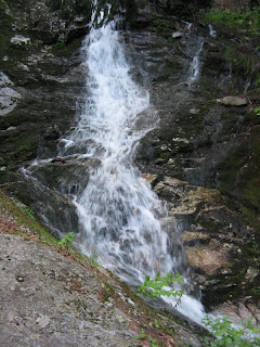
 A couple hundred feet up this old logging road there is a nice waterfall on Dearth Brook. A very short bushwhack gets you down to the bottom for a good look.
Next I drove a few miles back towards Lincoln and parked at the Wildwood Picnic Area. I walked back up the road to the west and headed in on the old Beech Hill Trail, which was abandoned in the 1980s. This led up the valley of Black Brook, over the ridge of Beech Hill, and down to the Reel Brook Trail. Parts of it can still be readily followed, while other sections have been swallowed by the undergrowth.

The objective was a nice cascade on Black Brook about a half-mile in. At this point, the old track is in the "very obscure" category, and access to the base of the cascade is blocked by a massive hemlock blowdown. I did find a good view of it from a nearby high bank.
 In 2008 I continued up this valley, on and off the old trail, then bushwhacked ahead to the ridge well to the E of where the trail crossed it. There were some beautiful open ferny glades up on the ridge.
My objective was a set of south-facing cliffs, which afforded a view back down the Black Brook valley to Mt. Moosilauke.
 Mt. Wolf could be seen close by to the SE. An interesting area off the beaten track.
 On this week's trip, after visiting the Black Brook cascade I returned to the Wildwood Picnic Area and poked around there for a few minutes.
A path leads down to a pretty spot along the Wild Ammonoosuc River.

The last stop for the evening was the trailhead for the Beaver Brook Trail up Mt. Moosilauke. When time is short, I enjoy the 0.8 mile round trip hike to the first/lowest of the many Beaver Brook Cascades. From the parking area you get a view up to the upper Beaver Brook ravine.

The trail makes four brook crossings in the first 0.2 mile, two of them on sturdy bridges.

This DOC sign is designed to prevent unnecessary incidents on the steep and tricky trail section alongside the cascades.

The hike to the first cascade is only moderately steep, and there is a nice hangout ledge at the base from which to admire it.


No comments:
Post a Comment