
The massive bulk of Smarts Mountain (3230 ft.) dominates the countryside for miles around in the Connecticut River valley north of Hanover. It's the highest of the loosely affiliated "Middle Connecticut River Mountains." Of the four trails that climb it, the most scenic is the Lambert Ridge Trail, the Appalachian Trail route from the south. About halfway along this trail open quartzite ledges offer views of the main summit mass, still two miles away.

For a few years my bushwhack wish list has included an exploration of several beaver ponds and a long, gentle ridge in the wild region on the south side of Smarts, which in 1997 was purchased by the federal government through the Forest Legacy program. This 1,600 acre tract is owned by the National Park Service and managed by the US Forest Service. To approach the Ranger/Lambert Ridge trailhead on the Lyme-Dorchester Road, I drove down the Connecticut valley from North Haverhill on NH 10 - a very scenic route with lots of farmland. I made a quick stop at Haverhill Corner with its town green and classic colonial houses.

I stopped at the wonderful Lyme Country Store to pick up a breakfast sandwich and other goodies, then headed east on the bumpy Lyme-Dorchester Rd. The unpaved section past the Dartmouth Skiway was smoother. At the trailhead this sign has been posted by local bear researcher Ben Kilham, author of the book, Among the Bears.

I started my hike with a mile-long walk up the Ranger Trail, which is no longer "officially" maintained but receives alot of use. This was originally a jeep road for the first two miles, used by the firewarden posted in the Smarts tower.

The Ranger is a Jekyll-and-Hyde trail. Some sections offer easy, dry, smooth walking...

...while others consist of long stretches of boot-sucking muck.
 About a mile in the trail comes beside Grant Brook. Here I struck off through the woods, heading eastward to the beaver ponds.
 Up on a low ridge this open birch/hardwood forest offered some of the best whacking imaginable.
 Nearing the ponds, the woods became sprucey, wild and rough, with confusing rolling terrain.
 I kept my course until I reached the brook that flows from the beaver ponds.
I followed the brook upstream through a small beaver meadow.
 After some thick going I emerged on the south shore of the largest beaver meadow, with Smarts Mountain looming impressively to the north.
 I could see that the new snow that had fallen the previous weekend was still lurking in the woods at higher elevations, so I decided my eventual destination would be a slide I had been to once before on the steep south face of the mountain. The summit could wait for another, snow-free day.
At the south end of this meadow there was some open water. In the distance I could see the low ridge I would ascend towards the main mass of Smarts.
 I made a side trip to the SE for a look at Mud Pond, the only one of these wetlands that has an official name. Wonder if anyone has bagged all the Mud Ponds in New Hampshire?
 I whacked back to the north around the big meadow and crossed the brook where it flows in.
 An old beaver dam provided solid footing for the crossing.
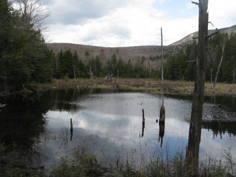
 I pushed through some dense conifers to the shore of the northernmost beaver pond, this one full of water. A beautiful, secluded spot.
Another example of beaver engineering.
 I battled through another band of spruce thickets, and emerged in open hardwoods, heading up onto the long, gentle south ridge of Smarts.
Thousands upon thousands of trout lily leaves were emerging, but only a handful of flowers so far.
 I liked this mossy boulder wearing a cap of shining club moss.
Partway along the ridge I came upon a series of small ledgy meadows that showed on Google Earth. I skirted around these through the woods to avoid trampling the luxuriant lichen growth. Wonder who built this cairn, and how long it's been there?
 The moose like the meadows, too.
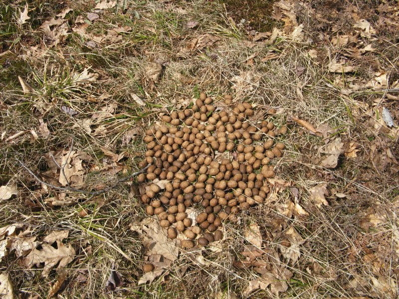
This was the largest and grassiest of the meadows. Neat random spots in the woods.
 Above 2000 ft. the woods darkened with conifers, but remained fairly open.
I ascended gradually through an area of "pick-up sticks" forest.
 At about 2200 ft. the new snow cover became fairly consistent. I angled across the slope to the small brook that I believed flowed from the slide I was seeking.
 Yup, this was it - I soon climbed to the lower part of the slide.
Looking down from the top of the lower slide - first views to the south.

I ascended steeply through reasonably open woods to the upper slide. The snow was several inches deep, mushy and slippery.

I broke out at the bottom of the main upper slide for a look up. Much too wet and steep to climb on the rock.
 I made my way up very steeply through the woods parallel to the slide. Halfway up I went out to the edge for a great vista across the Grant Brook valley to Lambert Ridge, with (L to R) Winslow Ledge, Moose Mountain and Holts Ledge/Bear Hill beyond. The AT goes over Lambert, Holts and Moose.
 Near the top of the slide I found a small dry seat near the edge for a welcome break in the late afternoon sun. From here I could see distant peaks in central and southern Vermont, including Killington, Salt Ash, Okemo, Dorset and Stratton.
 On my previous visit here I had accessed this dramatic dry ledgy perch out on the edge of the slide. The warm sun beckoned, so I left my pack in the woods and crabwalked carefully across and down to it on dry rock.
 This spot opens a wide view to the south, including Reservoir Pond with Mt. Sunapee beyond.
 A zoom on Reservoir Pond. In front of the pond you can see parts of two of the beaver ponds I had visited earlier in the day.
One of the more interesting perches for the obligatory boot shot.
 Looking down the slide.
 Back at the edge of the woods, I liked this framed SW vista.
On the way back down I returned to the mid-level viewpoint, where you get a good look down at the lower half of the upper slide.

Lambert Ridge and the Grant Brook valley - a beautiful area!
 A side view of the slide.
Once back down below the slide, I whacked down and across to the Ranger Trail, which at this point might be called Ranger Brook.

Where the trail crosses Grant Brook, you come to the old garage where the firewardens would park their jeep.

There were some horrific muddy stretches in the next mile, but then there was a lovely stretch right alongside the brook, including this little sliding cascade.

The only hiker I met all day was this porcupine ambling up the trail. Perhaps he was slowly working on his 52 With a View list. Upon my approach, he scampered up into the woods. A neat conclusion to a great day on the wild south side of Smarts.

Steve . . . that is quite an impressive slide! Also, that northernmost beaver pond certainly is a very attractive spot!
ReplyDeleteJohn
1HappyHiker
John,
ReplyDeleteThe beavers have been proverbially busy over the years in that lower area south of Smarts. It would be interesting to know when that slide came down, but I haven't found any info on it. Steep and slippery-looking, for sure!
Steve