Relatively few hikers venture onto the trails on the northeast side of Mt. Cardigan. Even though they are lightly used, and in some places subject to periodic disruption by logging, they are well-maintained by the volunteers of the Cardigan Highlanders, under the direction of their stalwart leader, Craig Sanborn.
These trails are covered in the AMC Southern NH Trail Guide, which is being updated for a new 2010 edition. There have been some changes in this area - a couple of trails that feed onto the Mowglis Mountain-Oregon Mountain ridge are no longer accessible at the bottom, and a new ridge trail has seen some use - so a trail-checking trip was in order.
On a warm morning, with upper 80s predicted for a high, I parked at the end of Welton Falls Road and started up the Old Dicey Road, an eroded gravel road that is a hot and not particularly attractive access route.

At 1.2 miles I turned left onto the Back 80 Loop, a pleasant trail that climbs easily through shady hardwwod forest.

This trail meets the Back 80 Trail at a cellar hole.

An example of efficient trail signage.

A few years ago the Highlanders made a fine relocation on the Back 80 Trail, creating an enjoyable hardwood meander.

Farther along the trail passes a series of beaver ponds and meadows, one of which opens a view up to Firescrew.

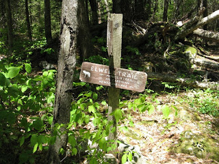
The Back 80 Trail ends at its junction with the Elwell Trail. The 10-mile Elwell Trail is somewhat of a legend for its obscurity along its middle miles, where at present no one is maintaining it. The Highlanders have it well-marked and cleared to a point east of Oregon Mountain, but from there to Bear Mountain logging and lack of maintenance have left it in a near-bushwhack state.

Heading east, the Elwell Trail arrives at a fine viewpoint in 0.4 mile, with a view up to ledgy Firescrew...

...and down to one of the beaver ponds in the valley.

In places there is little evident footway, but the trail is well-blazed.

On the viewless summit of Mowglis Mountain there is a plaque honoring Camp Mowglis, whose boys and counselors built many of the trails in the Newfound Lake area. You often see their small white wooden trail markers, bearing the outline of a wolf.

Here a very lightly-used trail branches off, following a ridgecrest route from Mowglis Mountain to Oregon Mountain, saving a significant down-and up on the parallel Elwell Trail. This was brought to my attention by a local trail runner who helps maintain some of these routes.

The Oregon Mountain Trail is in the "used more by moose than humans" category. It is blazed but requires much care to follow, for experienced hikers only.

In 1.6 miles it ends at the ledgy summit of Oregon Mountain, where there is a view of Cardigan and Firescrew. My trusty measuring wheel is taking a much-needed break.

A spur leads back to the Elwell Trail, and another 0.3 mile east is a great area of open ledge, the best viewpoint on the upper Elwell Trail with a panorama to south, east and north.

The Sandwich Range can be seen in the distance.

I continued 0.5 mile farther east to a viewpoint at the end of the Oregon Mountain ridge. Beyond here the trail gets sketchy, though the Highlanders maintain it for another mile to the old Welton Falls Trail junctions. There are few views from here to Bear Mountain and quite a bit of logging activity.

On the way back a milk snake slithered off the trail.

Back at the big ledge area, at about 5:30, a chorus of wolves began howling down in the valley. There is a private wolf sanctuary on the flank of Oregon Mountain - was it dinner time? Descending on the Old Dicey Road, I saw where a road branched off for the sanctuary.

The two miles down this eroded Old Dicey Road was a slog at the end of a long, hot day, but it made a loop possible through some very interesting and less-visited Cardigan country.


No comments:
Post a Comment