What a glorious stretch of November weather! John Compton and I headed north to the Mill Brook Road trailhead in Stark, knowing we wanted to get a big view with today's clear, sunny skies. The only person we saw on the 4.5 mile drive up the gravel road was a deer hunter heading into a clearcut.
At the parking spot (surely one of the loneliest trailheads in the Whites) we opted for a trail hike to Unknown Pond and The Horn over a bushwhack up an eastern spur to the Pilot Ridge and on to the summit of Hutchins Mountain. Back in late fall of 1990, when I whacked with several friends across the four main Pilot peaks from Lost Nation, the descent down the west side of Hutchins proved to be the most difficult going of the day and took longer than expected. With November's limited daylight it seemed a better bet to choose the known trek over a long bushwhack route we hadn't used before.
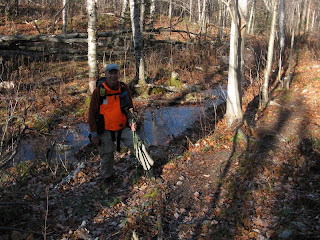
After some mucky footing at the start, the walking on the Unknown Pond Trail was pleasant through open hardwoods.

After a mile or so we began the steadier climb up through an extensive birch forest.

At the top of the climb we continued a short distance ahead on the Kilkenny Ridge Trail to the side path leading down to the classic view of The Horn rising above Unknown Pond. A thin skim of ice gave the vista a different look.

We didn't linger too long at the pond, so we would have more time atop The Horn, one of the great spots in the Whites. We soon headed out on the southbound Kilkenny Ridge Trail.
 The trail descends to a wet sag before beginning the long, meandering climb of The Horn.
We came upon some recent axe work.

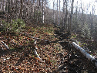
The Kilkenny Ridge Trail is a very pleasant ramble with a remote feeling. Trail conditions were dry and excellent.


As it slabs around the side of The Horn, the trail gets fairly rocky - a Kilkenny version of the notorious Link, but about one-tenth as difficult.

The spur trail to The Horn -- only 0.3 mile to the views!

Just below the top there are a couple of little ledge scrambles.

Then you have to find a way up the imposing summit ledge. Only by getting up there can you enjoy the full range of views from the watchtower of the Kilkenny.

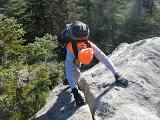
It's a pretty challenging little scramble. I usually approach it via a crack on the east side.

The summit ledge, which AMC explorer William H. Peek described in 1885 as "a rock as large as a goodly, hospitable dining-table." The Bulge rises nearby, with Vermont horizons beyond.

The summit benchmark, placed in 1965.

With the 90-plus mile visibility, the cameras saw plenty of action.

The shadowy view south to South Terrace, North and South Weeks, Waumbek and the Presidentials.

Southeast to the Moriahs and Carters beyond the Crescent Range.
 Baldpate, Old Speck and the northern Mahoosucs, beyond the southern knobs of Unknown Pond Ridge.
North to the Percys and the Nash Stream mountains. The Devil's Slide is seen in shadow at center right.
 My favorite Horn vista is northwest to the trailless Pilots, with their multiple peaks and down-flowing ridgelines. When I once made a solo summer whack to a small cliff and talus slope on the east flank of the Pilots (towards the right end in this photo), the feeling of remoteness was amazing - even though I ran into two local guys fishing the West Branch of Mill Brook down in the valley, and even though the talus was only two miles from the end of the road.
As I was sitting on the talus, gazing at a unique view of Unknown Pond Ridge, The Bulge and The Horn rising above the upper bowls of the Mill Brook valley, I heard a stealthy step above me, at the top of the slope. Whatever was up there kicked a small loose rock down. When I turned around and looked up - nothing. I must admit it sent a bit of a chill down my spine when I thought of the frequent reports of mountain lion sightings in the Lancaster/Kilkenny area. It's pretty wild out there.

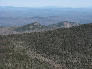
A zoom on Hutchins, with inviting south-facing ledges below its summit.

The Bulge and the bulky Mt. Cabot loom close at hand, tough to see with the low November sun.

The Rangeley area mountains in Maine were clearly visible. Most prominent were the four sharp peaks of the Bigelows, seen to the right of the scraggly spruce.

One of our objectives was to find a clear view down to the highland ponds at the base of The Horn. After exploring along the densely grown ridgecrest, we were successful. Unknown Pond is on the left, tiny Bishop's Pond is on the right.
 A closeup of Unknown Pond and its neighboring cliff.
Bishop's Pond, where John and I had a late, chilly lunch in the sun two weeks earlier. In the 1970s, before the Kilkenny Ridge Trail was built, the AMC Guide recommended this pond as a key to a bushwhack ascent of The Horn from the Unknown Pond Trail, "swinging L higher up to avoid the cliffs." I did that route in the summer of 1990, wading through waist-high ferns in the birches, then scrambling up the steep, rough upper part of the SE ridge.

Rogers Ledge (L) and Square Mountain (R), two interesting smaller peaks in the northern Kilkenny. The Kilkenny Ridge Trail passes over Rogers Ledge, where the southward view is superb, while Square, with its huge cliff face, is a bushwhack (which should be avoided during peregrine falcon nesting season, April 1-August 1).
 This view shows the breadth of the birch-clad basin of Unknown Pond Brook.
 The Horn casts a mighty shadow on the land.
 Back to the summit ledge, it's 2:30 and time to head out.
A last look at the Pilots, with late afternoon shadows slipping into the ravines.

Evening sunlight on the shore of Unknown Pond.

A steady pace back down through the birches got us back to the car just as it was getting dark. We had gotten a full measure of satisfaction from our journey to The Horn.


No comments:
Post a Comment