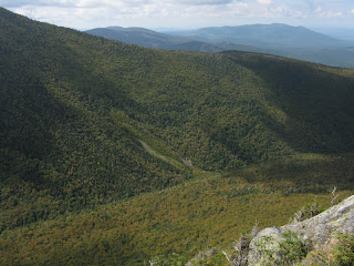
On something like the tenth sunny day in a row, I headed to the Northern Presidentials to "redline" the upper Gray Knob Trail and enjoy some sightseeing in and around Castle Ravine, which might be my favorite of the glacial cirques in the range. A highlight of the journey would be a sojourn at Emerald Bluff, one of the great ravine viewpoints in the Presidentials. As I arrived at the Castle Trail trailhead, I could see that the only clouds in all the Whites this morning were hovering on the Northern Peaks.

I headed out, hoping the clouds would clear off the summits by the time I got up to the Castle Ravine viewpoints. Since it hadn't rained in quite a while, the crossing of the Israel River at 0.4 mile was fairly easy.

The next mile on the Castle Trail was an easy stroll through a pleasant leafy forest.

The next segment of my trek followed the Israel Ridge Path for 0.4 mi., with some fine brook scenery. This is still the Israel River, which is formed by the convergence of Castle Brook and Cascade Brook, flowing out of their respective ravines.

The start of the Castle Ravine Trail was marked by one of the classic RMC trail signs.

There are several awkward and slippery brook crossings in the first section of Castle Ravine Trail - one of the Israel River and three of Castle Brook.

The proximity of the streams makes this a very scenic walk, with several small cascades on display.

Farther up the trail, I made a detour bushwhack across the valley to a slide that I had previously visited in 2001.

From here I could see the lofty perch at Emerald Bluff, the day's next destination.

Looking up the slide, the Castles were in view. For a few minutes they were "Castles in the Clouds," but the fog soon cleared.

The best part of the view, despite the poor lighting, was up the valley to the great headwall of Castle Ravine.

On the return bushwhack I crossed the brook at a nice open spot looking downstream towards Mt. Bowman.

Once well into Castle Ravine, I turned left onto the Emerald Trail. This is a relatively new trail, having been built in 1970 by Klaus Goetze, RMC trailmaster at the time, and club volunteers.

It was quite steep, rising 850 ft. in 0.5 mi., but there were no difficult scrambles.

I arrived at the Bluff ready for a long lunch break. Elevation here is about 4,025 ft.

A short spur path leads out to the upper outlook at Emerald Bluff, which is a fine viewpoint...but the perch just below (seen here) opens a more dramatic vista. To get there, you drop off a steep ledge (more challenging coming back up) and follow a well-beaten path for a few yards. Fabulous spot!
 The view down to the floor of the ravine is startling. The rounded bulk of Mt. Bowman rises beyond, with Cherry Mtn. in the distance.
A thousand-foot down-look.

I could see the slide I had visited on the way up the valley.

The views of the Castle Ravine headwall were remarkable.


Across the valley were the crags of the Castles. With binoculars I spotted a lone hiker scrambling up and over the ledges.

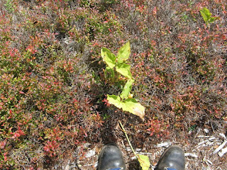
After an hour or so, I reluctantly left the Bluff. At my feet I noticed the fruits of two hardy high-elevation trilliums.

From the top of the Emerald Trail I headed up the Israel Ridge Trail, then across the Perch Path to the RMC's Perch shelter, tucked away high on the headwall of Cascade Ravine. There was a backpacker staying here - the only other hiker I encountered all day.

Just up the trail is this mossy little stream, a headwater for Cascade Brook.

After crossing the Randolph Path the Perch Path becomes exposed and typical Northern Presy rocky.

From one spot there was a nice view down Cascade Ravine.

At the upper end of Perch Path I turned right onto the day's redlining objective.

This turned out to be a scenic route through scrub and across talus - rocky in places, but not as gnarly as I had expected for a high elevation sidehill trail.


From open areas the western Whites could be seen beyond the Castles. Mt. Lafayette is in the distance, right of center.
 At the upper end of the Gray Knob Trail (4,800 ft.) I continued up Randolph Path and Israel Ridge Path a short way, and found a rocky perch looking across at the headwall of Castle Ravine and the summit of Mt. Jefferson.
This spot had a bird's eye view of the ravine floor, with Israel Ridge (also called the Emerald Tongue) on the right.

A multiple trail junction near treeline.
 I used the Israel Ridge Path as my descent route. There was a nice section with pretty good footing along the east side of the Emerald Tongue.
From a semi-open spot, an impressive waterfall could be seen high on the headwall of Cascade Ravine. In the 1890s the great trailbuilder J.R. Edmands laid out the Israel Ridge Path and a network of "pleasure paths" in Cascade Ravine. The latter led to the so-called Third, Fourth, Fifth and Sixth Cascades. (The First and Second Cascades are along the Israel Ridge Path.) Wonder if this was one of those? The Cascade Ravine paths were abandoned after the 1927 storm and 1938 hurricane, and nowadays the bushwacking would likely be pretty fierce in there.

As it drops down the steep nose of the ridge, the Israel Ridge Path makes use of two ladders. Nice work by the RMC trail crew.


There were some beautiful woods along this section.
 The last pitch down towards Cascade Brook was very steep.
 The trail crosses the brook just above the Second Cascade, then descends alongside it. A short side path leads out to the open slabs beside the cascade, one of the sweetest spots in the Presidentials.
 I lingered here for a while in the evening sun.
Two more ladders just below the Second Cascade.
 My last stop of the day was a short side trip on The Link to the top of the First Cascade, another fine spot. From here it was 2 1/2 miles out on the Israel Ridge Path and Castle Trail.
This ten-mile loop offered a tremendous variety of scenery. For the short version (7 1/2 miles), you can just do the loop into Castle Ravine, up the Emerald Trail to Emerald Bluff, and down the Israel Ridge Path past the cascades. Because of the multiple brook crossings, this hike is best avoided at times of high water. An alternate route to the Cascades and the Bluff, with fewer crossings, is via Lowe's Path and The Link.

Great blog Steve, I had the pleasure of meeting you Labor Day morning, with a friend of mine, at your store. We enjoyed the conversations and the stories of Mr. Waterman... I am reading through his wife's book "Loosing the Garden". I look forward to reading through more of your pasts here.
ReplyDeleteTom
Another first-rate report, Steve! Although not all, I’ve been on many of the trails, and have been to many of the places highlighted in your report. It was nice to revisit these places through your eyes, via your descriptive and detailed reporting!
ReplyDeleteJohn
1HappyHiker
Inspired by this blog, I did Castle Ravine trail today(7/21/17). 7 stream crossings(at least), most requiring boots and socks removed. Wild, wonderful! Took Gulfside to Adams and Lowe's path home. A great day!
ReplyDeleteThat is a wild area, and those crossings are never easy!
Delete