On our last full day in the Catskills, a cool, crisp windy day with 100+ mile visibility, I climbed Hunter Mountain (4040 ft.), the second highest peak in the region, and took in amazing views. Starting out on the Spruceton Trail, at the end of the beautiful Spruceton valley, I was trying to decide whether to climb Rusk Mountain or Hunter. The exceptionally clear views tilted the hike in Hunter's favor. The Spruceton Trail follows an old jeep road all the way to the summit, and though not the shortest, it is the easiest route to Hunter with, no steep grades along the 3.4 miles to the top.
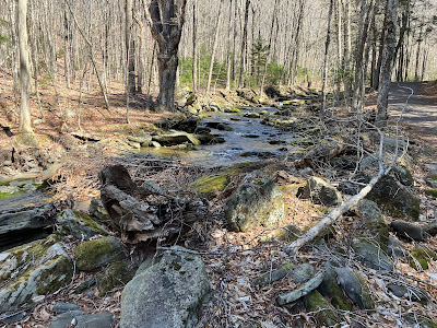
At the start the trail follows Hunter Brook.
This hairpin turn is where the short but steep herd path heads up to Rusk.
Then Spruceton Trail makes a long, easy-graded traverse through hardwoods along the side of the slope.
At 1.7 miles the trail reaches the col between East Rusk and Hunter. Another herd path leaves here for Rusk, making a loop over Rusk and East Rusk possible.
I was still a bit on the fence about Hunter vs. Rusk when a hiker named Tom Richardson came down from the Hunter direction. I asked him about the snow situation on Hunter and he reported it was not a major issue, only for the last 10 minutes was there significant cover. It turns out that Tom is quite an accomplished Catskill hiker, having completed in February the "rolling grid" - climbing all of the Catskill 3500-footers in each month for twelve consecutive months. According to the website for Hikers Anonymous, he was just the third hiker to complete this feat. On this hike he had made the side trip to Southwest Hunter and was looping over Rusk Mountain back to the trailhead.
Above the col, the Spruceton Trail climbs more steeply.
Higher up, the trail passes by gnarled old yellow birches.
First snow patches at ~3300 ft.
A view and a geocache awaited at John Robb Lean-To.
This shelter has an unusual access path. You drop into a deep crack between ledges.
Then you swing around a corner and emerge from the crevice.
The lean-to looks to be in pretty good shape.
Just below the lean-to is an excellent view ledge, with a great perspective on West Kill Mountain. In the distance are North Dome, Sherrill and Halcott.
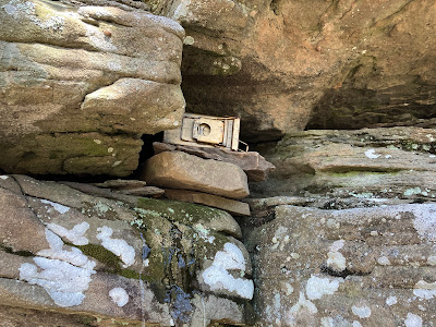
A ledge-dwelling geocache.
Back through the crevice.
Above the junction with Colonel's Chair Trail there was a long stretch of easy walking through boreal forest.
The snow cover was continuous on the final moderate climb to the summit, but never more than a couple of inches.
Signs at the summit.
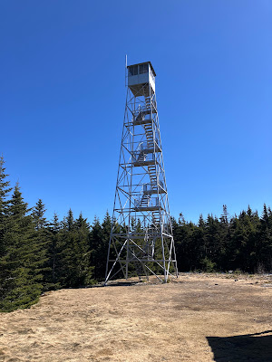
The Hunter Mountain fire tower. This 60-foot steel tower was constructed in 1917 and was originally located 1/3 mile to the south. It was moved to its current location in 1953. It fell into disrepair in the 1990s, and it was proposed for dismantling, but fire tower enthusiasts raised money for its renovation and it was reopened in 2000. It is listed on the National Register of Historic Places.
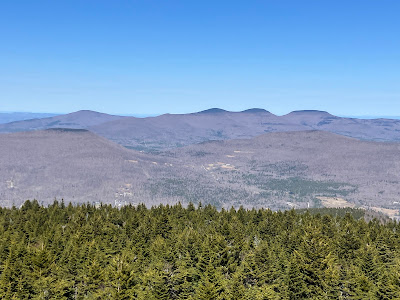
Though the wind was cold and biting, the views from the upper stairs of the tower were stunning on this crystal-clear day. This view looks west down the Spruceton valley with Rusk Mountain on the right and part of West Kill, North Dome and Sherrill on the left. Many western Catskill ridges line the horizon.
Looking NE towards Tannersville with Kaaterskill High Peak on the right. Stoppel Point in the center, and part of the Blackhead Range on the left. Many ridges in western Massachusetts are seen in the distance, including Mt. Greylock through the broad gap between Stoppel Point and the Blackheads. It was clear enough to see Mt. Snow in southern Vermont to the right of Blackhead Mountain.
The Blackheads (R to L): Blackhead, Black Dome and Thomas Cole, with Windham High Peak to the far L.
Looking north, many peaks in the southern and central Adirondacks could be spotted with the aid of Peakfinder, including Crane, Puffer, Bullhead and Gore Mountains.
The southern Catskill peaks, including (L to R) Balsam Cap, Wittenberg, Cornell, Peekamoose, Lone, Table and Slide. Southwest Hunter in the foreground.
Looking SW to Panther, Fir, Big Indian, Doubletop, Graham and Eagle.
East along the Devil's Path to Plateau, Sugarloaf, Twin and Indian Head. All but two (Friday and Rocky) of the Catskill 3500 peaks can be seen from Hunter.
Down-look.
After the cold wind drove me down from the tower, I walked the last 0.3 mile of Spruceton Trail south along the remarkably flat ridgecrest.
Major intersection here.
I wanted to check out a ledge that had a magnificent SW view when I first climbed Hunter in 1985. Alas, the trees have had their way with this vista.
There are still some peeks through the trees, such as this spread of Big Indian, Doubletop, Graham, Eagle, Balsam Lake and Balsam.
Heading back down after a satisfying Catskill view fix.
The next day was also gorgeous, and warmer. It was hard to head for home, so I took a short walk through the fields on the Colgate Lake Trail for a close view of the Blackheads.
I looked longingly at the south ridge of Blackhead, which I have bushwhacked twice
A final view of Blackhead, marked by a small slide, from the Stewart's Shop on Rt. 23 near Cairo.











No comments:
Post a Comment