A bushwhack into Burt Ravine, the deep cut on the west side of the Presidentials between the Jewell Trail and Cog Railway ridges, to climb a slide that fell into the south fork of Clay Brook during the 2017 Halloween storm.
The trail approach was the easy to moderate lower mile of the Jewell Trail, starting at the USFS parking lot.
The first part of the whack featured some nice open woods.
A small antler.
Plenty of moose sign.
The whacking became more difficult when I dropped into the drainage of Clay Brook. Lots of blowdown in here.
Wild woods.
Slow progress through here. Many of the rocks were super slick.
I crossed this small slide along the bank.
A small cascade.
It took quite a while to reach the fork where the north (left) and south (right) branches of Clay Brook divide.
As I swung southeast to follow the south branch, I was confronted by an impassable tangle of blowdown.
I worked a way around it and then ascended through more reasonable woods.
I stayed close to the south branch as the 2-foot contour Lidar map promised some interesting features along this stream. First was this mossy wall.
Then I worked my way out to the brink of a rock canyon and peered down at a cascade 25 feet below.
Farther along there was an even deeper rock cut with a sizeable cascade, but I couldn't safely get a clear look.
The brook then swung east and I paralleled it through the woods until I saw the tree jam from the slide below.
Some ungainly gymnastics got me through this....
...and I emerged into an idyllic meadow-like scene at the runout of the slide, with the gentle brook meandering through. The bottoms of the two forks of the slide can be seen in the middle, with the Clay-Washington ridge above.
Fireweed and purple-blooming asters brightened the scene.
This looked like large-leaved goldenrod.
Looking back along the brook.
A ledgy cascade was revealed at the foot of the slide.
Looking up the two lower forks of the slide, where revegetation is well underway less than five years after the fall.
Cascade close-up.
Side view.
I took a long lunch break on a fine rock seat just above the foot of the slide, with a view over the meadow and out to distant peaks in Vermont.
Looking up the left (east) fork of the slide, which would be my choice for ascent.
A great variety of plant life has taken hold here.
Looking down at the foot of the slide.
Bird's eye view of the cascade.
Loose rock gully in the middle.
Getting higher.
Views opening out to the Dartmouth Range, with a ghostly birch adding a stark accent to the scene.
Side view.
Higher up, the slide widened and I could look down to the peninsula of scrub where the two lower forks diverge.
Looking up.
At ~4000 ft. I found a comfortable perch and savored the view for a while.
The Jewell Trail ridge rises impressively across the ravine.
Approaching the top of the slide.
No balloons found on this bushwhack, but I did come across this shiny ice axe. After I got home I was able to contact its owner, a backcountry skier, via a search on the Facebook Lost and Found group. This slide is sometimes skied as part of a tour of Burt Ravine.
The average slope on this slide is a relatively moderate 29 degrees, but there are some steeper pitches. My clinometer measured this pitch at 34 degrees.
Top of the slide, at just under 4200 ft.
View from the top.
Full view from the top.
I figured that the whack from here up to the Cog Railway service road would be difficult. It began in promising fashion.
But within a couple of minutes I ran into a mess of fir wave blowdown.
That was fun.
I had planned to contour across to the road, but more blowdown and treacherous spongy footing made that route unappealing. It was easier to just climb.
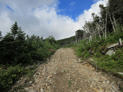
I was happy to reach the Cog service road at 4400 ft.
On the way down three Cog trains passed by. I exchanged waves with the passengers in all three, and left my $10 in the slot down at the Cog hiker parking lot (for use of the service road) before road-walking back to my car.


No comments:
Post a Comment