Fog-shrouded views, robust cascades and a beautiful boreal forest ridge walk on the Kate Sleeper Trail.
Instead
of the usual approach on Livermore Trail for the first 2+ miles, I used
the Cascade Path, Boulder Path and Lower Snows Mountain XC Ski Trail.
The site of the Swazeytown dam on Slide Brook, used to impound water for river log drives in the early 1900s.
Meadow alongside the Lower Snows Mountain XC Ski Trail.
Leaner.
Pleasant walking on the XC trail.
White Cascade was in full flow after recent thunderstorms.
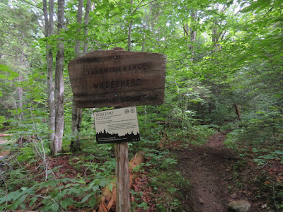
The Wilderness sign was wet, and the trail was, too.
Slide Brook.
Looked like there was some water scouring on the first South Slide, which is ascended via the Mount Tripyramid Trail.
View of Mt. Tecumseh before the summit was engulfed by fog.
Distant view to the SW beyond Sandwich Dome.
Heading up the lower open part of the slide. The middle section of the ascent is mostly in the scrub.
Descending hikers, who said ascending the North Slide was a bit sketchy due to the dampness.
Lost Pass with Mt. Israel beyond.
The open upper section of the slide.
Looking down the first South Slide. This fell during an intense rainstorm on October 4, 1869. It was the first of the three big slides on the Waterville side of Tripyramid. The bright scar of the slide was visible as far away as 50 miles to the south, and attracted the attention of Geology Prof. George H. Perkins of the University of Vermont. Two weeks after the slide fell, Perkins, accompanied by Rev. M.T. Runnels and Charles Cutter, hiked in to view and climb the slide. Perkins later wrote an article giving a detailed description of the slide, published in The American Journal of Science and Arts in 1870. It soon became a popular route for climbing Tripyramid, and remains so today as part of the MountTripyramid Trail.
Near the top of the slide the Kate Sleeper Trail diverges to the SE.
The trail sign is set back in the scrub.
After a brief, rough traverse, the Kate Sleeper Trail emerges at the top of the second South Slide, which came down during torrential rains on August 13, 1885. This same storm also triggered Tripyramid's North Slide.
Steep! According to Alford A. Butler, who with several companions visited the scene two days later, on August 15, the second South Slide was even larger than the first. Writing in the March 1886 Appalachia, he observed that together, the two slides had “made the fair mountainside a desert of rock. One is awe-struck and saddened at the extent of the havoc before him.”
This sketch accompanied Butler's article.
A good time to head into the woods and traverse across the ridge to West Sleeper. The trail is very steep as it exits the slide.
After an initial rough sidehill section, the Kate Sleeper Trail becomes one of the finest boreal forest walks in the Whites.
Ferns, firs and soft footing in a remote setting. The trail was opened by the Wonalancet Out Door Club in 1900 to connect the trail systems of Waterville and Wonalancet.
A gentle climb heading up to West Sleeper.
Blowdown patch near the summit.
A well-worn path leads to the high point.
The flat summit is surrounded by ferns and old balsams. At 3881 ft., this is the high point of Sleeper Ridge. The two Sleepers are the most remote peaks in the Sandwich Range Wilderness, each requiring a minimum of 5.6 miles to reach by trail.
Climbing back up onto the second South Slide.
Shape-shifting vistas.
When the fog cleared, views extended all the way to Killington Peak in Vermont.
Side view of the first South Slide.
The trickiest spot descending the first South Slide, even more so when wet.
Black Cascade, alongside the Mount Tripyramid Trail.
Of course, the sun came out when I was back down in the valley.
The pool below White Cascade.
I looped back via the Norway Rapids.
The crossing of Slide Brook on the Norway Rapids Trail looked dangerous in the strong flow, so I donned Crocs and waded across at a flat spot above.
Many of the trails in Waterville Valley, including the Mount Tripyramid Trail, are maintained by the Waterville Valley Athletic & Improvement Association (WVAIA). Nice to see some of their traditional black-on-yellow signs coming back, hand-painted by WVAIA President Dan Newton.


No comments:
Post a Comment