
I headed down to the Belknap Range for the second time this week, to check on some trails in the Mt. Major-Straightback Mtn. area, to enjoy some snow-free hiking, and to "bag" little Mt. Anna, the last peak I needed to complete the list of the "Belknap 12" peaks.
I set off from the large parking area for the Mt. Major trails off Rt. 11, where there is a kiosk with trail map. There is currently a major effort underway by the Society for Protection of NH Forests and Lakes Region Conservation Trust to purchase and protect several land parcels in the Mt. Major area. Most of the land that the trails pass over is privately owned, and it remains open to public use at the discretion of the landowners. Hikers should take great care to treat the land with respect (no camping, fires, littering etc.). Info on the fundraising effort is here.

I started up the blue-blazed main trail to Mt. Major, which has serious erosion issues in some spots.

At this fork I headed right on the yellow-blazed Brook Trail.

At 1.6 mi. from the trailhead, where the Brook Trail heads left, I continued ahead on the lightly-used, green-blazed North Straightback Link. There's no sign marking the junction, and to navigate the spiderweb of less-used trails on the Belknaps I highly recommend obtaining a copy of the old Dave Roberts Belknap Range map from the Gilford Public Library, or the newer map by Weldon Bosworth, which is available online here and may also be available in printed form at the library.
There was deep leaf cover on the North Straightback Link, which makes a stiff ascent to the north summit of Straightback Mtn.

A glimpse of Lake Winnipesaukee and Mt. Major through the trees.

A little scramble near the top of the Link.

Weathered sign at summit of North Straightback (1910 ft.). A hiker who I met here was the last person I saw for the rest of the day.

View of Mt. Major from the Quarry Trail.

I had lunch at this open area by the junction of the Quarry Trail with the Straightback-Anna Link portion of the east-west Belknap Range Trail.

Distant view to (L to R) North Pack Monadnock, Crotched Mtn. and Mt. Monadnock.

Heading west toward Mt. Anna, the trail passed through many ups and downs in a less-visited area. For southern NH, parts of the Belknaps have a real "out there" feeling.

Trail junction on the flat, wooded summit of Mt. Anna (1670 ft.)

The Belknap Range Trail heading west from the summit of Anna through a piney, shrubby corridor.

I went 0.2 mi. SW down the Blue Trail (which eventually leads down to the Hidden Valley Scout Camp) and lounged for a while on a nice sunny ledge.

A beaver pond in front of little Mt. Shannon.

Afternoon light on a rock face heading back towards Straightback Mtn.

The western Belknaps from a ledge approaching the south summit of Straightback.

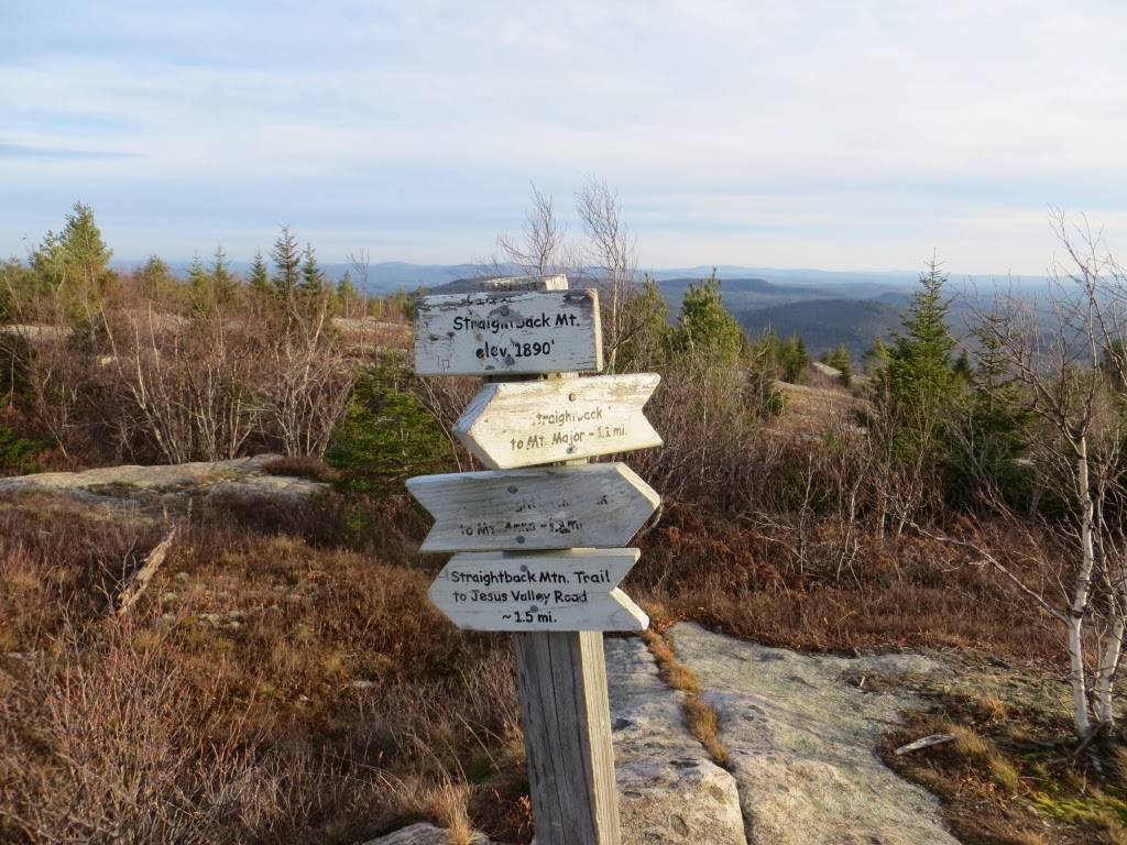
Trail signs on the open south summit of Straightback (1890 ft.).
I made a side trip for 0.2 mi. along the lightly-travelled Straightback Mountain Trail, heading eastward along the peculiarly desolate open ridge.

A long view to the SE.

A cairn along the Straightback ridge.

Late in the afternoon I headed east to Mt. Major, following blue and yellow blazes beyond the Brook Trail junction.

Mt. Moosilauke from a northern outlook ascending towards Mt. Major.

The old stone hut at the summit of Mt. Major. This may be second only to Mt. Monadnock in popularity among mountains in southern NH, but with dusk approaching there was no one around.

I sat down for a while to enjoy the show, including this panorama of the Sandwich Range.

Off to the west, Smarts Mountain (L) and Mt. Cube (R) loomed on the horizon.

The snowy peaks of Mt. Monroe and Mt. Washington peered over to the L of Mt. Shaw, highest of the Ossipee Range.

A wider shot of the northern view, sweeping from Mt. Shaw on the R across to Carr Mountain on the L.

A near full moon rode the sky to the east.

After sunset, some vivid colors appeared to the west.


As I started my descent, the moon shone brightly above Copple Crown Mountain. I made a headlamp descent of the orange-blazed Boulder Loop Trail, which I'd only been on once, in the ascending direction, about 10 years ago. I almost lost the trail in a few spots, but was always able to pick it up again, and completed a fine 8.7 mi. loop (including side trips) in the Belknaps.

Steve . . . congratulations on completing the "Belknap 12"!
ReplyDeleteYour report was very interesting to me, especially since I've visited none of the destinations that are described and photographed.
Those sunset photos are truly outstanding!
John
Thanks, John - the Belknaps are really an outstanding place to hike, especially in the shoulder seasons. Wish they were closer! Hadn't been to Mt. Major in a few years - sure is a marvelous spot, though apt to be swarming with hikers in summer.
DeleteThe sunset was an unexpected treat - just worked out that way.
Steve
Nice trekking in my neck of the woods! Usually, I'm driving up to your neck of the woods.
ReplyDeleteYou can get that nice double-sided Weldon Bosworth map at the Gilford library. There are several maps to choose from. I think I paid $3 for mine last spring when Cameron and I did the Belknap 12.
North Straightback Link is nice, we took that on one of our loop trips last spring. Less used, but nice views looking back when the leaves are down or not yet out.
Fantastic sunset photos, you were at the right place, right time!
Thanks, Summerset! The Belknaps are a great change of pace, especially this time of year. That's a fine trail system.
DeleteI'll stop by the Gilford library sometime and pick up the Bosworth map. I have it on my computer, but there's nothing like having one on the trail.
That was my first time on North Straightback Link, and I enjoyed it. Will add it to our guidebook descriptions.
Steve