
SLIDE BROOK RAVINE: 10/1/13
Being on a Moosilauke theme lately, I decided to undertake a bushwhack journey to a large slide in the ravine of Slide Brook on the SW side of the mountain, which is prominently seen from viewpoints along the shore of Mud Pond in Tunnel Brook Notch and from an outlook on Blueberry Mountain. I had first visited this slide on a wet day back in 1996 and wanted to return on a sunny day. Other attractions for the hike were the hardwood foliage along the Tunnel Brook Trail, scenic Mud Pond, and cascades along the bushwhack section of Slide Brook.
I started out from the southern Tunnel Brook trailhead on Long Pond Road near Glencliff. This trail has mostly easy grades, with one moderate climb up to Tunnel Brook Notch, and excellent footing. It follows Slide Brook much of the way, crossing it twice. This scene is at the second crossing.

The trail passes a small manmade pond on Slide Brook maintained as a water supply for the Glencliff Home. Two kingfishers flew by here, giving their loud rattling call.

The hardwood-rich Tunnel Brook Trail is an especially delightful walk during foliage season.

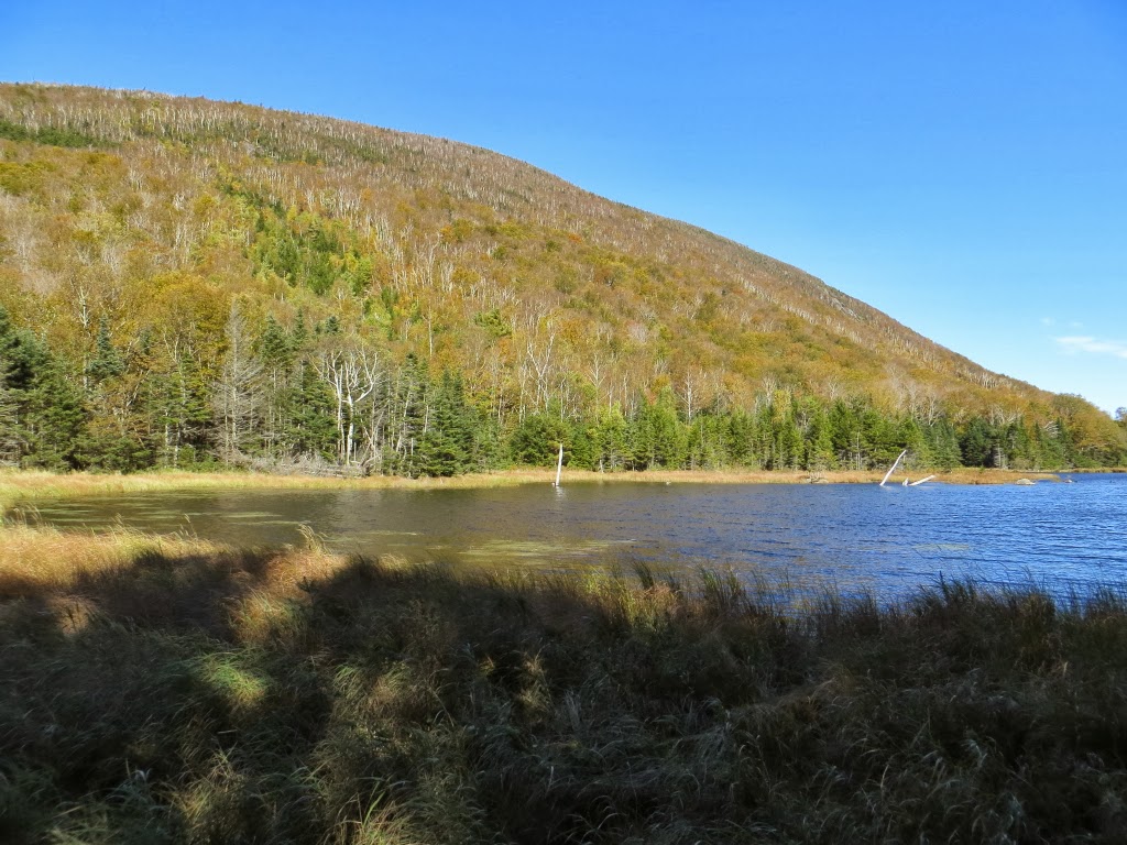
After 2.3 mi. I arrived at Mud Pond, the southernmost of the chain of beaver ponds in Tunnel Brook Notch. This scenic area is one of my favorite locations in the Whites.

Looking across the south end of Mud Pond to Slide Brook Ravine - its slides hidden in morning shadow - and the South Peak of Mt. Moosilauke.

En route to Slide Brook Ravine, I bushwhacked past the south end of Mud Pond, enjoying views of Mt. Clough...
...and the profile of Tunnel Brook Notch.

The bushwhack started out in open hardwoods, but I knew that wouldn't last. Overall, though, the woods were not overly thick most of the way up to the base of the slide.

Farther up the valley this weedy little opening looked almost like an old logging camp site, or at least a portion of road.

From my previous trip I knew the base of the slide would be found just below this cascade.

To my surprise, it was marked by a cairn - perhaps by slide-running skiers?

Starting up the lower track of the slide.

Pearly Everlasting has colonized this patch of gravel.

As I slowly and carefully made my way up the very steep pitch, the first views back to Mt. Clough began to appear.

At 3400 ft. the slide opened up. It's a monster of a slide, with thousands of loose rocks making for treacherous footing.

Western view to Mt. Cube, Piermont Mtn. and Blueberry Mtn., with Vermont on the horizon.

A slide down-look.

I especially like the view down to Mud Pond and slide-scarred Mt. Clough. It's interesting to note that the Clough slides are mostly stripped down to bare bedrock, quite unlike the rubbly slide here in Slide Brook Ravine.

A closer look at Clough.

A zoom on Mud Pond, with an old slide track visible above.

From my perch at 3600 ft., looking up to the top of the slide, which extends up to 3800 ft.

An old, mostly revegetated slide on the north side of Slide Brook Ravine.

From the edge of the slide, I had a good look at the biggest slide on the north wall of the ravine. I hoped to visit it, though I wasn't sure I had enough time. From my perch on the big slide on the south wall of the ravine, I planned to descend/slab across to meet Slide Brook higher up than where I left it (at 3100 ft.), and then continue up to the base of the north slide at 3400 ft. The very steep terrain and dense scrubby conifers had other plans. I ended up doing a lot more descending than traversing, and it was slow going.

Eventually I crossed this old slide track, one of two I had seen on Google Earth along my planned traverse.

This little stream is the headwater of Slide Brook, but I didn't realize it at the time and thought it was the second slide track I needed to cross. I kept slabbing across the steep slopes trying to reach the "real" brook. I couldn't understand why it wasn't rising up to meet my route. When I finally consulted my map, compass and GPS I saw, to my chagrin, that I had circled around the headwall and was actually descending on the north side of the ravine! By now it was too late to climb back up through the gnarly terrain.

Instead, I made a leisurely descent along the brook, re-visiting some cascades I'd seen on the way up, and finding some new ones.

There were many nice vignettes along Slide Brook.


I took a long break on a sitting ledge at the base of this cascade.

Another nice cascade. None of them are named.

Eventually I pulled away from the brook and descended through the colorful open hardwoods towards Mud Pond.

I ended up by the north end of Mud Pond, and with some maneuvering crossed on the old beaver dam.

Back on the Tunnel Brook Trail on the west side of the pond, I sat at a favorite spot and enjoyed the evening sun lighting up the western slopes of Moosilauke.

A slightly different perspective.

A closer look at the slide I had visited. From Mud Pond I headed down Tunnel Brook Trail at a brisk pace. The day had one more surprise in store for me. About halfway down, a young but good-sized bull moose came barreling out of the woods right in front of me, trotted down the trail a ways, then turned around to look at me. Not a good situation during rutting season. I stood still while eyeing escape options on either side of the trail, and was relieved when after about ten seconds he swung around and continued running down the trail. I could see his tracks gouged into the trail until the crossing of Slide Brook below the reservoir pond, after which I breathed a sigh of relief. An exciting ending to a fine day of exploration.

Hi Steve,
ReplyDeleteAdventures such as this are so exhilarating! Thanks for sharing! Your narrative and photos provided an excellent virtual experience, but obviously not the same as actually be there.
Although I'm sure it provided some anxious moments, your unexpected meeting with the moose was a thrilling way to end a day that had already been very rewarding.
John
Thanks, John - it was a memorable day! The moose encounter was startling in its suddenness. I was very happy when he turned around after staring at me.
DeleteSteve
I have to concur with John. It's so freeing to pick an interesting feature and go hike it. You've really opened my eyes to all kinds of interesting hikes in the Whites, Steve. I've eyed the slide next to the Benton Trail and wondered what it would be like to climb it. Have you ever been up that way?
ReplyDeleteThanks, Philip - it is indeed rewarding to choose a spot and go see it. I did once go into the ravine (called either Benton or Tunnel Ravine) on the south/west side of the Benton Trail, back in the mid-90s. I found traces of the old Tunnel Ravine Trail, a nice waterfall, and the collapsed remains of an old DOC cabin. I climbed most of the way up a slide on the east/north wall of the ravine, which dates back to 1973. The slide you mention is probably the huge new one on the west/south wall, which fell during Irene. It's barely visible on Google Earth because of a shadow. My bushwhacking guru, J.R. Stockwell, went up that slide last year, and this summer a Dartmouth prof named David Kotz and a friend climbed it; he posted a cool report at http://davidkotz.org/2013/08/02/tunnel-brook-ravine/
DeleteI got some good looks at that slide from fir waves to the west of the Benton Trail. Lots of interesting places on Moosilauke!
Steve
Hello Steve,
ReplyDeleteNice One! And a great ending to the Day!
You certainly are on a Moosilauke tear these days.
Thanks for the trip report and photos, always informative, always inspiring.
Adventure daringly,
Mark--Silver Lake/Madison
Thanks, Mark - hope you've been having some good adventures!
DeleteSteve