
On a sunny and warm late summer day, Carol and I took a leisurely ramble up the Moriah Brook valley on the east side of the Carter-Moriah Range - one of our favorite places in the Whites. Stretching for five miles deep into the Wild River Wilderness, surrounded by high, lonesome ridges, this valley has a special magic. The mellow Moriah Brook Trail traverses the length of the valley, leading through lush hardwood and birch forests and passing by many inviting cascades and pools.
We made the long drive over through Gorham and Shelburne and down Rt. 113 to the gravel Wild River Rd. At the start of that road we stopped for a short walk to view the site where the suspension footbridge on the Highwater Trail was swept away during Tropical Storm Irene.

We parked at the trailhead by Wild River Campground, which was fairly busy for this remote location. Here we encountered a Harvard freshman orientation group heading out for a backpack trip. We leapfrogged with them several times along Moriah Brook Trail. Nice young folks. For the start of our hike we followed the Wild River Trail to the start of Moriah Brook Trail. At the junction there was more damage from Irene.

It's a long way up to the ridge - typical of the valleys on the east side of the Carter-Moriah Range.

The Moriah Brook Trail suspension bridge over the Wild River survived the storm.

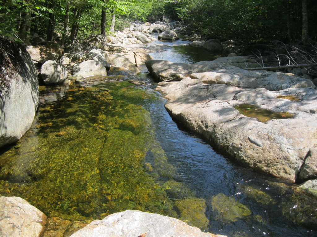
Looking upstream (south) along the Wild River. Looked pretty placid this day.

There are some large old hemlocks along the bank of the Wild River.

We soon entered the 23,700-acre Wild River Wilderness.

Nice ledgy spot along the river.

More destruction from Irene.

After a section on the combined Moriah Brook Trail/Highwater Trail along the river, we followed Moriah Brook Trail into its namesake valley, mostly following the grade of a branch of the old Wild River logging railroad (1890-1903), with a few rough patches where the grade's been washed out. After another mile we came to the first crossing of Moriah Brook at the upper end of rugged Moriah Gorge. There was a railroad trestle at this location. This is the view looking down into the gorge from the trail crossing.

Farther up the valley I made a short bushwhack for a look at a scenic beaver pond on the south side of the trail.

A tall stand of Joe-Pye-Weed at the edge of the pond.

Nearby was this unusual grassy spot on Moriah Brook.

Recent beaver activity along the trail.

The section of trail between the first two crossings offers long stretches of smooth walking on the old railroad grade, through nice hardwood and birch forest.

At the second crossing, we headed downstream to a beautiful spot with ledges, a pool and cascades.

We relaxed on a ledge shaded by an overhanging yellow birch. A wonderful spot on a warm late summer day.

Carol went a-wading in her Crocs.

Banding on a ledge of gneiss, I believe.

After a long lunch break, we headed back to the trail.

Looking back at our hangout ledge.

We continued up the trail, passing more cascades and pools.

Then we set off on a bushwhack to one of the many open ledges on the SE slope of Mt. Moriah, which was burned over in 1895 in the wake of intensive logging. We'd been to this ledge twice before in years past, and looked forward to another visit.

The ledge offers an unusual view up to massive North Carter, with Mt. Lethe on the L and Imp Mountain on the R.

A zoom on the bowl beneath North Carter. The upper part of a new slide unleashed by Tropical Storm Irene can be seen on the L.

From the ledge, there are also views of higher cliffs and ledges on the SE ridges of Moriah. The white-topped crag on the upper right of this photo is a commanding perch.

A photo taken from that crag during a 1996 bushwhack exploration with Peter Doucette and Creston Ruiter, looking down the Moriah Brook valley.

There's a peek up at the great rocky knob high on the main SE ridge of Moriah.

That knob is an amazing spot, as Creston Ruiter and I discovered on a 1995 bushwhack. Click here for a great photo report on a 2009 bushwhack to this peak by Chris Whiton.

Our ledge also gave us a partial look at the long east ridge of Middle Carter. This was traversed by the late Guy Waterman during his incredible journey climbing the 4000-footers from all four points of the compass in winter. More recently, master bushwhacker J.R. Stockwell also traveled this entire four-mile trailless ridgecrest.

Nice open spruce woods on our bushwhack today.

On our way back, we took a long break at another gorgeous cascade-and-pool combo.

An iron pin left over from the logging days.

Good axe work near the beaver activity area. We made a full day of it along Moriah Brook, and vowed to return again next summer.

Isn't it simply terrific to live in such an area where you have easy access to an outstanding location like the Moriah Brook valley where you can while away a beautiful summer day! Judging from your photos, you and Carol truly capitalized on a remarkable day by enjoying the delights offered by the refreshing water of the brook, as well as the sweeping vistas from a mountain ledge. Mr. and Mrs. "Mountain Wanderer" at their finest! :-)
ReplyDeleteJohn
Thank you, John. We certainly are lucky to have access to beautiful places like this. That valley and the adjacent ridge of Moriah have provided many fine adventures, and I'm already itching to go back!
ReplyDeleteSteve
Nice place for a warm day Steve. Thank you for sharing. :)
ReplyDeleteThanks, Yvon - it's a great area!
DeleteSteve
I was thinking that the Wild Valley Road to the campground was closed from Irene, I guess I was wrong. Beautiful pics! Evans Notch is my favorite area due to its uniqueness. I hope to someday get back there and do some more hikes! I like to think of it as a hidden gem that not too many people travel to due to it being out of the way.
ReplyDeleteHiking Lady
Thanks for your comment, Hiking Lady! The Wild River Road actually was closed due to damage from Irene, it just re-opened in July and is in very good shape. I agree with you, the Evans Notch area is one of the best, and it is indeed off the beaten track. I would go there more often if it wasn't such a long drive. Even living in the White Mountains, it takes us an hour 40 minutes to get to some of the trailheads.
DeleteSteve