With a solid, deep snowpack in the woods, 'tis a great season for bushwhacking. On this sunny, windy day, with temperatures in the low 30s, I chose to make a third visit to a nameless set of south-facing cliffs on the long SW ridge of Mt. Kancamagus, on the north side of Waterville Valley. These cliffs are seen on the far R of the photo below; on the L is the cliff called "K1," which briefly had a blazed path to it in around 1916.
I first visited the SW cliffs in January 1996 with Cath Goodwin, and I made a return visit in April 2005. These are not the type of cliffs where you find a wide open ledge perch. They drop off abruptly and there are only a couple of small spots where you can stand or sit and take in the view; access to these spots requires caution. The view is commanding, however, and the place has a very wild backcountry feel to it.

I started from the familiar Livermore trailhead in Waterville and soon turned L on the gentle Greeley Ponds Trail.
 It had been unusually cold for several days, and streams such as the Mad River were actually starting to ice back up after having opened completely during the mid-March thaw.
 The trail bridge over Flume Brook.
A mile and a half from the trailhead, I turned R onto the Kancamagus Brook Ski Trail, which has seen somewhat of a renaissance in its maintenance in recent years. The junction is located at the edge of a 1930s vintage logging camp clearing.
 I went perhaps 0.4 mi. up this trail, which was well-tracked by backcountry skiers. In keeping with trail etiquette, except for a few constricted spots I made a separate snowshoe track along the edge.
Then I headed north into the woods for the bushwhack up the SW ridge, which is forested mainly with hardwoods en route to the cliffs. The first part of the climb is, however, encumbered with numerous beech saplings (sons of beeches, we call them), plus young conifers in places. The two or three inches of snow on top had gotten wet in the sun, but underneath there was a solid and dependable base. No spruce traps today.
 Farther up the ridge I wandered out into the fine open hardwoods I recalled from my two previous trips.
 This forest had its share of tall, gnarled trees.
 As the spruce-topped cliff spur loomed ahead, I swung around to the east to gain access to the ridge up behind the cliffs.
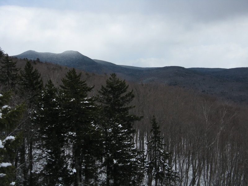
The broad mass of Mt. Kancamagus could be glimpsed across the Kancamagus Brook valley.
 Th final approach to the ridge, through still more open woods.
 At the top I was greeted by this alien-like, triple-trunked tree.
 The crest of the ridge was graced with a lovely birch glade.
 I bushwhacked south down the ridge through denser woods, until the dropoff could be seen ahead.
 I removed my snowshoes as there was a mix of wet slippery snow and bare ground out at the brink. After some careful maneuvering I found an open spot at the edge of the cliffs.
 The wide view south towards Sandwich Dome gave that top-of-the-world feeling.
 The massive bulk of Sandwich dominates many a view in the Waterville area.
 To the SW, Mt. Tecumseh rose behind a portion of the Mad River valley traversed by the Greeley Ponds Trail.
 I particularly like the SE view, where the Tripyramids bristle behind the wooded dome of nearby Flume Peak.
 This may be my favorite view of that distinctive triad of peaks.
 Viewed head-on, the North Slide looks impossibly steep.
 To the R of Flume Peak are the long ridges of the northern Flat Mtn. and Snows Mtn.
 With the afternoon sun beaming down, and the wind held at bay, two hours - including a short snooze - passed quickly at this nifty little spot. One parting look at the south view before the return trip.
 I went a short way north along the ridge before heading down, stopping to admire this "legacy tree."
 Late afternoon shadows in the open woods.
 Coming down off the ridgecrest, I passed a number of bear trees. On my April 2005 visit, while snowshoeing north a ways along the ridge from the cliffs, I had a close encounter with an early-foraging bruin, who paid little attention to me before ambling off down the slope.
 I circled around below the cliffs and caught the slightest glimpse up to the crags where I had just been lounging.
 I steered a better route on the way down the broad ridge, and stayed in wonderful open hardwoods for a long time.
 I passed through this glade of old sugar maples halfway down the ridge. Farther down, I went back through the area of beech saplings.
 A moose had crossed my tracks during the day. And a fine day it was, out in the quiet backcountry of Waterville once again.