
If it's October it must be time for our annual White Mountain CROPWALK. Every fall since 1989, I have joined Mike Dickerman and several other friends for a longish hike that raises money for the hunger-fighting programs of Church World Service (www.cropwalk.org). There are nearly 2,000 community CROPWALKs around the country, but as far as we know ours is still the only one on that takes place on mountain trails. Over the years our generous sponsors have donated more than $50,000 to this worthy cause. Twenty-five percent of that has been distributed to the local Community Action Program food bank in Littleton.
This year's route had a wetland theme, following a 12-mile loop on four trails - some of them seldom traveled - through the beautiful Three Ponds area in the southwestern part of the White Mountains. As shown on the Forest Service kiosk below, the Three Ponds basin between Mt. Kineo and Carr Mountain harbors several named ponds and an extensive series of beaver ponds, swamps and marshes. As it turned out, due to recent heavy rains the wetland theme would be carried through to the footing on the trails as well.

After spotting cars near the top of the Hubbard Brook Road in the Hubbard Brook Experimental Forest, we drove back down the road and up a side road to the northern trailhead for the Mount Kineo Trail. Our particpants this year included (R to L below) Thom Davis, Candace Morrison, Roger Doucette, Cate Doucette, Mike Dickerman, and your correspondent, plus John Compton behind the camera.
 Under sunny morning skies we set off on a moderate climb to the ridgecrest of Mt. Kineo. The trail crosses the crest about a mile SE of the wooded, trailless summit. Along the way we traversed a few grassy wet areas.
 Ferny birch and conifer forest along the trail.
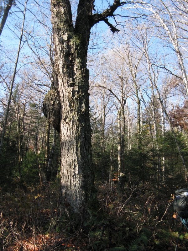
We passed this impressive old yellow birch tree.
 We stopped for a short break on the top of the ridge. Here (and along the trail on the way up) were markings related to the long-term ecological research studies being conducted in the Hubbard Brook Experimental Forest. Thom, a geology professor at Bentley University, has participated in research projects at the HBEF. As Thom noted, it was here that the effects of acid precipitation on the environment were first documented, and the studies published from HBEF research are known worldwide in the scientific community.
After a steep descent on the S side of the Kineo ridge, the trail angled down through a hardwood forest that was badly damaged by the 1998 ice storm, resulting in a dense understory of saplings and brushy growth.

The grade eased off as we approached the broad floor of the Three Ponds basin, which is formed by two shallow valleys - Brown Brook on the E and Sucker Brook (plus the Three Ponds) on the W - separated by a low ridge.

The Mount Kineo Trail joined a snowmobile route, soon crossing a tributary of Brown Brook on a wide bridge.
 This fern-filled opening had the look of an old logging camp, though a quick search turned up no artifacts on the ground.
 However, this porcelain pot was hung on a tree. Thom gives it an inspection.
Where the trail turns L (S) on the floor of the valley, it passes by a beautiful bottomland hardwood stand.
 We soon had our first look at the mile-long wetland complex known as the Brown Brook Marshes, with the long ridge of Carr Mountain glimpsed across the valley. This is notable as one of the most extensive wetland areas in the White Mountain National Forest. Click here for an account of an exploration in this area last year.
A stark sentinel tree overlooks the marsh near a bridged brook crossing on the trail.
 The trail provided easy walking through the woods alongside the marshes, though there were some very mucky spots to negotiate.
 A stillwater section of Brown Brook.
 The crossing of Brown Brook by the junction of the Donkey Hill Cutoff was the day's biggest challenge. Everyone made it across, with no mishaps.
Here we turned R and headed NW on the wild, twisting, rough trail known as Donkey Hill Cutoff.
 In a few minutes we came to a side path that drops down to the edge of Brown Brook for a wide view N up the marshes towards Mt. Kineo. I've long considered this one of the finest lowland vistas in the Whites.
 A zoom on Mt. Kineo's humpy ridgeline.
After passing an extensive beaver-flooded area on the western half of Donkey Hill Cutoff, we turned L on the Three Ponds Trail and walked along the shore of the beautiful Middle Pond, with Carr Mountain rising across the water.
 Our lunch spot was a grassy opening on the shore of the pond, as peaceful a backcountry spot as you could ask for.
 The view N up the pond to Whitcher Hill.
A gnarled old white pine has stood guard along the W side of the pond for many years.

A couple of dads on a fishing day hike with their Cub Scout sons obliged us by taking our traditional group CROPWALK photo by the shore.
 After lunch we retraced our steps back to the junction of Three Ponds Trail and Donkey Hill Cutoff.
 A delicate balancing act was required to cross the beaver dam heading N on Three Ponds Trail.
 The N end of the crossing was the trickiest part.
 A short distance farther we had a lovely framed view from the NE corner of the Middle Pond.
Next up was a short side trip on a path to the shore of the Upper Pond, with Mt. Kineo presiding in the distance.

Looking N across the Upper Pond.
 In another mile the trail emerged along the edge of a vast bog bordering Foxglove Pond, with the northernmost spurs of Carr Mountain close by to the W.
 A cluster of pitcher plants on the edge of the bog.
 Looking back at the long N ridge of Carr, with the summit on the far L.
A little farther along we crossed a considerably smaller Brown Brook at a nice mossy cascade.

Wet footing was the rule along many stretches of trail today.
 Soon the snowmobile trail departed westward, and the Three Ponds Trail climbed along a wild, primitive section on the western flank of Whitcher Hill.
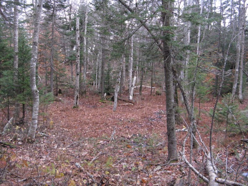 Mike pauses to savor the remote setting on this high plateau.
 Where the trail crested a high point on the N shoulder of Whitcher Hill, it led through a marvelous stand of open and slightly stunted ridgetop hardwoods.

Then there was a long descent down a northern slope, through more hardwoods.

 Well down into the Baker River valley, the hiking trail merged with the Woodstock-Warren snowmobile trail. Looking back, the hiking trail is on the L, the snowmobile route on the R.
As we reached the junction with the Hubbard Brook Trail, the sun reappeared after hiding behind clouds for a few hours.

This lightly-used trail follows a logging road for a bit, then ducks into the woods, crosses a brook, and passes near this beaver meadow. It requires care to follow in this area.

It then makes a moderate climb to the namelss notch between Mt. Kineo and Mt. Cushman ("Hubbard Notch," maybe?)
 On the floor of the notch are several more beaver ponds and swamps.
The trail has been relocated around a flooded area at this pond. I went a short way back on the abandoned section to get this picture of the beaver dam.
 The beavers have been proverbially busy.
 The last wetland of the hike was a pretty one.
 Looking NW back up the notch.
 We all made it out before dark, concluding a very interesting and rewarding trek. Thanks to everyone who hiked and sponsored the 2010 CROPWALK!!
No comments:
Post a Comment