
Few mountains under 3000 ft. offer the rewards of Mt. Cube (2909 ft.), whose quartzite-capped summit rises east of the Connecticut River and SW of Mt. Moosilauke. It is part of the loosely affiliated range known as the Middle Connecticut River Mountains, and the Appalachian Trail traverses its crest. Both its south and north summits sport spacious open ledges, providing completely different panoramas.
Of the three trail routes to Cube, the most scenic is the AT from the south, a section known as the Kodak Trail. This name was applied by the Dartmouth Outing Club because a) the trail goes over the Eastman Ledges (get it?) and b) there are several "Kodak moments" from open ledges along the route. The remote trailhead is reached by driving 2.4 mi. up gravel Quinttown Rd. from NH 25A in Orford, and parking on the left in front of this gate. In the last 100 yards there is a dip and rocky stretch in the road that could cause problems for low-clearance vehicles; there are other places to park 0.1 to 0.2 mi. back from the gate.
 As you walk up the road past the gate, you come to a second gate, with the Eastman Ledges in sight above. Watch out for barbed wire as you pass through the opening of this gate.
 Just beyond, there is an inviting pool in the South Branch of Jacobs Brook.
 A short distance farther you pass the boundary of AT corridor land owned by the National Park Service.
The Kodak Trail starts 0.5 mile from the first gate. The mileage stated on this sign for Mt. Cube is off by 1.4 mi.; it's actually only 3 mi. to the top.
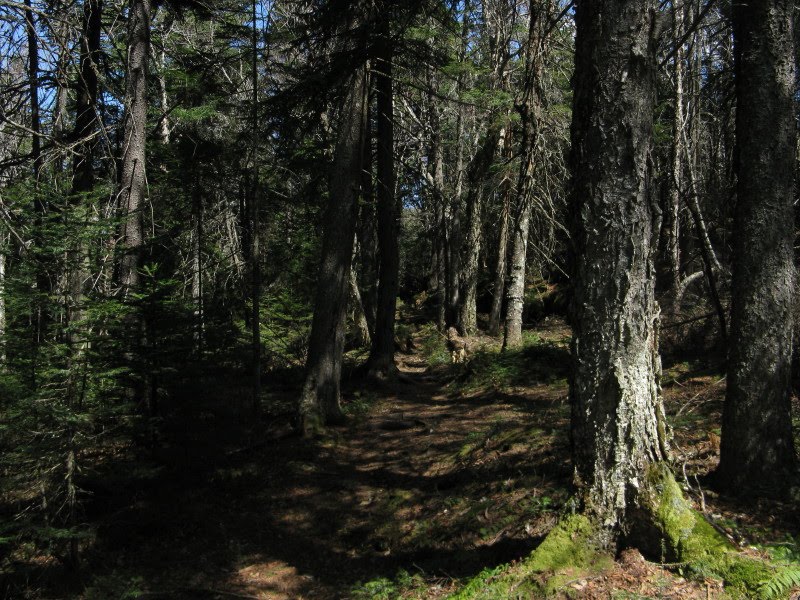
 The trail starts out with a moderate climb through hardwoods. It was a crisp, glorious spring morning, one of the best times of year in this open and presently leafless forest.
After only 0.6 mile of climbing on the trail I emerged on the open viewpoint atop the Eastman Ledges - a great destination for a short hike. It would be very popular were it located closer to the major hiking areas. The massive bulk of Smarts Mtn. dominates to the south. The ridge that sweeps down in the foreground is the route of the J Trail, the northern AT approach to Smarts.
 Looking SW to Mousley (L) and Stonehouse (R) Mtns., two lower satellite peaks of Smarts.
 Even from this low elevation (1900 ft.), I could see Vermont's Killington Range on the horizon.
 The flat-topped bump in the center is Smith Mtn. (2213 ft.), another spur of Smarts. A few years ago I bushwhacked to my namesake peak. No views, but there was a nice little grassy/ledgy meadow on top.
In the hardwood forest behind the Eastman Ledges, yellow violets were greeting the sun. Many trout lily leaves were emerging, and these woods should be bursting with their beautiful blooms in the next week.
 The trail descends to cross the North Branch of Jacobs Brook. A 100-foot side trip down an old road on the left revealed this pretty cascade.
 In the other direction (east), an overgrown path led 0.1 mi. to this beaver pond, with part of Mt. Cube visible in the background. The AT property corridor includes this end of the pond.
 Back on the Kodak Trail, there was an easy step-stone crossing of the brook.
The white-blazed route led through some scruffy hardwood-birch forest.

Farther along was this open fern glade beside the trail.
 At about 2.5 miles, well beyond the side trail to Hexacuba Shelter, the mostly mellow trail suddenly becomes very rough and rocky as it climbs three switchbacks to open ledges at 2350 ft.
 Another nice view of Smarts here, with Mt. Cardigan popping out on the horizon. The Eastman Ledges knob is in the center foreground.
 The ridgecrest of Cube is made of quartzite, a hard metamorphic rock that is very resistant to erosion. These smooth ledges are slippery when wet, and even to some extent when dry.
 There are some big old yellow birches along the next section of trail.
 At 2550 ft. the trail swings around this big quartzite slab.
The top of the slab is an excellent viewing and resting spot.

The upper section of trail meanders through some deep spruce woods. The trail was in good shape for mid-April - there was only one three-foot-long patch of snow en route to the summit. There were occasional muddy and soft spots throughout, but much of the trail was dry, even when not on the ledges.
 At the 3-mile mark (from the gate) this ledge provided a look ahead to the ledges on the south peak.
 Around 1:00 I arrived at the south peak, the true summit of the mountain. The sun-warmed ledges here overlook one of my favorite vistas in all of New Hampshire - an expansive sweep of Smarts Mtn. and its many outlying hills. This is a wild and relatively unknown corner of the mountains.
If you look closely at an enlarged image, you can see the firetower on the summit of Smarts. Croydon Peak can be seen over the flat ridge to the R of Smarts.
 DOC trail signs at the summit junction.
 On the highest ledge a triangle inscribed in the 1870s by the U.S. Coastal Survey is still clearly outlined - a testament to the erosion resistance of the quartzite.
 On the west side of the summit there are vast views across the Connecticut River valley into Vermont.
 Looking NW, the Signal Mtn. Range in east-central Vermont is seen beyond the town of Bradford.
 The Breadloaf Mtn. range (L) and Mts. Abraham and Ellen (R), in the Green Mountains, stretch across the horizon beyond rounded Sunday Mtn.
 Camel's Hump (R of center) is also prominent in the distance.
 A residual patch of snow behind a ledge step departing the summit on the AT northbound.
A yellow-blazed side trail, a bit overgrown in places, leads 0.3 mi. to the open ledges on the north peak.

A rough scramble up ledges leads to the viewpoint.

A prime ledge perch awaits, looking NE over Upper Baker Pond to Mt. Moosilauke.
 A closer view of the Moose. The little white spot seen over the level ridge on the R is the tip of Mt. Washington.
 To the NNE is the ledgy Benton Range: L to R Black Mtn., Sugarloaf, The Hogsback and Jeffers Mtn.
 The Hancocks, Mt. Carrigain and Scar Ridge rise more to the ENE.
 Due E is the miles-long sprawl of Carr Mtn., with the Sandwich Range seen in the distance on the L.
 Back at the south peak, I stopped for a late afternoon siesta.
 Descending the Kodak Trail, I visited this ledge expanse just 100 ft. off trail to the W, easily reached by following bare rock.
 I made the side trip of 0.2 mi. up to Hexacuba Shelter; the spur trail climbs about 125 ft.
The six-sided shelter is unique among the many along the AT.
 A new register had been placed last fall. There were a few late fall entries, then none between 11/21/09 and 3/29/10.
Evening at the Eastman Ledges.

The golden light was gorgeous in the hardwoods on the final descent. Every time I hike it, I like the Kodak Trail more and more. Thank you, DOC!

Interesting report, Steve! Also interesting is how the Kodak Trail was cleverly named (i.e. for the "Kodak moments" from the Eastman Ledges).
ReplyDeleteOn my only visit to "the Cube", I took the Mt. Cube Trail which was okay, but from your report it seems that the Kodak Trail provides a more scenic route.
John
John,
ReplyDeleteKodak is the nicest route up Cube; the Eastman Ledges alone are worth the price of admission. The Cross-Rivendell Trail is pretty scenic as well. The Mount Cube Trail is a nice woods walk, but as you know there are no views til you reach the top.
Steve
The flowers in the middle CT. River mountains are really great! The soil must be sweet, because I see lots of trees/flowers that I've been told like sweet soil there. Someone suggested that had to do with glacial movement leaving some sweet limestone soils from Vermont on them as they receded.
ReplyDeleteSteve, I am intrigued by the trek you mention to Smith Mountain. I have a mind to go "pondbagging" and do a hike linking all the ponds the are nearby on the western side of Smarts :-)
Hi Jason,
ReplyDeleteYes, there sure seems to be an abundance of flowers in that area. Your pond tour idea sounds interesting. Would like to check out the trail to Trout Pond sometime. The day I went to Smith Mountain I also visited beaver ponds on Smith Mountain Brook, then a nameless beaver pond and Lily Pond between Moody and Mousley Mtns. Found a couple of small views of Smarts and Cube from ledges on Mousley. Neat area!
Steve
Thanks for the tip on Kodak Trail's views. Sue and I hiked it last Monday. We climbed that steep slab in your photo not knowing the trail cut left to avoid most of it. On our way back from the north peak it started to rain and poured all the way down. Lots of A.T. hikers so we did not go to shelter. Still, I would like to do it again.
ReplyDeleteHi Doug,
ReplyDeleteKodak Trail is a gem. Love those quartzite ledges. Sorry you got rained on!
Steve
Hello, I would really like to hike this trail. Is there a map available that has this trail on it? Thanks
ReplyDelete