Friday, January 31, 2025

Cliffway Viewpoints Snowshoe: 1/30/25


On a cold and windy day I headed up to Randolph for a snowshoe loop over a series of lower elevation Randolph Mountain Club (RMC) trails. The highlight was the little-used trail known as Cliffway, which  leads past three viewpoints, two of which provide a unique angle on King Ravine. Along the way I set snowshoes onto twelve different trails.

There were no cars at the Appalachia parking area when I pulled in at 11:00 am - a rarity. A short distance up Air Line, I turned onto a gentle section of The Link, swishing through a couple inches of fresh powder atop a thin packed base.


The Link passes by an extensive maple sugaring operation with a special use permit from the Forest Service.


Memorial Bridge over Cold Brook.


On to The Amphibrach, one of the most pleasant trails in the Northern Presidentials.


A short side path leads to Cold Brook Fall.


Excellent snowshoeing on Amphibrach, with 4-6" of new powder atop a beautifully packed track. This is part of one of two main routes used to reach the RMC's winterized Gray Knob cabin.


First tracks.


As I turned onto the Monaway, I knew the trail breaking was about to get a whole lot harder.


It looked like no one had been on this trail all winter.


Slow going in deep unconsolidated snow.


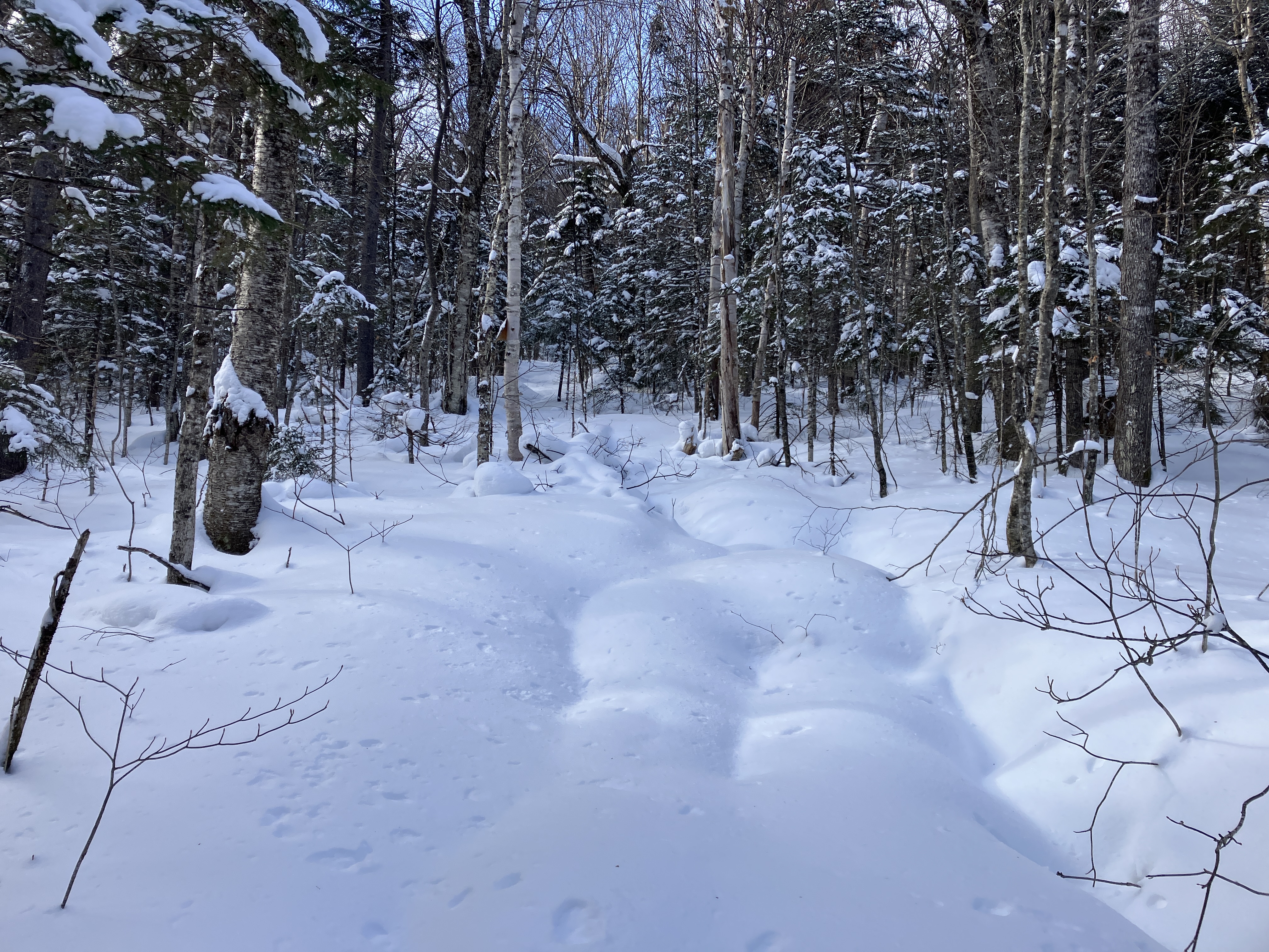
Beautiful wintry forest.


No January thaw this year.


A picturesque winter day.


Approaching the junction with the Ladderback Trail. Monaway bears left here.


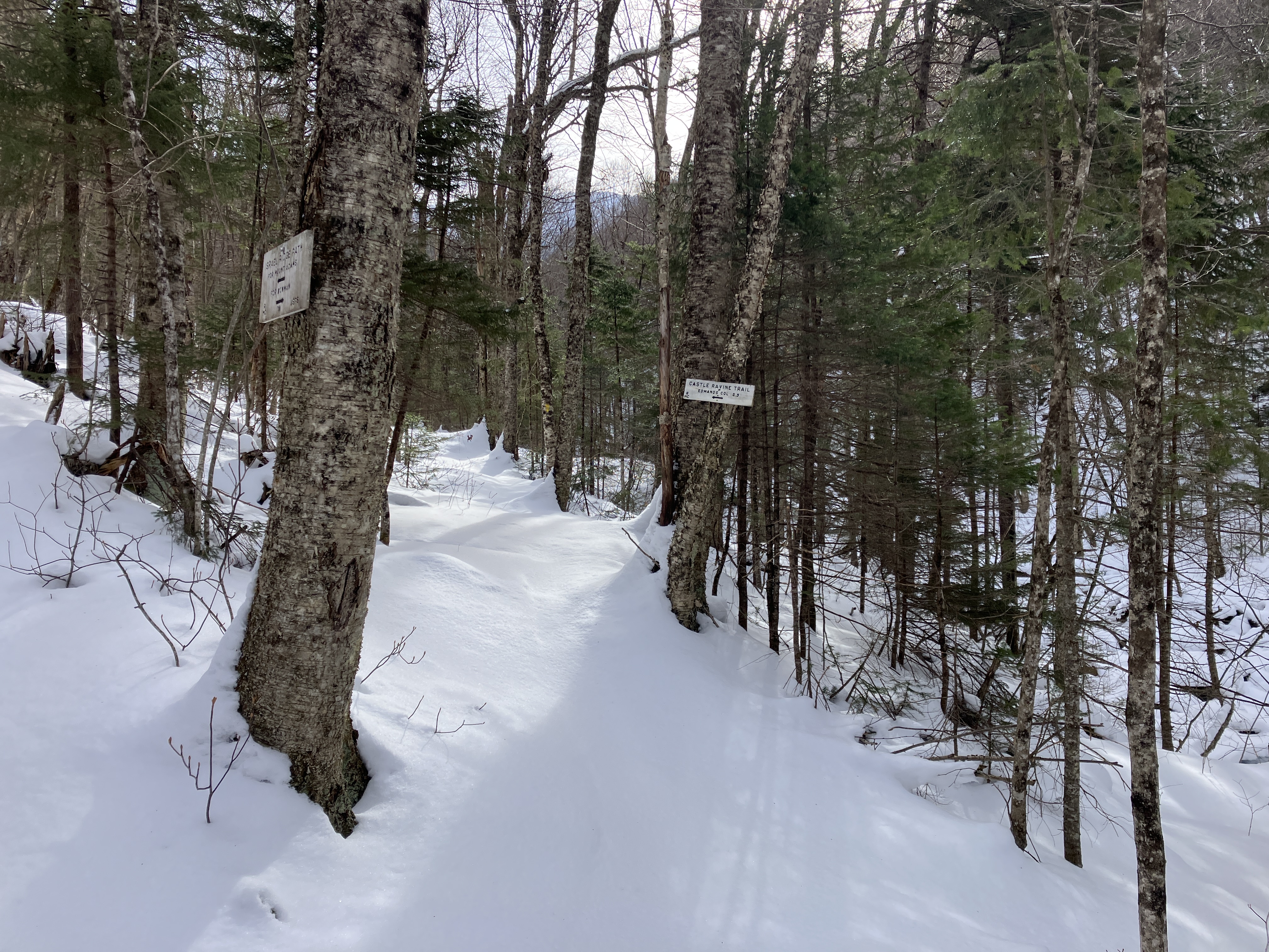
Reaching the junction with Cliffway. This "pleasure path," along with Monaway, Ladderback Trail and Along the Brink, was cut in 1933 by longtime Randolphian, the mapmaker Louis F. Cutter.


The snow was shallower and the breaking easier in the conifer forest on this shoulder of Nowell Ridge.


One of the objectives for this hike was to check on the state of the viewpoints. First up was King Cliff.


Looking good!


On the L, Mt. Madison peers over Durand Ridge. King Ravine is well-displayed. On the R, wind-driven clouds and snow are whipping across the summit of Mt. Adams.


A scene along Cliffway.


At the next viewpoint, Bog Ledge, the view has become partly restricted. Still pretty nice.


After another 0.3 mile Cliffway reaches north-facing White Cliff.


To get the open view here, one must go onto the path known as Along the Brink. At 20 yards long it may be the shortest named trail in the Whites. Its name is literal, and the west end of it is potentially dangerous in winter. 


I dropped down to  the safer middle part of the trail from behind, and enjoyed the view of the Pliny Range behind the western end of the Crescent Range. L to R are Mt. Starr King, Mt. Waumbek, and the three peaks of Mt. Weeks.


Directly across the valley is the Crescent Range. L to R: Mt. Randolph, Lookout Ledge (below), Mt. Crescent, and part of Black Crescent Mountain, showing a talus slope known as "Crescent Scar."


Leaving Along the Brink and heading back to Monaway on the Ladderback Trail.


Along the Ladderback Trail.


In the hardwood section of Ladderback Trail I found the deepest snow of the day.


This short trail is named for Ladderback Rock.


Fabulous downhill 'shoeing on Amphibrach.


Just for fun, on the way back I followed Beechwood Way/Sylvan Way/Fallsway/Maple Walk and Valley Way, concluding a very enjoyable 5.3 mile loop.


Tuesday, January 28, 2025

Castle Ravine Snowshoe Ramble: 1/27/25


With winds of 40-55 mph predicted at 4000 ft., I scrapped plans for a peak hike and switched to a more sheltered valley hike that had been on my wish list for winter: a snowshoeing probe into Castle Ravine, my favorite glacial cirque in the Presidentials. This ravine is seldom visited in winter; a search on newenglandtrailconditions.com dating back to 2010 found only three reports involving Castle Ravine Trail. There are many stream crossings on this route, so with the long run of cold weather it seemed like a good time to head into the ravine. I hoped to make it three miles in to bushwhack to a familiar slide with a view. I knew I would most likely be breaking trail all or most of the way, so I had a secondary slide objective that was a half-mile shorter. I was able to park at the Bowman trailhead, which was partly plowed or at least packed down, and a short walk along the Presidential Rail Trail brought me to the start of the Castle Trail.


I was pleased to find an old choppy track with a bit of new soft snow on top.


The crossing of Israel River at 0.4 mile was solid.


For nearly a mile the Castle Trail rises at an easy grade through open hardwoods.


I thought these might be bear tracks meandering next to the trail.


At the junction with Israel Ridge Path the track continued ahead on Castle Trail. From here on I would be breaking trail.


A solid snow bridge for another crossing of Israel River.


A rocky section that was rather miserable for snowshoeing.


I skirted this steep ledgy spot by staying along the frozen edge of the river.


Part of the 0.4 mile section on Israel Ridge Path involves sidehilling along the riverbank.


Castle Ravine Trail, straight ahead.


Classic Randolph Mountain Club trail sign. Israel Ridge Path and Castle Ravine Trail are among the 100+ miles of trail admirably maintained by RMC.


Good 'shoeing here!


Of the four stream crossings I made on Castle Ravine Trail, the first (shown here) and fourth were sketchy, while the second and third were solid. In fact, while coming out by headlamp I mis-stepped on this one and broke through into the water, losing part of a pole in the process.


Getting deeper into this beautiful, secluded valley. The wind was roaring overhead, but was not an issue here.


Trailside ice formation.


More ice.


Overview of the next crossing.


The trail goes up what is a dry brookbed in summer.


At the next crossing - this is a triple cascade in summer.


The trail humps over a boulder pile that is a "debris flow levee" deposited by an old slide that is now completely revegetated.


This streamside tour through a yellow birch glade is one of my favorite trail sections in the Presidentials.


After its fourth stream crossing (and seventh overall on this route), Castle Ravine Trail ascends the slope above Castle Brook on an ancient logging road.


An opening along the trail provides a view up to the lower end of the Castellated Ridge. The snowy ledge patches are remnants of slides dating back to the November 1927 storm or the September 1938 hurricane. The patch on the right was my secondary objective for the day; from its edge there is a great view of the Castle Ravine headwall. At this point I had decided to continue up to my primary slide objective farther up the valley.


A smooth stretch of trail in an open forest of birch and fir,


This spot was a strenuous sidehill.


The wind was gusting through here, and the drifts made for slow going.


Wind sculpture.


Approaching the turnoff spot for the bushwhack to the slide. Thanks to 1.8 miles of trail breaking, and careful navigation at the stream crossings, it had taken four hours to reach this point.


I dropped steeply down the slope to make yet another crossing of Castle Brook.


The slide glimpsed ahead.


After crossing the brook, ascending through prickly conifers.


This slide, which fell around 1970, has been partly revegetated with young spruce, and is thus loaded with spruce traps. It was a struggle to get onto the open part of the slide.


Made it - with a look up to the Castles on the Castellated Ridge. No sun here, unfortunately, but the wind wasn't bad and the temperature was relatively mild.


I believe these are the First and Second Castles, which are magnificent viewpoints along the Castle Trail.


Looking across the ravine to Israel Ridge, with the wonderful viewspot known as Emerald Bluff on the right.


A partial view up to the headwall.


The wind was whipping snow off the exposed heights.


A fine view of the Pliny Range, looking northwest down the valley.


L to R: Mt. Waumbek (with Pliny Mountain in front), South Weeks, whitened Mt. Cabot peering over, Middle Weeks, North Weeks, Unknown Pond Ridge, Rogers Ledge, and distant Long Mountain.


Heading up the relatively short slide.


A weather-beaten white pine.


Top of the slide at 3170 ft.


Late afternoon light.


Looking down.


Expanded view at the top.


Last look at the Castles. After taking a break it was four o'clock - time to get going!


Descending at the base of the slide.


When I climbed back to the trail, I had a rude surprise. The wind had filled in my tracks and I had to re-break the upper half mile of the trail! The lower two miles were done by headlamp - a full and rewarding day.