A hike into the Great Gulf Wilderness is always special. This
huge glacial basin between Mt. Washington and the Northern Presidentials offers some of the grandest alpine scenery in the East.
As the AMC White Mountain Guide has
noted through its many editions, "The views from its walls and from
points on its floor are among the best in New England." The Great Gulf
was the first designated Wilderness in the Whites, created under the
Wilderness Act of 1964.
It had been more than a decade since I last set foot in the Gulf, so I was long overdue for a visit. The day's main objective was a reconnaissance of the overgrown slide section of the abandoned Adams Slide Trail, once touted by the AMC Guide as “the steepest path of its length in the White Mountains.”After that, the open talus slope on the lower Buttress Trail beckoned for its impressive views within the Gulf.
This is the long way to the summit of Mt. Washington.
The impressive suspension bridge across the Peabody River near the start of the trail.
At 0.7 mile, paths lead down to a nice ledgy spot on the Peabody's West Branch, which the trail follows for many miles into the Gulf.
Into the Wilderness at 1.6 miles.
Nice view of the West Branch at 2.4 miles.
At 2.7 miles the trail reaches a gravelly spot known as The Bluff, which has a designated tentsite behind it (fires not allowed).
There are limited views from the ground here, but by scrambling up this boulder you can survey the scene.
Mount Adams towers 3,500 feet above The Bluff.
To the west rises Mount Jefferson, with Jefferson's Knee, the route of the audacious Six Husbands Trail, prominent on the right.
Major junction at The Bluff.
Bear box at a tentsite on a little ridge between Parapet Brook and the West Branch.
Bouncy suspension bridge over the West Branch.
Clam Rock, location of another tentsite. From here on, the tumbling, boulder-strewn river is a near-constant companion. It's one of the finest riverside walks in the Whites.
At 3.3 miles there's a wonderful spot with a view upstream to Jefferson's Knee.
From here to the crossing of Chandler Brook at 3.9 miles, the trail is unrelievedly rough and rocky. In places it is almost Link-like.
A massive boulder overlooks a golden pool.
Did I mention that it is rough and rocky?
Another view of the Knee. Yikes!
Trail crew axe work. Thank you!
Would be a bushwhacking nightmare.
At 4.5 miles, leaving the Great Gulf Trail to head towards Jefferson Ravine.
Crossing of the West Branch on Six Husbands Trail. It was easier than it looks, thanks to the low water level.
On the mellow lower part of Six Husbands Trail. The middle part is another story.
At 5.0 miles I turned right onto the Buttress Trail, immediately crossing Jefferson Brook.
The lower 0.1 mile of the Buttress Trail (shown below) was originally part of the Adams Slide Trail. From 1908-1910, a group of AMC trail builders led by Warren W. Hart opened a series of audacious trails climbing up the steep walls of the Great Gulf. The steepest of these was the Adams Slide Trail, cut in 1909, straight up the rugged south face of Mount Adams. In its lower third it followed the track of a narrow slide. As Hart reported in the July, 1910 Appalachia, on June 29th he and Alexander Wilson (one of many volunteer trail-builders recruited by Hart) discovered a brook flowing out of the mountainside in Jefferson Ravine and “decided that the new path up Mount Adams should pass this spot, and planned the course of the trail as far as the foot of the great slide. On the following day, Dr. Larrabee, with the aid of Steele, Sanborn, and Evans, marked the path up the series of slides nearly one-half mile in extent, and through the scrub to the bare crest of the long easterly ridge of Mount Adams.” The trail was completed to the summit on July 31 by Hart and five others, on a day that brought snow, hail, rain, sunshine and a cold wind. Concluded Hart, “This trail is about one and three-eighths miles in length, is quite rough and difficult, but the ridge is desolate and magnificent.” Other AMC members completed the Buttress Trail that September.
The Adams Slide Trail was maintained by the AMC for six decades. The 1920 edition of the
AMC White Mountain Guide noted that “It is about 1 ¼ mi. long, rises about 2,400 ft., and is said to be the steepest path of its length in the White Mountains….The trail leads through small growth and soon enters the track of a great slide, which it follows up a steep slope.” After its junction with the Buttress Trail, “the Adams Slide Trail continues to ascend steeply and as the footing is insecure care should be used, particularly for the descent.” Above the top of the slide, the trail pushed through a belt of scrub forest, then emerged upon “the great southerly ridge of Mt. Adams. This ridge, covered with great stones and barren of vegetation, is very impressive. The way is rough but plainly marked by cairns.” The trail continued up through boulder fields over several rocky knobs and joined the Star Lake Trail a few hundred yards below the summit. The guide recommended allowing two hours for the ascent.The ca. 1900 photo seen below, from the Library of Congress collection, shows the Adams Slide as seen from the Mount Washington Carriage Road. The trail probably followed the right fork of the inverted "V."

Largely because of its steepness, and the resulting difficulty in maintaining it, the Adams Slide Trail was abandoned in 1971. The slide that the trail followed was already partly overgrown in a Shorey Studio photo that appeared in Bradford Washburn’s 1926 guidebook,
The Trails and Peaks of the Presidential Range of the White Mountains. Parts of it can still be seen in a 1955 aerial photo, but by the early 1990s it was almost completely revegetated. The route of the trail is still occasionally ascended by historically-minded adventurers. Some old red blazes remain, and the rocky track of the slide is still evident in the woods, but the trail is very difficult to follow in the scrub, where much of it is overgrown, and is also challenging to navigate in the long bouldery stretch above treeline. As a slide enthusiast, my interest was to check out the slide portion of the old route, even though it is fully treed-in. The beginning section was obscured by brush and blowdown, but the track of the slide soon became evident.
Just to the west was another track of the old slide, this one quite clogged with debris.
Some distance up I came across the first faint trace of the old red blazes.
This little spine of boulders looked like a characteristic debris flow levee deposited along the edge of a slide.
Another blaze.
The track of the slide was quite prominent here.
And here. Estimating from the old photo, the slide extended for about 1,200 feet, from an elevation of 3,460 feet to about 4,250 feet, with an average slope of 33 degrees. The upper third of the slide was quite steep at 37 degrees.
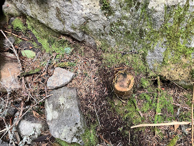
There were some signs of unauthorized maintenance on this abandoned route.
Some larger rocks along the track.
Looking down. It is steep!
The slide track at 4,000 feet, 550 feet above the Buttress Trail. I went a bit farther up, then headed back down, having no desire to battle through the krummholz at treeline and undertake the long boulder scramble above. Many years ago I was supposed to join some friends on an attempt to follow this old route. As I recall, I overslept and missed the rendezvous. It turned out that they lost the trail in the scrub and endured a horrific thick bushwhack up to treeline.
I spotted this blaze on the way back down.
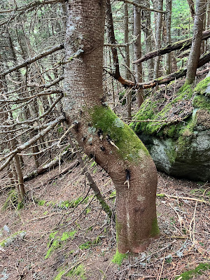
Twisted fir.
Heading up onto the talus slope traversed by the Buttress Trail.
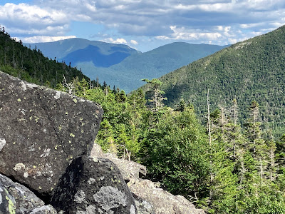
Great view of Jefferson Ravine and Jefferson's Knee.
Looking up the valley to the headwall of the Great Gulf.
Headwall zoomed. Mount Clay on the right.
Mount Washington's Chandler Ridge.
Carter Dome and Wildcat.
The Buttress Trail is wild and primitive.
Heading back down the Great Gulf Trail, I made a short bushwhack into a blowdown area for this profile of Jefferson's Knee.
Long view down the West Branch.
Evening view from The Bluff.













Fabulous photos. A truly wild place to explore. I have wondered about Adams Slide trail for years. Thanks for going there.
ReplyDelete