Tuesday, October 29, 2024

Kettles Path: 10/28/24

I had a sunny, crisp late October day for the fall maintenance trip on the Kettles Path, a one-mile-long trail I adopted through a cooperative program of the Waterville Valley Athletic & Improvement Association and White Mountain National Forest.

The first of just two blowdowns along the trail was sticking up onto the trail from the steep slope below.


Cut and removed.


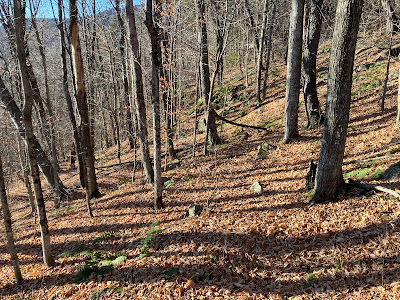
With the leaves down, the three Kettles along the trail are more visible. These bowl-shaped hollows were formed when chunks of glacial ice were stranded as the glacier receded. Sediments built up around the ice chunks, and when they eventually melted these hollows were formed.


The trail brushes by one of the largest white pines in Waterville Valley.


This interesting fungal sculpture has changed a bit over the last couple of years.


Each season I am happy to see this battered white ash still standing tall.


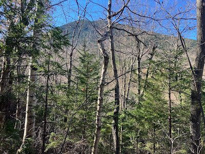
A nice hardwood corridor.


Cleaning drainages is an important task for adopters.


This small obstruction was easily dispatched.


Cleared.


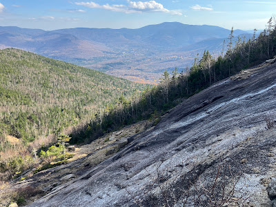
The reward at the top of Kettles Path is the ledgy nubble called The Scaur, with a wide view across the valley to Sandwich Dome and Jennings Peak. The sun was beaming down on this south-facing perch, making a stay here quite comfortable even with the temperature in the high 30s.


Snow guns were firing on the upper slopes of Waterville Valley Ski Area on Mt. Tecumseh.


Middle and South Tripyramid rising darkly to the east.


From an opening on the west side of The Scaur, a view of East Osceola and the Painted Cliff.


A  long ridge sweeps up to the main summit of Mount Osceola.


The "Rock of Gibraltar," found a short distance east along Irene's Path.


As I often do, I bushwhacked through hardwoods down the slope below the cliffs of The Scaur, returning to the Kettles Path below.


Saturday, October 26, 2024

Passaconaway Cutoff: 10/25/24

I had a cool, sunny day for the fall maintenance trip on Passaconaway Cutoff, the adopted trail of the AMC Four Thousand Footer Committee. We maintain this trail under the White Mountain National Forest Adopt-a-Trail program, which enlists volunteers to perform the basic maintenance tasks - brushing, blazing (outside Wilderness), removing blowdowns and cleaning drainages - for many of the trails across the region. For information visit www.fs.usda.gov/main/whitemountain/workingtogether/volunteering. (Similar programs are offered by the Appalachian Mountain Club, Wonalancet Out Door Club and Dartmouth Outing Club.) Adopting a trail is a great way of "giving back" to the mountains that give us so much pleasure. The work can be tiring, but also very satisfying. Today's primary task was cleaning the 57 drainages along the trail, with just a few blowdowns to remove.

It's been a dry fall, and the water level was very low in the beaver pond alongside the Oliverian Brook Trail, 0.7 mile from the trailhead.


This part of the Oliverian Brook Trail provides smooth walking on the grade of the Swift River logging railroad operated by the Conway Lumber Company in the early 1900s. According to Bill Gove's excellent book, "Logging Railroads of the Saco River Valley," (out of print) this was an especially busy branch of the railroad, serving a number of logging camps in the broad Oliverian Brook basin.


The Oliverian Brook Trail enters the Sandwich Range Wilderness a quarter mile before reaching the junction with Passaconaway Cutoff.


Time to wield the tools.


This leaner looked like it was ready to fall onto the trail.


I was able to pull it down and move it off the trail with help from my long-handled hoe.


This bony limb was blocking the footway.


Cleared.


The water was low where the Cutoff crosses the west branch of Oliverian Brook.


There is a nice hardwood section of the Cutoff above the brook crossing. This link in the northern route to Mt. Passaconaway, connecting the Oliverian Brook Trail with the Square Ledge Trail, was originally opened by the Passaconaway Mountain Club around 1920, following the conclusion of intensive logging in the Albany Intervale by the Conway Lumber Company. Following lumber roads up this valley, it originally stayed close to the brook, crossing it three times low down, then ascending along its south side to meet the Square Ledge Trail at the site of an abandoned logging camp on the north slope of Nanamocomuck Peak. The trail was abandoned after the Hurricane of 1938 caused flooding in the valley and unleashed a large slide on the east slope of Mt. Passaconaway, causing great damage to the trail. The trail was reopened in 1965, more or less following the route of the destroyed older trail. In 1981 the upper half was relocated higher up the slope and away from the brook, meeting the Square Ledge Trail farther to the east. In 2006 the entire trail was included in the expanded Sandwich Range Wilderness.


 The rocky upper section of the west branch.


Mount Passaconaway looms through the trees as the trail ascends along the flank of Square Ledge.


Cleaning the drainages is a top priority, since a waterbar clogged with leaves and other debris does not function well in diverting water off the trail.


  In some of the deeper drainage ditches I was up nearly to my knees in dry fluffy leaves.


I was happy to reach the upper end of the trail.


Before heading down I took a break at the edge of a small cliff below the trail, with a peek up at a shadowed Mount Passaconaway.


Here also I enjoyed a nice view north to the Nancy Range, part of the Southern Presidentials, and nearby Hedgehog Mountain. On the way out, a half mile from the trailhead with dusk drawing on, I quickened my pace when coyote howls broke out a short distance to the east.  This is evidently a good area for coyotes, as two years ago on a July afternoon I heard them down below me while bushwhacking up to the East Slide on Mount Passaconaway. It certainly adds a touch of wildness to the Wilderness.


Wednesday, October 23, 2024

Southwest Slide, Mount Osceola: 10/23/24

On a sunny, balmy October day with temperatures rising into the 70s, I returned to one of my favorite slides - the impressive Southwest Slide on Mount Osceola. The slide, which fell during Hurricane Carol in 1954, is prominent in the view of Osceola from the town of Waterville Valley, as seen in this photo taken from the edge of the golf course.


The first half of the approach to the slide was a mellow walk along the northern trails of Waterville's excellent cross-country ski network.


A new shelter for skiers.


The powerful surge of this slide scoured out its streambed (a western fork of Osceola Brook) for a mile and a half downstream. It also gouged out this parallel gully just to the east of the brook.


The lower end of a boulder train deposited by the runout of the slide.


Farther upstream, a ledgy spot along the brook. I could imagine the water and debris from the slide slamming through here.


A beautiful glade of sugar maples and boulders on the ridge west of the brook.


There was still a bit of maple color overhead, but it was falling fast.


There are several old logging roads leading up the valleys on the south side of Osceola.


Approaching the base of the slide, with the summit of Osceola high above.


Squeezing through along the steep footwall of the slide.


According to my pocket clinomteter, parts of the footwall have a slope of 40 degrees.


The right side of the footwall checks in at 45 degrees. Yikes!


Side view of the footwall.


After skirting the footwall to the right, I emerged to this view up the slide. The fork seen on the right is a much older, smaller slide, perhaps dating back to the 1880s.


Scrambling up the next set of granite slabs.


A short side trip led to the base of the older slide's footwall. This is extremely steep. approaching 50 degrees.


I cut over to the top of a gravel swath to bypass some wet slabs above.


On each of my several trips to this slide, I've avoided going out on this big exposed slab. I do not want to get partway up it and discover that the rock is slippery.


Which is what would happen at the top of the slab, with a ledge step to negotiate as well.


Down-look from the next level.


Expanding view out towards Sandwich Dome.


A small dike of intrusive rock cuts across the Mount Osceola Granite that makes up the ledges of the slide.


Continuing up. These slabs measured 30-31 degrees, about the average pitch for the slide as a whole.


These ledges on the upper part of the slide are steeper at ~35 degrees. Luckily they were dry and grippy.


Side view with Mount Osceola above.


Peering down.


Time for a long break in the sun near the top of the slide. The view takes in Mount Tripyramid, the Sleepers, Mount Whiteface and the northern Flat Mountain with the town of Waterville Valley below.


Looking across to Sandwich Dome. Some treacherous loose footing over there.


Looking up to the top of the slide. Doing the bushwhack up to the Mount Osceola Trail once was enough for me.


Zoom on Tripyramid (with the North Slide prominent), Sleepers and Whiteface.


After an hour's sojourn, time to head down, carefully. The crab walk was used to descend the 35 degree ledges.


Can't get enough of this scenery.


The sun drops behind the trees.


I was able to mostly walk upright down the 30 degree ledges.


A number of white pines have taken root on this 70 year old slide.


Looking back up after crossing to the other side of the slide.


An interesting rock formation.


Pothole pool above the footwall.


I'm glad I didn't try to scale the footwall.


Late day sun in the hardwoods.


A balloon, of course.


Homeward bound on the ski trails.