Thursday, March 31, 2022
Early Spring Scenes: Late March
Wednesday, March 23, 2022
SW Slides, Mt. Osceola
With cold overnight temperatures setting up firm snow in the woods, I decided to pay another visit to the big SW Slides of Mt. Osceola. Of special interest was a report of obvious signs of an avalanche at the base of the slides, as seen on February 20: https://mountwashingtonavalanchecenter.org/all-observations/entry/5677/
As someone who frequents slides in the winter, I wanted to see this for myself. At 10:00 am, mine was the only car in the large Livermore parking lot. The Waterville Nordic trails had been closed for the season due to thin, icy cover, which meant I didn't need a trail pass for the 1 1/2 mile approach along the north end X-C trails.
A view of Mt. Osceola from Osceola Vista Campground (Bob's Lookout XC trail). There are actually two Southwest Slides. The larger one on the left (west fork) fell during Hurricane Carol in August 1954. On the right (east fork) is an older slide of uncertain date, possibly occurring in 1883.
It was a beautiful early spring morning as I 'spiked along the crusty/icy XC trails. Being on the south side of the mountain, this route was sheltered from the strong winds that were gusting from the NW this day (up to 114 mph on Mt. Washington).
The snow was firm in the hardwoods in the morning, though it would soften up by late afternoon.
Woodpecker tree.
Very firm crusty snow in the conifers.
Approaching the base of the slides, with the crest of Mt. Osceola rising above.
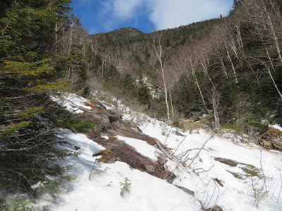
Looking up the slides from an opening cleared out by the avalanche. Not much snow left, and bits of ice were tumbling down as they melted in the sun.
Here there was a swath of small trees flattened by the avalanche.
It must have been powerful as after it surged down the steep footwall (~38 degrees as measured on the NH Granit website) at the base of the slides it came up over a rise to reach this point.
View up the 1954 slide from a high bank that provides a route around the footwall.
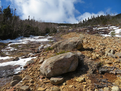
Heading up the gravelly swath that provides safer footing than the wet slabs on either side.
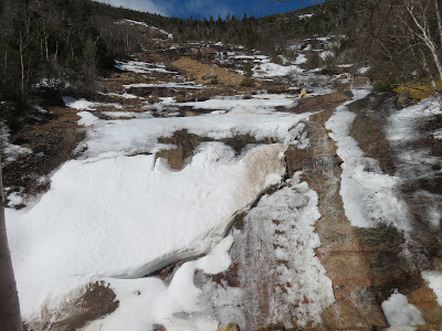
A cascade slides over the very steep (~45-50 degrees) footwall of the older eastern slide. Yikes!
View across steep slabs on both slides.
My turnaround point was the top of the gravelly swath, about 1/3 of the way up the slide. Too many wet slabs above, and I've been up there a couple of times in summer.
Side view.
Average slope here is somewhere around 30 degrees.
Down-look. I took a long break here in the sun.
View across Waterville Valley to Sandwich Dome and the northern Flat Mountain.
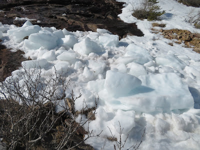
Ice chunks that tumbled down during the recent thaws.
Looking down over what I believe was the track of the avalanche above the lower footwall. The shrubs (looks like mountain holly) are leaning in that direction.
A peek at Waterville Valley's Green Peak ski trails.
Looking back up at one of the more impressive slide views in the Whites.
Peering down over the lower footwall.
Dirty, hardpacked avalanche debris.
The footwall cascade had opened up quite a bit during the time I was on the slide.
A ragged ice cliff high up on the slope of Osceola.
In late afternoon the snow was still hard and crusty in the conifers.
There are a number of old logging tote roads on these southern slopes of Osceola.
Nice hardwoods.
The snow had softened up here and I was punching through every few steps, but the snow was not deep.
Heading down to the X-C trails with Tripyramid in sight ahead.


