Sunday, June 29, 2025
Inlook-Kelton Trail Loop: 6/27/25
Thursday, June 26, 2025
Cascades, Slides and Emerald Bluff: 6/25/25
Easy grades through nice hardwood forest for nearly a mile on Castle Trail.
Someone had placed an old bucket next to the trail at the approximate location of a logging camp shown on Louis Cutter's early 1900s AMC map of the Northern Presidentials.
Nearby was what appeared to be a small cellar hole, though that seems somewhat unusual for a logging camp.
Heading onto the Israel Ridge Path, originally made by the great trail-builder J. Rayner Edmands starting in 1892. It is one of the more lightly used routes up Mt. Adams. In fact, I saw no other hikers during this entire trip.
It starts out with another crossing of the Israel River.
It then runs alongside the river with some nice water scenery.
Good work by the Randolph Mountain Club (RMC) trail folks.
At 1.7 mi., the Castle Ravine Trail continues ahead and Israel Ridge Trail bears left for a long sidehill ascent into Cascade Ravine.
Nice hardwood forest in the lower part.
Higher up, this brushy spot marks the site of one of several landslides that fell across the trail in the big November 1927 rainstorm. The 1929 Supplement to the AMC White Mountain Guide noted that the Israel Ridge Path had “been graded across three or four slides which came down in the 1927 flood, and which now afford fine outlooks.”
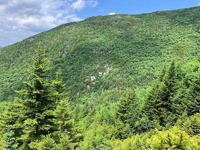
Looking up from here, you can see a hint of the old slide track.
Another old slide track, seen farther up on the trail. These slides have been completely revegetated.
This spine of boulders appears to be a "debris flow levee" deposited along the edge of that slide. The trail skirts around its lower end.
A short detour on The Link leads down to a fine ledge perch at the top of First Cascade, on Cascade Brook. Mount Bowman rises above.
You look down on the brook plunging over a series of ledge steps.
A nice spot to hang out for a while.
Before continuing up Israel Ridge Path, I took a stab at finding the location of the former Cascade Camp, which was located on the south side of Cascade Brook between the First and Second Cascades. It was originally built as a birchbark shelter by J. Rayner Edmands and several associates in 1892, and the great trail-builder welcomed many friends as guests there in the ensuing years. Edmands passed away in 1910, and two years later his niece donated Cascade Camp to the Randolph Mountain Club. The RMC immediately repaired the structure, and that September 38 people attended the RMC annual picnic at the camp. The next year over 80 hikers attended the annual picnic at the camp. A photo of that event is seen on the cover of Peaks & Paths, Judith Maddock Hudson's excellent history of the RMC. The camp was destroyed by a slide that fell from above in the November 1927 storm. From vintage photos I knew that Cascade Camp faced a ledgy wall. I thought the ledge face in this photo might have been the spot, but it was hard to tell, and the area may have been changed significantly by the slide.
The expansive ledges of Second Cascade make this one of my favorite spots in the Presidentials. I took a nice break here as well.
Cascade Brook slides down the edge of the ledges.
Partway up the steep climb, I made a short but thick bushwhack across to the remaining open area on the 1927 slide that flattened Cascade Camp.
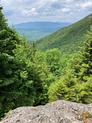
I found a nice flat, dry ledge perch on the slide with a beautifully framed view of the Pliny Range to the north.
Mount Starr King, Mount Waumbek, South Weeks, Mount Cabot and North Weeks.
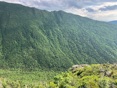
A steep-sided spur of Nowell Ridge closes in Cascade Ravine on the east.
Other than these steep ledges, this old slide is cloaked in a very dense growth of small spruces.
More ladders higher up on Israel Ridge Path.
Israel Ridge was originally called the Emerald Tongue. You can see why.
Israel Ridge has long been considered one of Randolph's most beautiful paths.
Farther up the ridge, I bushwhacked steeply down through fairly open woods to yet another 1927 slide.
This one also has a healthy growth of dense small spruce.
But there is a nice open area on the upper part.
One of three small white pines I spotted on this slide, at 3600 ft. well above their normal range.
Another view out to the Pliny Range.
This remote spot also has a view across Cascade Ravine to wild cliffs on the steep flank of Nowell Ridge.
A closer look at the cliffs.
A close-up of the "trigger point" where the slide tore loose during that epic November 1927 rainstorm.
Whacking back up to the trail.
I've seen freshly cleaned waterbars on several RMC trails recently. Nice work!
Turning onto the Emerald Trail to visit Emerald Bluff, the high point of the day at 4025 ft.
A short side trail leads to the Bluff.
With its phenomenal view into Castle Ravine, this is one of my favorite spots in the Whites.
Looking out to the Dartmouth Range. In the foreground is a slide on the west wall of Castle Ravine, which I have visited several times, most recently last winter.
The sun made an appearance to illuminate the headwall of Castle Ravine.
And Mount Jefferson's Castellated Ridge.
The Castles.
After an hour's sojourn on the Bluff, I headed down the steep and rough Emerald Trail, cut by RMC stalwart Klaus Goetze and friends in 1970. Did I say it was steep?
There are no really tough scrambles, though this rocky jumble is a little tricky to descend.
At the bottom the trail crosses a seriously mossy branch of Castle Brook.
Trail junction on the remote floor of Castle Ravine.
Castle Ravine Trail is wild and beautiful.
A favorite stretch alongside Castle Brook.
The trail climbs over a debris flow levee from a large slide that is prominent in a 1955 aerial photo but is now revegetated.
A multi-cascade at one of several crossings along Castle Ravine Trail, a couple of which can be challenging to execute with dry feet. After the final crossing down low on the Castle Trail, I walked the last easy section accompanied by the haunting song of a Wood Thrush.


