Between the humidity and wildfire smoke, there have been few days this summer with long-distance visibility. So when the Mount Washington Observatory reported 90-mile visibility on this cool, partly sunny morning, I wanted to get a big view. The South Peak of Mount Moosilauke beckoned for its sweeping western panorama that takes in the entire Green Mountain chain and, if it's clear enough, several peaks in the Adirondacks. It also provides unique close-in vistas of the ponds in Tunnel Brook Notch, the nine slides on Mount Clough, and the big northern slide in Moosilauke's Slide Ravine.
The day looked promising as I gazed up at Moosilauke's South and East Peaks from the front of Dartmouth's Ravine Lodge.
I opted for a longer, less traveled route to South Peak, cutting across to the Carriage Road on the Hurricane Trail.
An exciting bridge high above Gorge Brook.
The trail descends to a short section along the bank of the Baker River.
There's a sketchy washout on the trail as it climbs away from the river.
Most of this mile-long section of Hurricane Trail is a wonderful easy-graded walk through birch and hardwood, with good footing. Some of the nicest walking anywhere on Moosilauke.
On to the Carriage Road.
For some distance the Carriage Road climbs through a beautiful mature hardwood forest, with several sweeping switchbacks.
An inviting corridor.
At the junction with the Snapper Trail, the Carriage Road becomes significantly rockier and more eroded, testifying to the heavier use it receives as part of the classic loop over Moosilauke.
First views looking back, with Sandwich Dome in the distance.
A wide, rocky swath through the conifers, ascending steadily but never steeply.
A boulder barrier prevents snowmobiles from continuing to the fragile alpine summit.
Heading up the side trail to South Peak.
When I reached the top, there were some low clouds obscuring the western view, so I went over the the east side of the summit where there is a good standing view to the Whites.
On the right, the Hancocks and Mount Carrigain are prominent above nearby Mount Waternomee. On the left, the slides on Whaleback Mountain stand out above Mount Jim.
Mount Osceola, the Tripyramids and Mount Whiteface.
The low clouds soon lifted, revealing the huge western view. The Green Mountains were visible from Stratton Mountain in the south to Jay Peaks in the north. With binoculars, through Lincoln Gap in the Greens, I could see Giant and Rocky Peak Ridge in the Adirondacks!
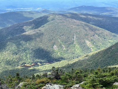
I spent a long time enjoying my favorite South Peak vista down into Tunnel Brook Notch.
From here I could study the nine slides on the steep east face of Mount Clough, all of which I have visited at least once.
A week earlier I was staring up at South Peak from the shores of these ponds.
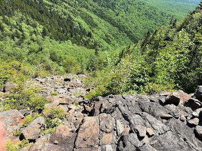
The big north slide in Slide Ravine, which fell in the late 1950s, looks especially wild from this angle.
I made a second visit to this slide back in June.
After a two-hour sojourn on South Peak, the main summit of Moosilauke was calling.
An unusually smooth stretch of the Carriage Road along the ridge.
A short side path on the bump known as "Middle Peak" opens a wide eastern view.
Ravine Lodge can be seen nestled down in the Baker River valley.
The summit rises ahead.
An important message.
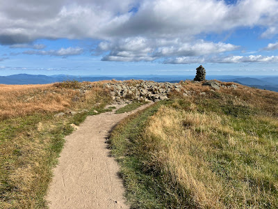
Tall cairns mark the way.
Looking back to Middle Peak and South Peak.
Excellent rock step work.
A great day to be above treeline.
Vast western horizons. From here I could see more peaks in the Adirondacks, including Marcy, Haystack and Dix.
An Appalachian Trail thru-hiker heads south.
Summit signs.
Weathered survey marker.
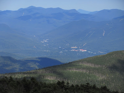
Peering down at Lincoln with the Hancocks and Mount Carrigain in the distance. The red-roofed Riverwalk Hotel is an unmistakable landmark.
Waves of mountains and ranks of clouds.
The Gorge Brook Trail leads out to East Peak.
Looking north along the broad ridgecrest.
Heading down the Gorge Brook Trail.
Hard to leave.
Looking back at the summit.
These signs surely have prevented some misdirected descents.
Informative signboard.


