On a warm, sunny, buggy day I wandered deep into the Sabbaday Brook valley and visited one newer slide and a couple of older ones. The mosquitoes were out in force as soon as I started out from the trailhead.
Though the East Branch of the Pemigewasset was running fairly low at 250 cfs, for some reason I found the three big crossings of Sabbaday Brook to be more difficult than usual on this day. It didn't help that I was being swarmed by mosquitoes as I picked my way across.
Into the Wilderness near the start of a 1.5 mile section that follows an old tote road along the east side of the brook. This road was used by the Conway Lumber Company's Swift River Railroad in the early 1900s.
Mainly good walkin' here, though there are a few washed-out sections.
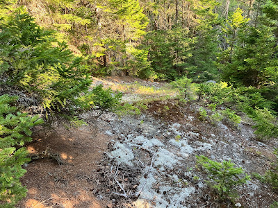
This lovely glade is the site of the Monahan Camp of the Swift River Railroad.
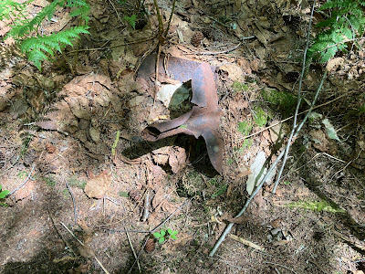
One of several artifacts scattered through the woods.
From here I followed an overgrown tote road towards the drainage of the tributary brook that flows down from the col between East Sleeper and West Sleeper.
A beautiful glade heading up the drainage.
I dropped down to the nameless brook and followed it upstream for a bit.
I came to the logjam deposited by the huge slide that fell off the slope of West Sleeper during Tropical Storm Irene in 2011. Time to take to the woods above the brook.
Paralleling the brook, I passed through some fine ferny glades.
No complaints here.
This route brought me to a jumble of logs and rocks at the edge of the slide, near the bottom.
Many of the rocks were unstable, careful footing required.
Emerging onto the base of the slide, where there is a broad deposit area that has been heavily revegetated.
This is a massive, wedge-shaped slide. On Google Earth it measures 0.25 mile long with a vertical drop of 700 ft. (from 3200 ft. to 2500 ft.) and a maximum width of 200 ft. The average slope is 31 degrees, with the upper part steeper at 33 degrees.
Part of Sleeper Ridge rises to the south. I have visited this slide a number of times since it fell, and it's been interesting to follow the progress of revegetation in the wake of major disturbance. Slide researcher Edward Flaccus studied White Mountain slides and their
revegetation in the late 1950s. He noted that a deposit area at the base
of a slide, as seen here, revegetates much more rapidly than the steep,
bare face of the slide above. In this deposit area the conifers red spruce and
balsam fir are taking over from deciduous species that dominated in the first few years after the slide..
Stunted balsam fir below, red spruce above.
I went partway up the wide lower part of the slide to enjoy the northeastern view for a while.
Potash Mountain and pointy South Potash are to the right. To the left of Potash are the Baldfaces, Bartlett Haystack, Carter Dome and Mt. Tremont/Owls Cliff.
Looking up the slide. I've climbed to the top twice, but this was as high as I would go today in the hot sun.
Down-look.
Birch seedlings (yellow birch, I presume, as that is a dominant tree in the adjacent forest) are speckling the slide with green.
Heading back down towards Sabbaday Brook, I saw that I was not alone in this valley.
This shovel blade was in a random location, not near any known logging camp site.
Nice hardwood whacking back down this side valley.
Looking up the tributary brook.
Barrel hoops are exposed in a bank along Sabbaday Brook, near the location of a relatively small logging camp.
The Sabbaday Brook Trail is a pleasing route as it penetrates the winding upper valley between the Sleepers, Mount Tripyramid and the Fool Killer.
A pretty section alongside the mossy brook.
Mossy, indeed.
I dropped down from the trail to check out the bottom of the 1924 slide that fell on the east slope of Tripyramid. The 1925 edition of the AMC White Mountain Guide noted that the slide "occurred in Sept. 1924; and the subsequent flood washed out the valley for some distance." This slide is revegetated save for one small open patch near its top, where I was headed via the trail and a short bushwhack.
Red trilliums still in bloom.
As it slices across the head of the valley, the Sabbaday Brook Trail passes a hardwood glade at the unusually high elevation of 3160 ft.
Fading blooms from the last trout lilies of the season.
The trail crosses the track of the 1924 slide shortly before it makes a sharp right turn onto the track of an older slide. This is the view looking down from the trail.
I bushwhacked up the steep slope to the last remaining open patch of the 1924 slide at ~3400 ft.
The 1925 edition of the AMC White Mountain Guide noted that either this slide, or the older one just to the south used by the Sabbaday Brook Trail, could be used as a route to the crest of Mt. Tripyramid: "Either slide may be ascended to its tip, with wild and interesting views towards Passaconaway and Chocorua." That vista is still available from the open patch, but may not be for many more years.
From this angle Passaconaway has a classic profile of a wooded Northeastern mountain. Here you can see the slope leading left down to the little bump where the great northern viewpoint is found.
Back down on the trail, I continued a short distance farther to the turn up onto the older east slide of Tripyramid. This slide is now almost fully revegetated and views are minsicule.
Looking down the track of this slide from the turn. The trail used to follow this slide all the way up from the bottom. In the mid-1980s a major trail relocation was made out to the north, coming back to the slide near its top, and the route going straight up the slide from below was abandoned.
On the way back down the valley I made another short bushwhack to the only opening left on the southern of two old slides on the Fool Killer. This slide may date back to the 1910s, as it looks fresh in a photo taken then that can be seen in the online archives of the AMC. When I climbed the Fool Killer in 1998, I used this slide for the start of the ascent, but even then it soon petered out. Such is the fate of many slide tracks in our fast-growing forests.
The patch still has a view up to the high crest of West Sleeper.
Damage from Tropical Storm Irene just above the trail's fifth crossing of Sabbaday Brook.
Sled runners near a logging camp location.
More relics from the big logging days when the Conway Lumber Company clear-cut the Sabbaday forest. This valley is now "forever wild" as part of the Sandwich Range Wilderness.


No comments:
Post a Comment