Holy cow, the Whites had some rain on Sunday night! The East Branch of the Pemigewasset, seen here from the Loon Mountain bridge, peaked at ~12,100 cfs Monday morning. Still not even close to the 30,000 cfs of Tropical Storm Irene in 2011, when the big rock in the river was underwater.
After a wet and dreary morning, I headed down to Waterville Valley in early afternoon to see how some familiar water features looked with the high water. Signs of clearing appeared as I crossed the Depot Camp clearing on the Livermore Trail.
The Mad River was looking pretty angry.
The Boulder in Slide Brook was marooned.
Every little stream was surging with whitewater.
Along the Livermore Trail I met Cam Francisco from the The National Center for Outdoor & Adventure Education (NCOAE), based in Wilmington, NC. Cam and his co-leaders were guiding a backpacking trip for students from a high school in Rhode Island. He had made a trip to bring some dry gear in to the group following the overnight torrential rains. Appropriately, Cam's recent blog post on the NCOAE website (ncoae.org) was entitled, "Managing Backcountry Rain by Adopting an Expedition Mentality."
I made the short side trip on Norway Rapids Trail to gawk at the raging Norway Rapids on Slide Brook. Yikes!
The school group was heading up the Livermore Trail for an afternoon hike.
This is normally a placid pool at the base of White Cascade on Slide Brook.
No light-colored ledges to go out on at White Cascade today.
Name temporarily changed to Whitewater Cascade.
A brimful Slide Brook above the cascade.
The confluence of Avalanche Brook (L) and Slide Brook (R).
The crossing of Avalanche Brook at the south end of the Mount Tripyramid Trail is normally fairly easy, but not this day.
Continuing up the Livermore Trail towards North Tripyramid.
A new washout just below the clearing at Avalanche Camp.
Avalanche Camp (the second of two to go by that name), used by loggers in the 1930s and 1940s.
Artifacts.
A new blowdown, snapped off by the previous night's high winds.
Beautiful maple glade beside the trail.
Looking down at the Avalanche Brook crossing at the north end of Mount Tripyramid Trail. Nope.
I left the trail and headed up a familiar old logging road on the north side of Avalanche Brook.
A pretty little stream lined with mossy rocks.
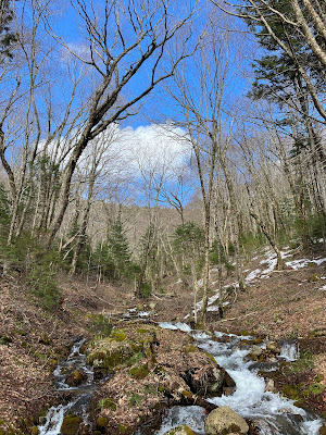
Water, water, everywhere!
Blue skies over a favorite maple glade.
Dutchman's breeches and trout lily emerging.
Time for a very late lunch break.
From my seat, North Tripyramid through the trees.
I had hoped to visit the East Fork of the North Slide to see what would surely have been a powerful cascade. But the brook draining the little ravine below the Scaur Ridge Trail was frothing - no way to cross without wading in my Crocs - and there was significant rotten snow lurking on the shady far side.
Instead, I made my way up this lovely little valley, which I refer to as Scaur Ravine.
Old yellow birches shelter the stream.
Another old logging road runs up the valley.
Climbing a steep slope to the Scaur Ridge Trail.
Random boulder.
I found a spot with a view of the North Slide and sat for a while, then continued whacking up to the trail, meeting it at the top of its hardwood section.
This trail is well-maintained by Dennis Follensbee, Jr., and the drainages were doing their job.
The hardwood section of Scaur Ridge Trail, which follows a well-built old logging road, is a joy to descend.
A nice framed view of North Tripyramid, the North Slide, and the narrow East Fork (on the left).
Moss-encased trunk.
The largest of several runoff streams coursing across the trail and down the slope below.
Bear tree.
Leaving the Wilderness.
Livermore Trail curves towards South and North Tripyramid.
The waters of Slide Brook did not recede during the afternoon. They were still roaring!


My goodness!
ReplyDeleteAlways wondered what the ice melting on Falling Waters trail would sound/look like.
ReplyDelete