I enjoyed a sunny 10-mile meander out of Lincoln Woods looking for pockets of color in this drab (up to this point) foliage season, taking in Black Pond, Franconia Falls, and several scenic spots along the East Branch of the Pemigewasset River. This loop offered a great variety of scenery. Along the way I had views of a dozen mountains and paid brief visits to several logging camp sites.
Middle Scar Ridge and Scar Ridge seen downstream from a bank along the Lincoln Woods Trail. Tropical Storm Irene opened up new views in many places along the riverbanks, but these are often severely undercut, requiring caution from viewseekers.
Middle Scar Ridge and Scar Ridge seen downstream from a bank along the Lincoln Woods Trail. Tropical Storm Irene opened up new views in many places along the riverbanks, but these are often severely undercut, requiring caution from viewseekers.
A sled runner at logging Camp 8, just north of the Osseo Trail junction.
Looking downstream to Mt. Osceola.
The familiar Lincoln Woods Trail, straight and wide.
Rusting bed frame at Camp 7, by the Black Pond Trail junction.
Mt. Flume seen across a meadow that was once Ice Pond, where ice was harvested for use in J.E. Henry's logging camps.
An old beaver swamp along the Black Pond Trail.
Looking down Birch Island Brook.
This logging camp clearing is right on the Black Pond Trail, but is not identified on the logging railroad maps.
The south peak of Owl's Head from the Black Pond outlet.
Serenity rules at Black Pond.
Bondcliff and its south peak rise to the northeast.
An elaborate campsite in the woods behind the pond. Leave No Trace - not!
An old beaver meadow to the north of Black Pond.
Nice sitting rock on the north shore of the pond, accessed by an unofficial fisherman's path.
Mt. Flume and the gnarled ridges of Whaleback Mountain seen from the NE corner of Black Pond.
Zoom on Flume.
From the pond I bushwhacked over to Franconia Brook and its fisherman's path.
An emerald pool and overhanging ledge at the north end of the Franconia Falls Trail.
A small cascade drops into the pool.
The pool is rimmed by sculpted ledges.
View from the top of Franconia Falls. North Hancock on the L, North Hitchcock on the R.
North Hancock and the Cedar Brook Slide.
Waterspout at Franconia Falls.
Another angle.
A rock bridge at the base of the falls.
The lower drop of Franconia Falls.
The railroad grade section of the Bondcliff Trail was still a green tunnel.
Artifacts at Camp 15, near One Mile Brook.
An old wash basin?
A long view downstream on the East Branch.
Nice open woods along the north bank.
Looking east up the East Branch. The water was so low I was able to rock-hop across the river.
The spot where I crossed.
This sloping rock provided a nice spot for a mid-river break.
Sun, rocks and a gurgling river.
A wild northern spur of Mt. Hancock.
A nice patch of color along the riverbank.
The wild, remote peak of Northwest Hancock.
Debris from Tropical Storm Irene where the Pemi East Side Trail crosses Cedar Brook.
Colorful canopy.
Bondcliff and its sharp south peak tower above the river.
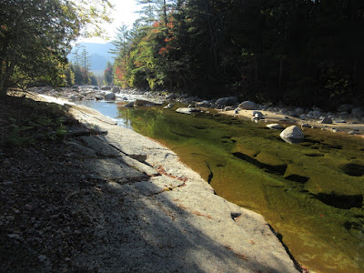
Sloping ledges fringe a placid stretch of the East Branch.
Cold, clear water.
View upstream along the ledges.
The Pemi East Side Trail crosses these flat ledges.
White cedars thrive along the riverbank.
A giant tilted rock at the river's edge.
The "Ranger's Pool," another scenic spot along the Pemi East Side Trail.
Cedar branches shade the edge of the pool.
Big view of the river and Mt. Flume from a high cutaway bank.
Bear box at Franconia Brook Campsite.
Along the road section of the Pemi East Side Trail.
A sandy beach created by Tropical Storm Irene, at the north end of the Pine Island Trail.
Downstream to Scar Ridge and Black Mountain.
A trailside peek at Owl's Head.
Looking upstream to South Twin Mountain and its lumpy spurs.


Steve,
ReplyDeleteWe did the exact same hike last year on September 2
Job
It's a great area, worthy of many visits!
DeleteSteve