BETWEEN THE SLEEPERS: 5/31/16
After a 3-mile approach up the Sabbaday Brook Trail, I did a bushwhack loop in the spacious side valley on the north side of the Sleepers in the heart of the Sandwich Range Wilderness. Highlights included an ascent of the huge Irene slide on West Sleeper and a visit to some gorgeous glades high in the valley, one of the more remote areas in the Sabbaday drainage.
Sabbaday Falls was in good flow on a quiet morning.
Looking down the flume below the falls.
The three wide crossings of Sabbaday Brook in the first mile are never easy, even with lower water levels.
The start of the long, pleasant section of Sabbaday Brook Trail up the east side of the valley, following an old tote road from the Swift River Railroad days of the early 1900s.
A peaceful scene along the brook.
The site of Monahan's Camp of the Swift River Railroad (1906-1916). This was a large camp located about three miles up the valley.
Part of what looks like an old cookstove from the Monahan Camp.
A sled runner, mostly buried.
An old tote road leading away from the camp.
Mossy rocks on Sabbaday Brook at the trail's fourth crossing.
The trail leads into the inner sanctum of the upper valley.
A fine patch of purple violets at a wet spot along the trail.
A burly yellow birch, off-trail.
I took a break a little ways up the brook that drains the valley north of the Sleepers.
There is a formidable growth of hobblebush in the lower part of this side valley.
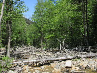
I popped out onto the brookbed a tenth of a mile downstream from the base of the West Sleeper slide. Torn and twisted trees continue for some distance downstream from here.
A wide swath of rocky rubble leads upstream to the base of the slide, providing an interesting wide-open approach.
In some areas revegetation by pioneer tree species - yellow and white birch and pin cherry - is well underway five years after the slide.
The brook meanders through the rubble.
Rocks and trees deposited by the slide.
The ridge of East Sleeper in view ahead.
Here I could sense that the slide was just around the corner.
The slide fell at a right angle to the brook and slammed into this bank at the bottom, turning its swath of destruction downstream.
Looking up from the base of the slide.
A closer look from an upper shelf. I first visited this slide in June 2012 when it was very new and went about 1/4 of the way up. Today I wanted to go to the top.
Spring greens on the slide and the ridge.
The best distant view is from the wide lower part of the slide and includes Mt. Tremont, Carter Dome, Bartlett Haystack, the Baldfaces, Potash Mountain and South Potash.
Heading up. The steep grade, hot sun and loose rock and gravel footing made for a slow climb.
A different angle on the view.
Ledge slabs halfway up.
Getting up near the top.
Down-look.
Steep!
Mt. Passaconaway pops into view above the north ridge of East Sleeper.
That is a long spur ridge.
A bottleneck near the apex.
The uppermost swath.
The slide started at this gouge during the torrential rains of Tropical Storm Irene in 2011. Elevation here is about 3150 ft. The base is at 2500 ft.
Mount Passaconaway.
I wanted to head into the upper part of the valley, and did not relish the idea of descending the loose slide, so I headed SE down a steep wooded slope. In places the footing was rather treacherous with half-buried loose rocks.
Evidently there is a large bruin residing in the area.
Lush glades in late afternoon light.
After crossing the Sleepers branch of the brook some distance above the slide, I climbed up to an old tote road Cath Goodwin and I had discovered on a 2007 snowshoe bushwhack up this basin to the Sleepers. This led me deeper into the valley.
High in the valley on that snowshoe trek we crossed an open area that we thought looked like a potential old logging camp site. I had long wanted to come back and have a look in the summer. It still looked like a potential spot, but there were no artifacts to be found.
It's a lovely glade, though it was here that the swarming black flies were at their most heinous.
This looked like White Baneberry.
Red Trilliums were still in bloom at 2800 ft.
I continued up to 3000 ft. to see these amazing glades that we snowshoed through on our 2007 trek.
Park-like and beautiful in any season.
Almost looks like a ski trail.
Heading back down the old tote road, which had petered out a bit below the glades.
An old shed; there was evidence that moose traveled the more open sections of the tote road.
From the road I had a peek at the slide.
The Fool Killer is glimpsed through the trees.
Another glimpse of the slide.
Farther down, the road had been overwhelmed by head-high hobblebush. It was a push through the tangle to get back to the trail, but I knew the walking would be easy from there on out.


What a great adventure, Steve. My wife and I hiked the Sabbaday Brook Trail the day before you, but we didn't get the nice blue skies that you had. And we stuck to the trail, so we missed some of those interesting sights you saw on your bushwhack.
ReplyDeleteIt was good to see you the other day. Glad you got out on Sabbaday Brook - it has long been one of my favorite trails.
DeleteSteve