Thursday, June 20, 2019

Noon-Jennings Loop: 6/19/19


An afternoon/evening tramp over these two fine viewpoints on Sandwich Dome. Up the Sandwich Mountain Trail and down the Drakes Brook Trail, a 6.5 mile loop with 2150 ft. of elevation gain.

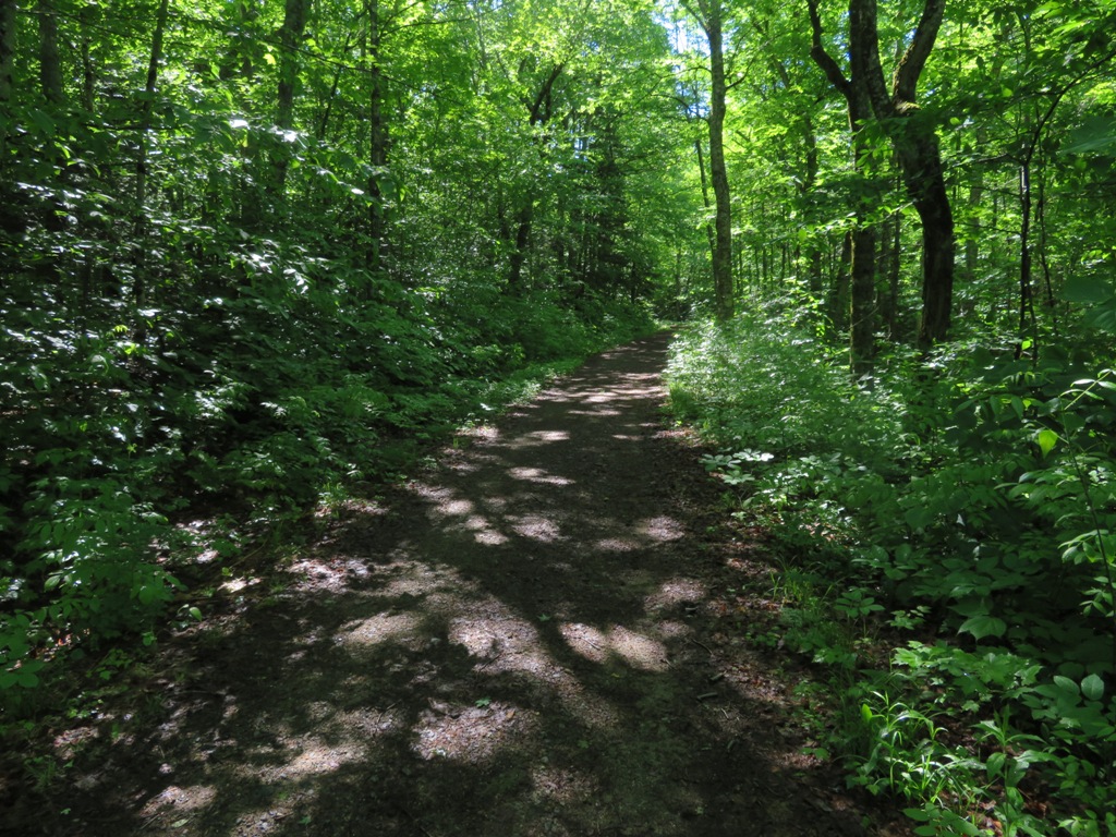
The Sandwich Mountain Trail climbs steadily to the Wilderness boundary.


Glacial erratics in a neat spruce forest on the way up Noon Peak.


The upper part of the climb to Noon Peak is steep. It's a good workout, ascending 1550 ft. in 1.6 miles.


The inviting outlook ledge on Noon Peak.


Looking north through Mad River Notch beyond the village of Waterville Valley. Mt. Bond, Zealand Mountain and the Hancocks in the distance.


Tripyramid, where I had been two days earlier.


Tripyramid's South Slides. The 1869 slide, the one the trail follows, is on the left. At the upper right is the top of the 1885 slide, crossed by the Kate Sleeper Trail. The strip on the bottom right is the new slide from Tropical Storm Irene in 2011.


Peering straight down into the Drakes Brook valley.


A second outlook on Noon Peak looks across the Drakes Brook valley to the northern Flat Mountain and its col with Sandwich Dome. The southern Flat Mountain peeks over the col.


The Sandwich Mountain Trail has some great ridge walking. It was opened in 1879 by AMC volunteers. Describing the new path in Appalachia, AMC stalwart Webster Wells wrote, “I think we may regard it as by far the most interesting excursion in the neighborhood of Waterville, and one of the most delightful in the whole mountain region.”


Whenever I hike here, I recall the ode to the trail from Waterville trail-builder and historian Nathaniel Goodrich in his history of Waterville Valley: "Beyond Noon Peak it passes through an area of curious elfin beauty. Gray ledge and grayer reindeer lichen, green moss and low green spruces, long vistas into mystery, utter quiet, a feeling of remoteness, of simplicity, pervade this spot. Go slowly here."


Farther along the ridge, there are more ledges with views. The best vistas are found by dropping down to the left of the trail on the ledges.


The double summit of Sandwich Dome looms close by.


The nubble of Jennings Peak.


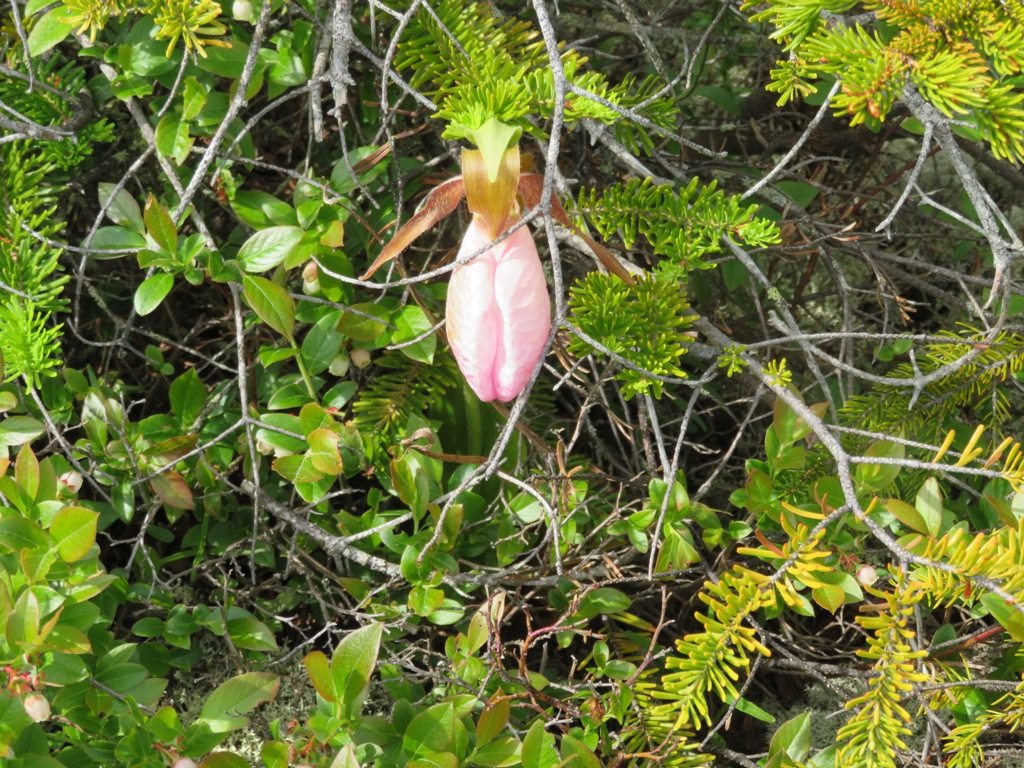
A ladyslipper emerging from the scrub.


Worth the side trip.


A steep pitch lifts you to the top.


The Sandwich Range in silhouette.


Waited out a soaking shower for about 20 minutes.


The signature vista from Jennings is the sweep over the wild valley of Smarts Brook, with the two Black Mountains on the L and Sachem Peak on the R.


The cliffs of Sachem Peak.


The high ridge joining Black Mountain and Sandwich Dome, traversed by the Algonquin Trail.


Ferns along the Sandwich Mountain Trail.


Drakes Brook, high in the valley, where the trail comes down to it.


At this spot you can see cribbing from an old dam or bridge [?], left over from logging days in the early 1900s.


A gentle stretch of Drakes Brook, still deep in the valley, lined with graceful yellow birches.


Cascade on Drakes Brook, off-trail and farther down the valley.


One of several bed frames strewn around the site of an old logging camp in the lower valley.


Tuesday, June 18, 2019

Tripyramids: 6/17/19


Enjoyed sunny skies and somewhat diminished bugs for the scenic South Slide/Scaur Ridge loop over this Sandwich Range trio, with a couple of bushwhack diversions along the way.


Late spring lushness on the Livermore Trail.


White Cascade, a beauty spot on Slide Brook.


The first of two logging camps named Avalanche Camp was located in the early 1900s near what is today's junction of Livermore Trail and the south end of Mt. Tripyramid Trail. Previous searches had failed to turn up any artifacts, but this time I spotted a section of pipe that I assume provided a water supply to the camp.


For the second time in two years, I hiked Tripyramid on a day WVAIA President Dan Newton was doing trail maintenance on the Mt. Tripyramid Trail.


This way for the South Slide.


I always stop for a break beside this small cascade on Slide Brook.


Black Cascade, named for its dark gabbro bedrock.


The Mt. Tripyramid Trail provides very pleasant walking as it heads up towards the South Slide.


I left the trail for a bit of bushwhacking along Slide Brook, passing this attractive fern glade.


A mossy spot where Slide Brook really slides.


Dan Newton (L) and Jim Dill (R), along with their supervisor, Friday, take a break from their maintenance work. Thanks, guys!


A big trailside yellow birch.


The trail passes through a gorgeous upland maple glade at around 2800-2950 ft. The hardwoods run higher on Tripyramid than on most other peaks.


Where the trail turns up to ascend the South Slide, which dates back to 1869, I bushwhacked across and up to reach a smaller slide that fell during Tropical Storm Irene in 2011. The runout from the recent slide has already been densely revegetated.


The slide in sight above.


The slide still looks fairly fresh, though revegetation is underway.


Smaller plants and tiny saplings gaining a foothold.


Pin cherry (L) and paper birch (R) are two "pioneer trees" that move in on a slide.


According to geologist/hiker Thom Davis, this thin tan band is an aplite dike in the granitic bedrock.


View from the upper part of the 2011 slide, which only extends about 200 ft. in elevation.


Stinson Mountain, Welch/Dickey, and Carr Mountain.


While bushwhacking across to the trail on the older South Slide, I crossed another slide patch with a view of Mt. Tecumseh and Mt. Osceola, with part of Mt. Moosilauke seen through Thornton Gap.


Looking at Sandwich Dome from the older South Slide, along the trail.


The steepest scramble on the South Slide.


Going up! On the South Slide the trail ascends on the order of 900 ft. in about 0.4 mile.


These painted arrows mark the junction with the Kate Sleeper Trail near the top of the South Slide.


One of my favorite White Mountain vistas, looking over the Sandwich Dome-Lost Pass area. Many trailless acres out there.


Looking over the long arm of East Sleeper to the Lakes Region beyond.


Lost Pass, with Mt. Israel behind.


Time enough for a short snooze.


Looking down from the very top of the South Slide.


The trail continues very steep and rough in the woods above the slide.


Then it abruptly mellows and meanders up to the South Peak.


Off-trail view of the Sleepers and Mt. Whiteface on South Peak.


A fine profile of Mt. Passaconaway.


Neat glade atop South Peak.


A glimpse of South Twin, the Bonds and Hancock.


Approaching the summit of Middle Peak.


Mts. Chocorua and Passaconaway from the summit ledge.


An off-trail spot peers down into the Sabbaday Brook valley.


After the easy climb to North Peak, I checked out the NE vista found off a short side path. This view is getting closed in by the trees, but is quite impressive with deep snowpack.


Still a few specks of snow on the south side of Mt. Washington.


An off-trail view of Middle and South Peaks, with East Sleeper and Mt. Whiteface to the L.


A beautiful spreading view of Sandwich Dome.


Looking NW to the Osceolas, Kinsmans and Franconias.


Osceolas.


Vast horizons.


Typical nasty stuff on the dark, slippery upper section of Pine Bend Brook Trail.


By contrast, the stroll along the nearly level Scaur Ridge is delightful.


Cool tree by the Scaur Ridge Trail junction.


A hobblebush-choked side path leads to northern views.


The mighty Carrigain.


Last red trilliums of this late season.


Sunlit beauty on the Scaur Ridge Trail.


Recent trail improvement by Scaur Ridge Trail adopter Dennis Follensbee.


Easy walking, a great trail to descend.


A peek at the North Slide.


Green and gold maple forest.


Evening illumination.


The second Avalanche Camp, in use 1930s/1940s.


Had the pleasure of walking the last two miles out with Liam Cooney, an active member of the White Mountains Red-Lining Facebook page. His loop over the Tripyramid slides put him over the 50% mark of hiking all the trails in the AMC White Mountain Guide. Well done!