Wednesday, September 20, 2017

ZEALAND NOTCH & THOREAU FALLS: 9/18/17


On a humid, partly sunny day I went looking for early foliage color in the scenic Zealand valley, one of the best of all places for fall hiking.

Ledges on the Zealand River, just off the Zealand Trail.


Zealand Ridge beyond a beaver swamp.


The bridge that replaced the former "Z-Bridge."


Smooth walking on the grade of the 1890s Zealand Valley Railroad.


A peaceful scene.


Mt. Tom seen across the beaver pond near the A-Z Trail junction.


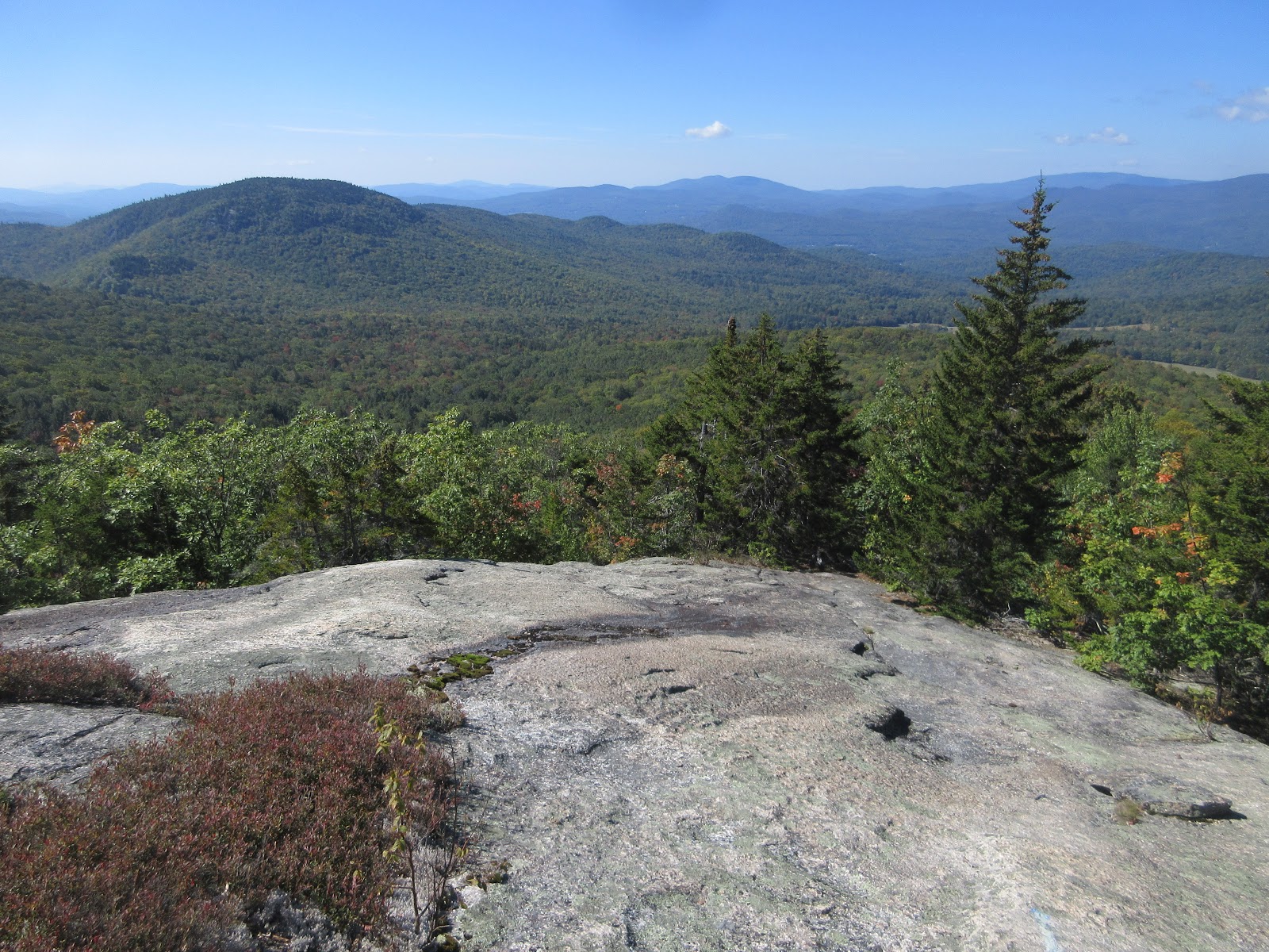
Zeacliff Pond Peak beyond the north end of Zealand Pond.


Zealand Pond.


Zeacliff rises above Zealand Pond.


A fine maple glade a short distance along the Ethan Pond Trail.


Zeacliff and Mt. Hale from the open area along Ethan Pond Trail in Zealand Notch.


Mt. Hale, with Zealand Falls Hut visible left of center.


The only people I saw on the Ethan Pond Trail were a southbound Appalachian Trail thru-hiking couple, Lady and the Tramp.


The cliffs and talus of Whitewall Mountain.


Heading south through Zealand Notch. Hard to believe a railroad was put through here.


Shoal Pond Peak and the NW ridge of Mt. Hancock.


Along the Ethan Pond Trail.


Early color along the trail.


Wild woods of the Eastern Pemi region.

Junction.


The broad ledge at the top of Thoreau Falls offers a view of Mts. Bond and Guyot.


A wider view, including Zealand Mountain.


 Mount Bond, with birch gold on is flank.


Thoreau Falls from the top.


Side view of the falls.


Zoom on the lower drop.


Hikers take in the view.


I crossed the North Fork at the top of the falls and descended 0.3 mile along the lightly-used Thoreau Falls Trail until it came back near the river. I hoped to find "Echo Cascade," a water feature described in an 1879 article in the White Mountain Echo tourist newspaper. Joe Richardson found it earlier this summer and posted some great photos. Lost waterfall sleuth Chris Whiton has also taken some fine photos of Echo Cascade.


I started bushwhacking upstream and soon ran into some very gnarly terrain, so I canned the search and settled for this fine pool and waterslide, somewhat reminiscent of "The Pool" along the Shoal Pond Trail.


A mini-cascade at the top of the waterslide.


Leaning red maple.


Not a bad spot to hang out for a while, out in the Pemi Wilderness.


Back at Thoreau Falls, dark clouds were gathering.


Peaceful scene in the Zealand valley, redux.


Early foliage on Mt. Oscar, from Rt. 302.


Friday, September 15, 2017

FISHER MOUNTAIN: 9/13/17


On a warm late summer day I enjoyed sunny open ledges and wide views on this close neighbor of well-known Welch and Dickey Mountains.

The unofficial trail up Fisher passes through some nice hardwood forest as it approaches the first ledges.


The first open ledge. Nearly all of the route from here to the summit is on bare ledge, which minimizes impact. There are some very steep pitches where grippy boots are needed. Careful navigation is required to follow the route, which is sparsely marked.


The SW view from the first open ledge, with Cone Mountain nearby on the left.


Continuing up the Fisher ledges, with views west towards Mt. Moosilauke.


One of several big slabs on the west side of the mountain.


The route ascends this huge, steep slab - potentially dangerous if wet, or icy.


The view from the top of the slab, with the fields along Mill Brook Road visible in the center.


This is perhaps the steepest pitch on the route.


The "fissure on Fisher" - one must step carefully across this crack. Not a good spot for dogs.


I crossed over the broad crest of the peak and bushwhacked down to one of my favorite view ledges.


This perch offers a unique view up the trailless Haselton Brook valley to West Tecumseh and Mt. Tecumseh (the pointy peak on the right).


The long ridge of Bald Mountain leads up to West Tecumseh. A large USFS logging project titled Wanosha is in the early planning phase and may impact the scenery in the left half of the photo and elsewhere in this fine backcountry area. There will be two public comment periods in the next year and a half.


Distant view NW to Kinsman Ridge, Cannon and the Franconia Range.

Image may contain: sky, tree, mountain, plant, outdoor, nature and water

The Franconia Range and Scar Ridge, marked by a slide on the west side of the Mack Brook drainage.


Moosilauke.


Wild, tangled country amidst the southern ridges of Tecumseh. The ledgy knob in the foreground is the NW peak of Hogback Mountain. The entire area between Cone Mountain and Mt. Tecumseh - about 3,600 acres - was burned over in a forest fire around 1820, five years after a hurricane downed large amounts of timber. Two centuries later, many open ledges and scrubby areas remain.


I wandered a bit over on the east side of the crest and found a peek at Sandwich Dome and Black Mountain, its SW shoulder.


A cairn marks the high point of Fisher's flat, 2609-ft. summit.


Descending to the crack is a bit tricky.


Relaxing on the top of the big slab.


Swirly clouds above the slab.


The darkly wooded mass of Dickey Mountain, seen from the back side, away from the Welch-Dickey Loop Trail.


Fisher Mountain from Mill Brook Road.