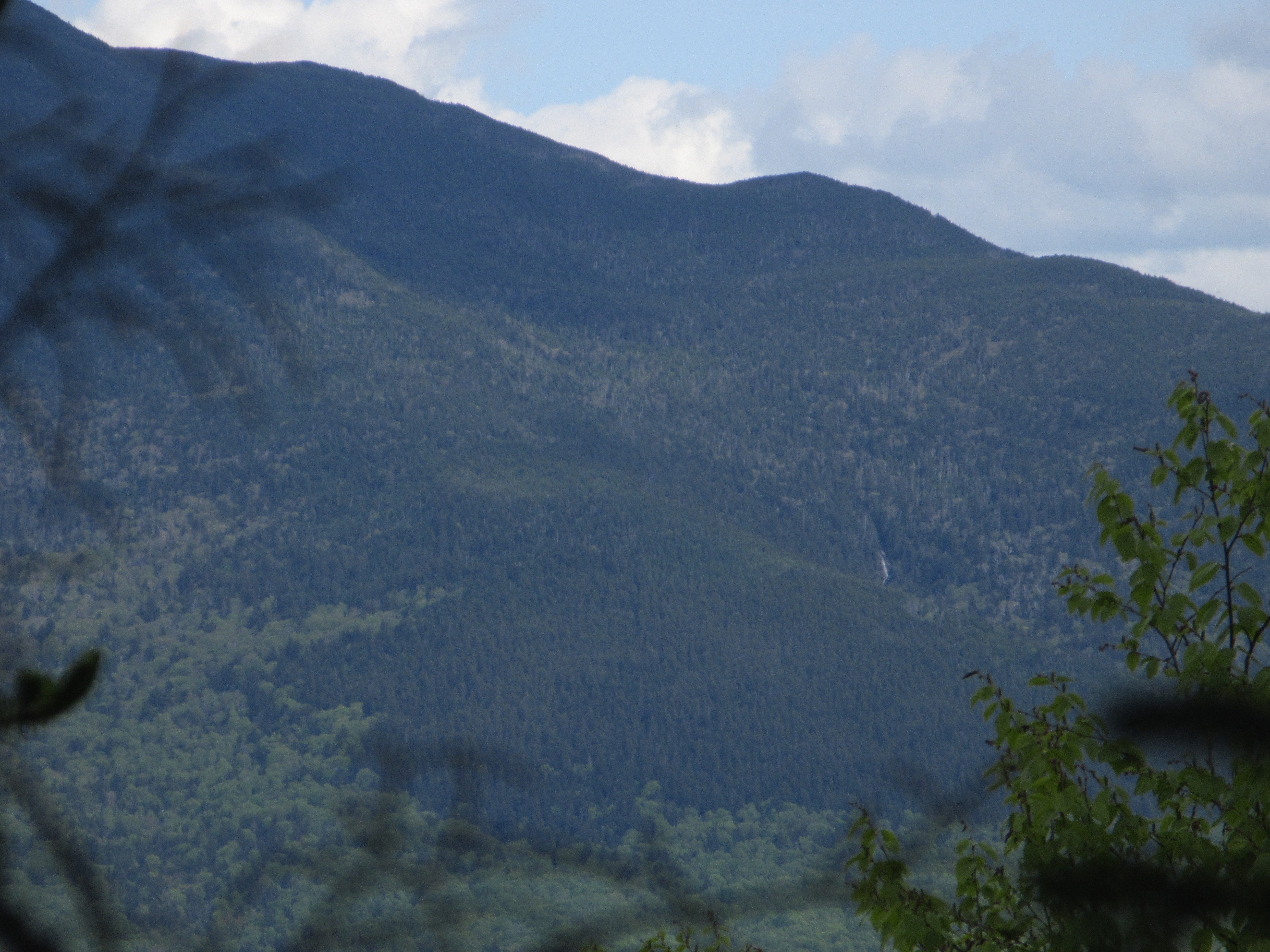
On a beautiful early June day I teamed up with Easton resident Kris Pastoriza and her canine companion, Ruby, for a bushwhack up along a nameless brook on the west side of South Kinsman Mountain. Kris is an avid local historian and co-author of Corps of Granite, a book on the Civilian Conservation Corps, and of two volumes in the Moosilauke Reader series, with a third volume due out this summer. Kris had told me about a lofty waterfall, high in a drainage on South Kinsman, that can be seen from a few vantage points in the Easton valley and on the Cooley Hill-Cole Hill range. I was able to spot it on two recent hikes to Cooley Hill, which has a nice view of the Kinsmans and out to Cannon and Lafayette from a small vantage just below the summit.
Just the day before I had climbed Cooley Hill via the Jericho Road Trail. (Pro tip: don't hike this trail on a wet day; it utilizes a brushy/grassy logging road for the lower mile, skirts the edges of two vast brushy clearcuts in its middle section, and its wooded upper section is currently overgrown in many places with beech saplings.) Seeing the waterfall in strong flow whetted my appetite for the bushwhack. It was a day that held some surprises.
After an approach on the Reel Brook Trail, Kris and I headed into the woods and began following the brook.
Nice open hardwood in the lower elevations.
A small preview of what was to come.
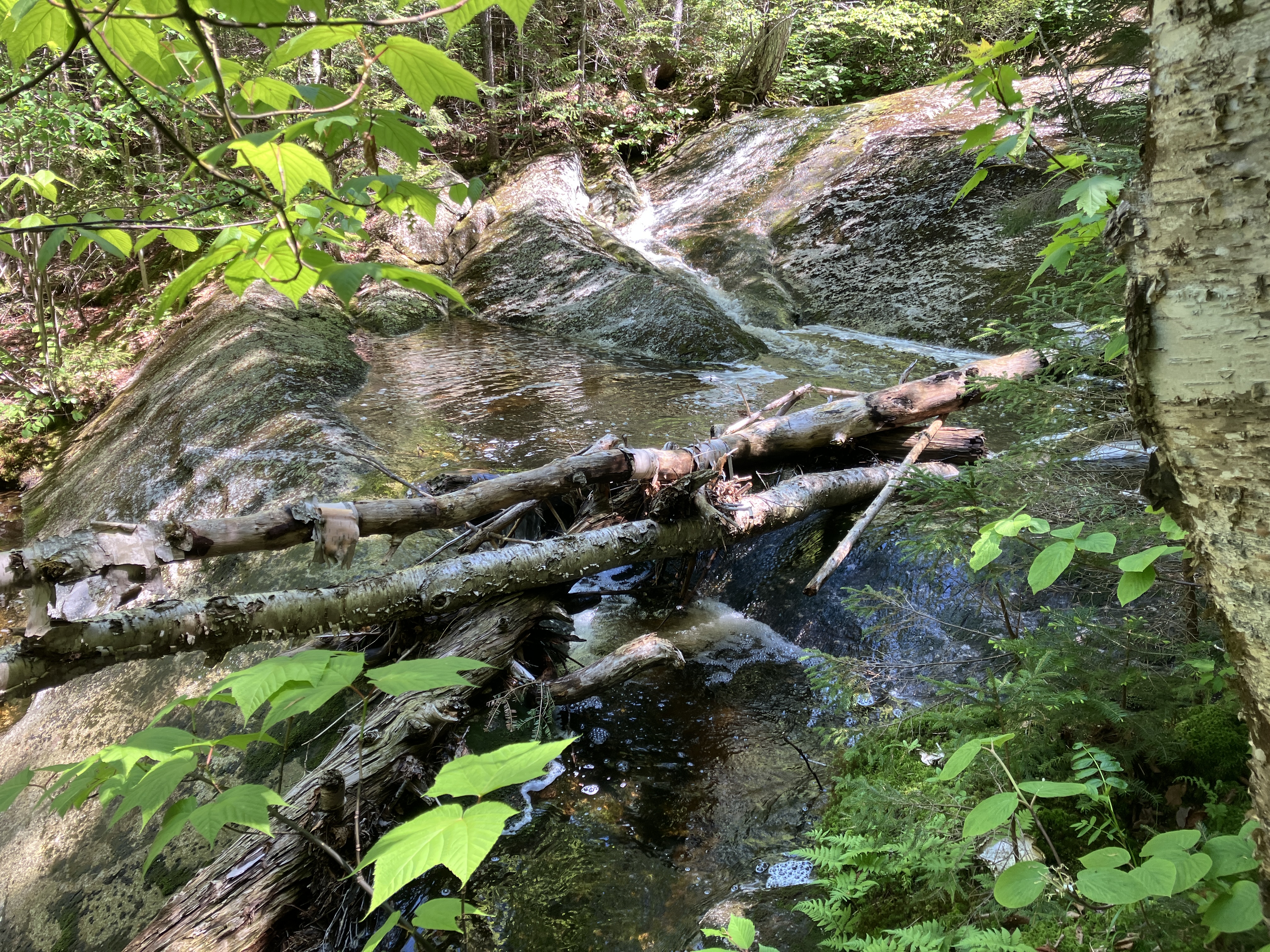
The first cascade and pool, lower level.
Upper level.
It soon became evident that this would be a cascade of cascades.
Mossy slabs.
Many of the pools were fringed with foam, some of which we saw floating through the air.
Another two-tier cascade.
A sluice funnels the brook between the two levels.
Kris takes in the scene.
The cascades keep on coming.
A mossy carpet.
Peering down at the next cascade.
We came across this single random piece of flagging, which seemed to be part of some kind of research project.
Every bend in the stream revealed more beauty.
A sizeable one up ahead.
Yup.
Next up, a chain of small cascades and basins, similar to one found on waterfall-rich Slide Brook, in the big drainage between the Kinsmans.
Side view.
Ruby was loving all the flowing water.
An amber pool.
Ho hum, just another cascade.
Potential shelter from a storm.
Remarkably, plants are clinging to the side of this sluice.
Higher up in the drainage, the woods got thicker and pricklier, and the terrain roughened up.
It was difficult to get a clear look at this one.
High in the drainage we stumbled upon a mostly buried bucket. Could there have been a logging camp up here?
That was confirmed when we found a pile of stove pieces nearby.
Kris noted that there were several sawmills in the Easton valley in the late 1800s/early 1900s, and perhaps this site was associated with one of them.
Kris named this nearby pool "The Logger's Washbowl."
Farther up along the brook we came upon this wild flume-like formation.
An ominous crevice.
Cascade at the top of the formation.
Slow going through here.
Above, we emerged on a ledgy swath that almost had the look of an old slide. Excellent exposure here of the Kinsman Granodiorite that comprises the bedrock in this drainage, as shown on the Bedrock Geologic Map of the Mount Moosilauke Quadrangle (2024), compiled by geologist Peter J. Thompson.

Black Mountain in the Benton Range could be seen in the distance.
The next ledge up was a great spot for a lunch break.
Yet another cascade and pool above our lunch spot.
We had been staying on the south side of the brook. The woods on the north side looked less than inviting.
It was no picnic on the south side, either.
High and wild as we head for the big waterfall.
Kris works through some blowdown along the stream bed.
A steep slope full of rocks and holes - we won't be going up that way to reach the top of the waterfall.
We continued up the streambed to the base of the waterfall, carefully avoiding hazards like this.
A jumble o' rocks, reminiscent of Mahoosuc Notch or the Ice Gulch.
There's the waterfall! Kris scrambles up for a better look.
The lower part of the waterfall is in plain sight. The taller upper part is hidden around the corner, and there's no safe way to get up to its base.
We decided to try and reach the top of the big waterfall trough the woods on the north side. It was a steep, thick, prickly looping route. Type 2 fun.
We emerged along the edge near the top, with a long view out to Vermont, including the Signal Mountain Range and Mts. Abraham and Ellen.
We had to go a little higher to find a safe flat spot to cross the wet ledgy swath and try to access a potential perch along the south edge.
We were fortunate to find a suitably level shelf to cross.
I carefully worked my way down to a dry perch while Kris kept Ruby safe on a leash in the woods at the edge. They later came out for a look.
A different view angle here, looking out to distant Camel's Hump and Mount Mansfield. Cooley Hill is in the foreground to the right
Looking down to the brink of the waterfall. This was as far as I deemed it safe to go.
A side view show the steepness even above the waterfall.
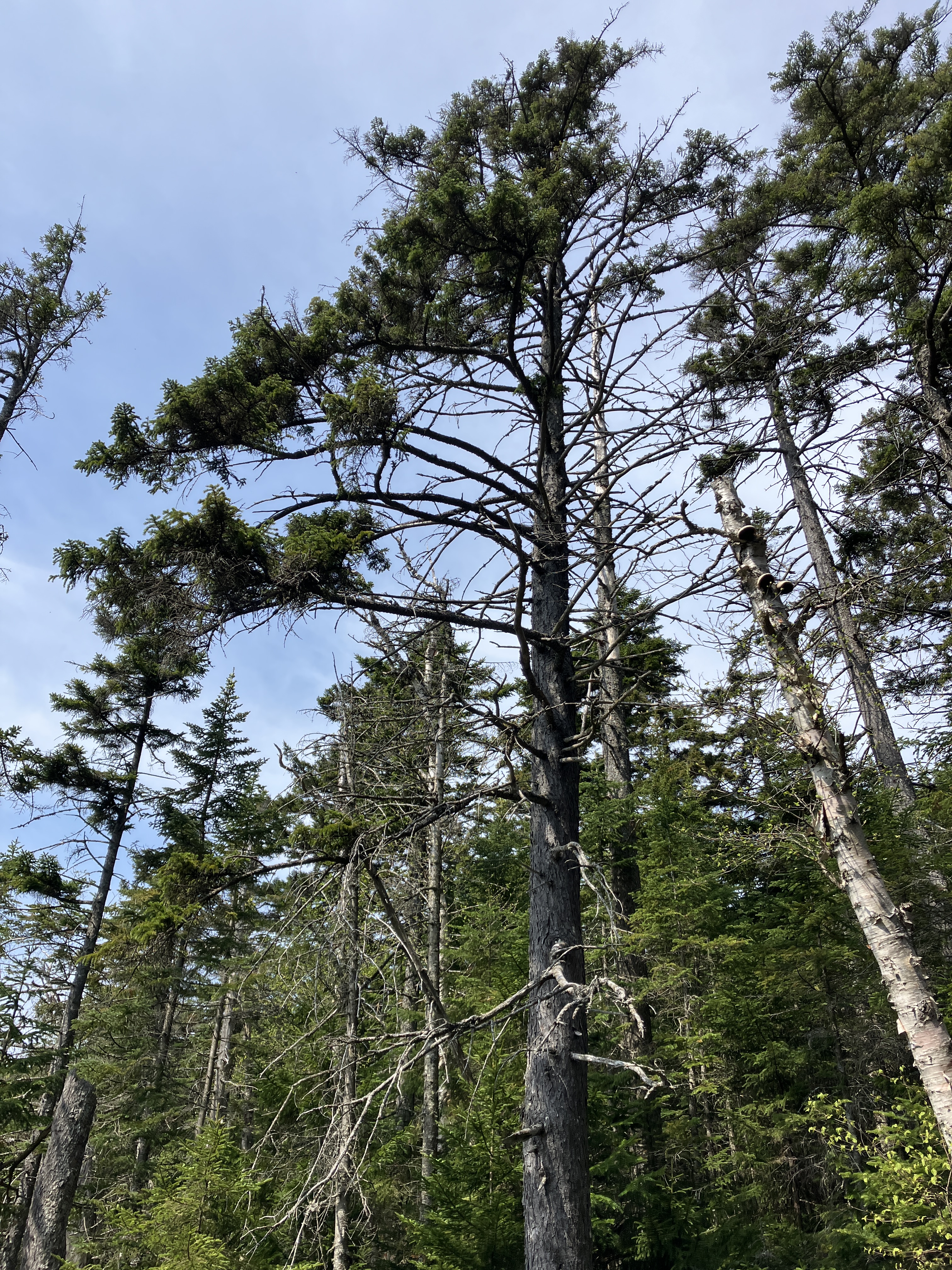
Some tall spruces overlook the brookbed/slide.
Looking up the ledgy swath.
For the 1350-ft. descent we stayed on the slope to the south, away from the waterfall and brook, and found generally decent woods, though steep in places.
Kris spotted this moose jawbone.
Ruby cools off in a forest pool.
Farther down, as we got into the hardwoods, we followed an old logging road for a while.
Near the bottom we followed a little ridge that I later discovered was a glacial feature known as an "ice-contact stratified deposit" from the Pleistocene era. These were deposited by the receding continental ice sheet and are shown on the Surficial Geologic Map of the Mount Moosilauke Quadrangle (2024), compiled by my friend P. Thompson Davis, Joshua A. Keeley, and Peter J. Thompson. Both the bedrock and surficial geology maps can be viewed, along with text commentary, on the NH Dept. of Environmental Services website:
www.des.nh.gov/resource-center/publications
A beautiful ferny glade down in the lower valley.
Back down on the Reel Brook Trail. "C'mon, let's go, this is the easy part!" Thanks to Kris and Ruby for a great adventure!


That was absolutely beautiful and amazing! I especially appreciated the links to the geology resources. I remember reading a large expose on the geology of the Garfield Ridge area you shared with us. Equally appreciated. You take care Steve. JimmyO jbborx@msn.com
ReplyDeleteThanks, Jimmy - glad you enjoyed it!
ReplyDeleteThank you for this wonderful trip report of high adventure in the Kinsmans! Love the “type 2 fun”
ReplyDeletecomment. Fantastic images as always…
Mark in Madison