I was overdue for a re-visit to the incomparable summit of Bondcliff, or the Cliffs of Bond, as they were referred to in bygone days. At 18.2 miles round trip it's a long slog, but the precious time spent savoring the views over the Pemigewasset Wilderness - in this case more then two hours - make it well worth the effort.
I can't count the number of times I've walked up the lower part of Lincoln Woods Trail, whether for short walks or en route to all-day remote bushwhacks - but I always find it enjoyable, at least when I'm fresh in the morning.
Washouts continue to nibble at the trail where it traverses a high riverside bank about 3/4 mile in.
Peering up the East Branch to Bondcliff and its south spur, miles away.
From the bridge over Franconia Brook, a view of Mt. Flume upstream.
Into the Pemi Wilderness.
Bed frame in the woods at the site of J.E. Henry's Camp 15.
Brambly clearing at the site of Camp 16, where the Bondcliff Trail turns left to begin the ascent of the mountain, 4.7 miles from the Lincoln Woods trailhead.
A confusing spot, just past the third crossing of Black Brook, where the trail descends a rocky brookbed for a few yards before making a hairpin turn left to resume the ascent. When descending the trail, one must swing to the right up this brookbed to reach the Black Brook crossing.
Above that hairpin turn the trail ascends three long rock staircases, the steepest stretch on what is otherwise a long gradual to moderate ascent up the mountain.
Just above the staircases is a neat nearly level, gravelly stretch that crosses a small old landslide.
From an opening you can look up at the high crags of Bondcliff, 1200 ft. above.
Black Brook is usually dry at the fourth crossing. On this day it was dry at the third crossing as well.
The ridgecrest is gained by long, sweeping switchbacks on a steep sidehill slope, following old logging tote roads that have become rocky in places..
Almost there.
There is just one tricky scramble on an otherwise very mild route. It's almost a cliff, but there is a series of convenient little platforms for footholds going up or down.
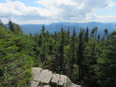
First views of the day at the top of the scramble, looking south to Mt. Hitchcock, the Osceolas and Scar Ridge.
Peering down from the top of the scramble.
Heading up through low scrub.
First look at Owl's Head and the Franconias to the west.
Spectacular walking heading up to the summit.
The close-up of slide-scarred West Bond rising from Hellgate Brook ravine has always been my favorite Bondcliff vista.
In the last decade, two new slides have been added to the Hellgate repertoire. The slide on the slope of Mt. Bond on the right fell during Tropical Storm Irene in 2011. The long fresh gash on the left rumbled down off West Bond during the Halloween Storm of 2017.
That is one impressive slide, very steep.
Looking southward from the Bondcliff summit.
Twisting valley of Hellgate Brook.
Mt. Garfield.
The wide expanse of the Guitar Slide.
Lincoln Slide.
The classic crag on which many a hiker has posed. Some don't venture out to the edge.
The Cliffs of Bond.
Down-look from the classic crag perch.
The steep, scrubby west ridge of Bondcliff. In 1995 I descended that ridge, crawling at times, and dropped into Hellgate Ravine to visit the Guitar Slide. It was a route I would not care to repeat.
The open ridge stretches away to Mt. Bond.
Scree walls define the trail in this precious alpine zone.
Franconia Range framed by a gully.
Looking NE to Mts. Field and Willey and the socked-in Presidentials.
Vast view over the eastern Pemi to the Nancy Range, Mt. Carrigian and North Hancock.
The wild north side of Hancock.
Top of the "Stinger Slide."
Closer look at the Desolation region on the north side of Carrigain.
Last view before dropping into the trees for the long walk out.
Open maple glade along the lower Bondcliff Trail, near Camp 16.


No comments:
Post a Comment