On a cool fall morning I headed over to the Paugus Road trailhead on the south side of the Sandwich Range for a loop hike over the south summit of Mt. Paugus to revisit the rough Old Paugus Trail and walk a new relocation on the Paugus Branch of the Bee Line Trail.
A stop at Chocorua Lake is mandatory when in this neighborhood.
The classic view of Mt. Chocorua.
A look at the day's objective. I had my eye on the slide-like rock slab on the left end of the summit ridge.
The first mile is a pleasant stroll up the valley of Whitin Brook, a beautiful nook of the Sandwich Range Wilderness.
This random piece of rail beside the trail was a puzzler - there was no logging railroad here.
After the first easy mile, the trail gets down to business and begins a stiff climb out of the valley. Around 2000 ft. you climb up through a steep, rocky, eroded gully and exit to the right. This photo is looking down from above the exit.
Then the trail climbs along the base of a sheer rock wall, of which Paugus has plenty.
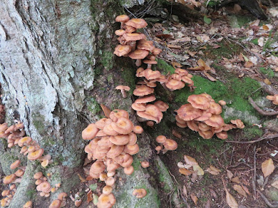
Tis the season for 'shrooms.
Above the Bee Line junction there are several ledge scrambles. This one is tricky as the rock is fairly slippery.
A framed view of Mt. Whiteface.
More scrambling leads to the first outlook.
A ledge at 2800 ft. looks south to the Ossipees.
Just above is a long sloping ledge that is wet at the top.
The trail levels on a wild spruce-wooded shoulder at 2970 ft.
Several more scrambles lead up to the ledgy knob of the south summit.
On the east side of the knob is a fine view of Mt. Chocorua.
The ledgy top of the south summit knob (3077 ft. by Lidar), where Old Paugus Trail and Lawrence Trail meet, has only very limited views.
The route down to the southwest view ledge passes to the right of these broken boulders...
...and along a short, obvious path through the scrub.
Down here is a spacious granite ledge, one of the great viewpoints in the Sandwich Range.
The view of Mt. Passaconaway and the cliffs of Square Ledge is especially fine. The knob known as The Overhang is down in front.
From the lower part of the ledge is a wide view of the Lakes Region.
Exfoliation.
On the way back I made a steep, prickly bushwhack to the cliffs/slabs at the south end of the summit. Here there was a marvelous view down into the Whitin Brook valley.
The long, steep slab below had the look of an ancient slide. Hard to tell.
Another view down the slab.
Looking down on Paugus spurs.
Descending the Old Paugus Trail, where the butt comes into play.
Typical Paugus terrain. It's not a high mountain, but it is surprisingly rugged.
Steep descent on the Bee Line.
Farther down Bee Line is a new 0.2 mile relocation cut this summer by the White Mountain Trail Collective working with the WMNF, bypassing an eroded section of trail. Lots of good trail work has been accomplished this year!


No comments:
Post a Comment