The inspiration for this memorable bushwhack came from a glimpse of a view I've obtained several times over the years: from the Israel Ridge Path as it climbs along the east side of Israel Ridge, en route to Mt. Adams. Between the branches I could see a lofty waterfall high on the headwall of Cascade Ravine (more properly known as the Ravine of the Cascades), the wild and rugged basin on the NW side of Adams. (Tree growth has now obscured this view from Israel Ridge Path.)
An AMC path into this ravine existed as early as 1883, and in 1888 a new path was cut all the way up the ravine, passing six notable cascades. Starting in 1891 the great trail-builder J. Rayner Edmands established three birchbark shelters in the ravine - Cascade Camp, Cliff Shelter and The Perch - and built a series of "pleasure paths" connecting with the Cascade Ravine Trail. In the early 1900s much of this network was obliterated by intensive logging, but the paths were restored by the Randolph Mountain Club, starting in 1910. Cascade Camp and some of the trail network in the ravine were then destroyed by the slides and floods caused by the big November 1927 rainstorm. The September 1938 hurricane finished the job with more slides and extensive blowdown. The 1943 Supplement to the AMC White Mountain Guide told the tale: "Until the flood of 1927 perhaps the most beautiful of White Mountain ravines, this valley has since been wrecked by a succession of storms and slides, especially the slides resulting from the September gale and flood of 1938. The beauty is nearly all gone, and the place is now hardly worth visiting, except to view the destruction. The trail is in very bad order..."
Thus since the early 1940s the ravine has been trailless above the First and Second Cascades, which are still accessed by the Israel Ridge Path.
I had long believed that accessing the big waterfall would be a very rough and difficult bushwhack. But after visiting the area on June 25 I was inspired to give it a try, and bushwhacking partner Daniel Newton was easily persuaded to join the effort. After visiting the First and Second Cascades, and checking out the site of Cascade Camp, we would head into the trailless ravine and see how far we could get.
The peaks were clearing as we set off on the Castle Trail from the Bowman trailhead.
These trails were all new territory for Daniel, a dyed-in-the-wool Watervillean.
One of three buckets around the site of an early 1900s logging camp.
When I first saw this depression the previous week I thought it was some kind of cellar hole, but my friend J.R. Stockwell, a logging camp aficionado, surmised - correctly, I think - that it was a root cellar for storing food at the camp.
On to the Israel Ridge Path - originally opened by Edmands in 1892 - for the second time in a week.
Along the Israel River.
Trailside patch of Wood Sorrel.
Scrubby growth where the trail crosses the track of a 1927 landslide.
Long climb along a steep sidehill into the lower part of Ravine of the Cascades.
The terrain gets rougher at the first junction with The Link.
A short descent on The Link brought us to the ledge shelf atop the First Cascade.
Cascade Brook tumbles down beneath the placid gaze of Mount Bowman.
Fine brook scenery upstream, as well.
We made a short bushwhack to a spot I had visited the week before, which seems the likely site of Edmands' Cascade Camp. A quote in Judith Maddock Hudson's excellent Peaks & Paths: A Century of the Randolph Mountain Club described the camp: "Two lean-to's at right angles facing a big rock, with the fire against the rock in the center."
This photo of Cascade Camp was taken by tramper Walter H. James in 1910 and appears on page 49 of Our Mountain Trips: Part II, 1909 to 1926, edited by Walter's grandchildren, Ben English, Jr. and Jane English. The stones of the fireplace can be seen in front of the rock face. Edmands and several associates built this birchbark shelter in 1892, and over the next decade the great
trail-builder welcomed many friends as guests there. As recounted in Peaks & Paths, Edmands was particular about things at Cascade Camp and his other camps: guests should remain in bed until Edmands had eaten his
breakfast of oatmeal and coffee, and dishes were to be washed with sand,
not soap, and dried with moss. Edmands passed away in 1910, and two years later his niece donated
Cascade Camp to the Randolph Mountain Club. The RMC quickly repaired
the structure, and that September 38 people attended the RMC annual
picnic at the camp. The next year over 80 hikers attended the annual
picnic at the camp. A photo of that event is seen on the cover of Peaks & Paths.(Photo courtesy of Jane English)
A duff-covered mound in front of the rock face at the likely site, when partly cleared off, revealed a pile of stones that we figured was the remnant of the fireplace.
Directly above this site is the overgrown track of the 1927 slide that wiped out Cascade Camp.
Returning to Israel Ridge Path, we made the short, steep climb to Second Cascade, scaling these sturdy ladders maintained by the Randolph Mountain Club.
Broad ledges and the sliding stream combine to create a wonderful scene at Second Cascade.
On his first visit to this spot, a happy camper.
Looking up the ledges.
Cascade Brook slips merrily down along the edge.
Daniel, who enjoys crafting poetry, was inspired to read several poems from Leaving the Low Country: Poems of Mountains and of Need, published last year by Timothy Muskat, a gifted writer and prodigious hiker (having completed the 4000-Footer Grid nine! times).
After our sojourn at Second Cascade, we struck into the woods, heading up into the unknown recesses of Ravine of the Cascades. We had in mind this intriguing description of the new Cascade Ravine Trail written in the December 1888 Appalachia by AMC Councillor of Improvements Frederic D. Allen: "Above the Lower Cascades the new path crosses the brook, and keeps in its bed (or not far above its southwest bank) by the long Lower Slip, by the leaping Middles Fall and the beautiful pool into which it plunges, by the Upper Slip and the Upper Cascades." Other descriptions from the early days simply refer to the Third, Fourth, Fifth and Sixth Cascades.
In a few minutes we came to what is labeled the Third Cascade in a photo in the AMC archives.
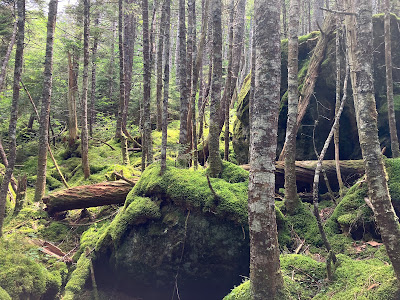
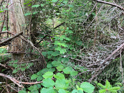
Verdure in the tangled forest of the ravine.
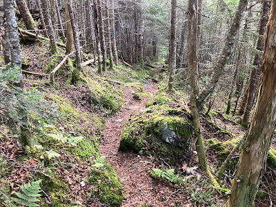
We slowly and carefully made our way up the rough floor of the ravine, taking care to avoid plunging into a hidden hole, and being mindful of minimizing our impact on the vegetation.
One of the few spots of easier going we found along the way.
We wondered if this might be the "Lower Slip."
Maybe the going will be better on that side.
The forest primeval.
We weren't sure which cascade this might be.
Mossy side view.
Some tough going through here. Where are the "pleasure paths," we wondered.
A hidden cave.
Looking down a waterslide. The "Upper Slip"?
Daniel and I took separate parallel routes for a short distance. I think I chose poorly.
A way through, barely.
This mossy brookbed provided temporary relief.
Reunited, we came to the lower, revegetated end of a slide that fell on the south side of the ravine, presumably in 1927. I had visited the open upper end of this slide a week earlier.
The cascades kept coming.
Wild rock scenery. Through the trees we could see lofty cliffs looming above. In this vicinity was located Edmands' Cliff Shelter, built in 1891, which was not as substantial as Cascade Camp and The Perch and by the early 1900s was no longer shown on Louis F. Cutter's map of the Northern Peaks.
Where's Daniel?
Steep!
Final approach to the big waterfall - we're going to make it!
We arrived at the base at 4:30 pm, after nearly three hours of bushwhacking.
We clambered up onto a tall boulder for a view from the bottom.
Daniel captured some great shots of False Hellebore and other local flora.
We ducked back into the woods and climbed to the next level, getting our first views out beyond the valley.
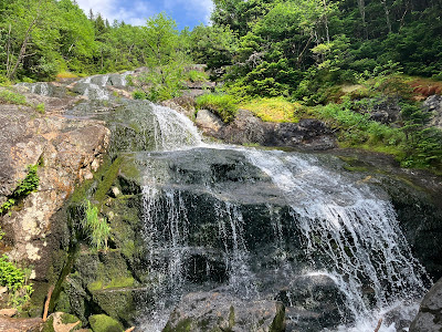
Cascade Brook dances down the ledges.
Another angle. We assumed this is the "Upper Cascade," visible from many points in the Jefferson area. We wondered if this large expanse of ledge was partly the result of one of the old slides. The 1929 Supplement to the AMC White Mountain Guide noted that the upper part of the Cascade Ravine Trail had been “erased by a slide or slides.” One of the slides could be followed up to the Perch Path and Randolph Path. "The slides, by stripping off the vegetation, have destroyed much of the beauty of the upper part of Cascade Brook.”
Carefully crossing at the top.
A "top o' the world" feeling at 3700 ft., peering out between the ravine walls.
Looking down.
Where the brook emerges from the woods at the top of the big waterfall.
Looking out over a spur of Nowell Ridge to Mount Starr King, Mount Waumbek, South Weeks and Mount Cabot.
We could have stayed here for hours, but the afternoon was gone and we did not want to be bushwhacking in the dark. We agreed that we would not like to descend the difficult 0.75 mile bushwhack route we had come up. My backup plan was to make a steep sidehill traverse across to Israel Ridge Path, about 0.3 mile long. This was a gamble, as the terrain and woods could prove to be quite gnarly and slow going.
At 5:50 pm we headed into the dense woods.
Our expectations for rough going were quickly met. Every step needed to be carefully chosen to avoid plunging into a treacherous hole.
Progress was measured in yards per minute. There may have been some profanity.
We crossed the overgrown track of another old slide.
Looking back. Kind of like The Link between Caps Ridge Trail and Castle Trail, but with no trail to follow.
A brief stretch of better going.
Uh-oh.
Virtually impassable. Time to back off and find a better route upslope.
Not here.
Here we go. Shortly after this Daniel heard voices above - indicating that Israel Ridge Path was within our range. We never saw those folks, or anyone else all day.
When we broke onto the trail at 7:20 pm, Daniel literally kissed the ground in gratitude. An intensely focused hour and a half to cover a mere 0.3 mile.
As we descended Israel Ridge, originally known as the Emerald Tongue, we caught this sunlit glimpse of savage cliffs on the east wall of the ravine.
I never thought I'd be watching the sun set high on the Israel Ridge Path.
Down we go.
Dusk drawing on at Second Cascade.
A brief foray onto the ledges before heading down, doing the last 2.3 miles by headlamp for a 10:30 pm exit. 'Twas a memorable day indeed!


No comments:
Post a Comment