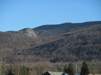
For many years a bushwhack to the huge cliff on a western spur of the Pilot Range, a few miles northwest of Mt. Cabot, has been on my wish list. Though the cliff is within the White Mountain National Forest, there is a mile and a half swath of private land between the scenic Lost Nation Road and the WMNF boundary. I knew a less direct route to the cliff entirely on public land was possible, but I had never followed through with it. Then last week Carol and I took a ride out Lost Nation way on a sunny afternoon, and a close-up view of the cliff inspired me to finally make the trek.
On the morning of my hike I paused on Lost Nation Road for a photo of the cliff (on the left) and the 3730-ft. peak of Hutchins Mountain.
This huge slab of syenite is about 250 feet high.
To reach the cliff, I made a long southeastward bushwhack traverse through the Town of Northumberland Watershed Forest, first following the drainage of Roaring Brook, where I came upon this nice cascade.
Farther upstream was this abandoned dam and water pipe.
As I continued up the valley, I found an old logging road that was going my way for a short distance.
Nice hardwoods in the upper drainage of Roaring Brook. In studying maps of this location, some show it as Northumberland Town Forest land, others as WMNF land.
An obstacle along the whack to the cliff was a climb up and over an intervening spruce-covered ridge, which had some rough terrain with poor footing and ample blowdown.
On the other side of the ridge I descended into the valley of Parks Brook, where I was greeted by a mess of blowdown.
It took a while to work a route around this.
Ferns and better woods ahead!
Parks Brook is pretty small, high up in its valley.
Good woods on the south side of the brook.
Heading up the flank of the ridge towards the cliff.
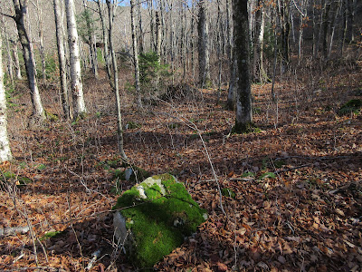
Better than good, these were spectacular woods.
I reached the crest of the ridge at a scrubby fern meadow just below the top of the cliff, with Hutchins Mountain in sight above.
There were several moose beds in this sun-filled meadow.
A short burst of climbing brought me to the top of the cliff. Now that's a perch, with a grandstand view of Hutchins rising above the valley of the north fork of Burnside Brook. The dogleg track of an old overgrown slide can be seen at the head of the valley.
Looking up along the top of the cliff.
A beaver meadow is seen in the broad hardwood basin below.
Zoom on the beaver meadow.
A startling down-look from the brink of the cliff.
The clifftop offers far-reaching views to the south and southwest, including the summits of 24 4000-footers. An hour and a half passed quickly here in the amazingly warm November sun.
Seen here (left to right) are South and North Twin, Owl's Head, Flume, Garfield, Lincoln, Lafayette, Cannon, South and North Kinsman and Moosilauke.
Mt. Cabot and Mt. Waumbek are seen beyond a spur of the Pilot Range, with Mts. Adams and Washington peering over between them.
This rocky knob juts up behind the cliff, on the crest of the ridge.
The top of the knob opens a view west to the mountains of Vermont's Northeast Kingdom, with the shadowed crescent of Cape Horn in the foreground.
From here I headed up the narrow, gentle ridge through fern glades mixed with gnarled birches and softwoods.
Tolkien forest.
This big open fern meadow shows up prominently in satellite photos.
A peaceful scene looking across to Hutchins Mountain and its old slide track.
A survivor of many winters.
From the fern meadow I descended down the head of the Parks Brook valley, passing this ancient logging road along the way.
This valley is home to many impressive yellow birches.
Tree of many limbs.
Reaching out.
Partway down the valley, it was time to climb over that miserable spruce ridge again.
Then back to hardwoods, though fairly slow going due to the thick, fluffy carpet of leaves hiding rocks and other underfoot hazards. I made it out just before dark, pleased that I had finally made an acquaintance with that awesome cliff.


Wow, what a beautiful spot, with a nice woods journey there and back. Great find, thanks for sharing!
ReplyDeleteAmazing! Such unique views. Interesting that Layfayette hides Liberty. What is hiding Jefferson from that angle? November has some of the best light!
ReplyDeleteJefferson is there, but it blends in underneath and is hard to discern unless the light is just right. I thought Flume was Liberty at first, but Peakfinder set me straight.
DeleteDo rock climbers visit this ledge?
ReplyDeleteI've seen one mention of it on a climbing forum, but it seems the difficulty of access due to private land has kept climbers away.
ReplyDelete