Tuesday was predicted to be the hottest day of the summer, and indeed it did hit 96 degrees in Nashua. Carol and I wanted to get another good long Pemi Wilderness hike in together before she started her work year at Lin-Wood School. This time we would head into the Western Pemi on the Franconia Brook Trail, aiming to get at least as far as the Hellgate Brook area. If the heat was tolerable, we'd continue the full eight miles in to No. 13 Falls, one of the most remote and beautiful spots in the Pemi. On such a scorching and humid day, the easy railroad grade walking on the Franconia Brook Trail would fit the bill, with several brooks for splashing and dunking. We headed across the suspension bridge at Lincoln Woods at 8:10 am, and into the cool of the forest.

We set an easy sauntering pace. No need to hurry on a long, hot summer day. The three miles on the familiar Lincoln Woods Trail went quickly enough.

Across the Franconia Brook bridge, we took the way to the left.

In its first mile, the Franconia Brook Trail (which is only rarely near Franconia Brook) crosses Camp 9 Brook three times. Camp 9 Brook, named for one of J.E. Henry's logging camps, flows out of a broad trailless basin on the SW flank of Bondcliff. This is the first crossing.

And the second.
 At 3.9 miles from the road the railroad grade leads ahead into a beaver swamp.
Here the trail makes a somewhat muddy diversion to the right between two beaver swamps. One spot on the edge of the western swamp provides a view up to the south end of Owl's Head - one of my favorite Pemi vistas.

The third crossing of Camp 9 Brook is at the north end of the relocation, via a flat-topped log.

Shortly after passing the junction with the Lincoln Brook Trail (4.6 miles), the Franconia Brook Trail runs along the edge of a scenic beaver pond. The westernmost spur of Bondcliff looms close by, and the shoulder of West Bond and the summit of SW Twin can be seen in the distance.

In the next half-mile there are several wetlands along the trail. This one had a profusion of tall Joe-pye-weed in bloom.

The water level is down in the area where the trail has been flooded by beavers the last few years. You no longer need to cross on the beaver dam, which has been breached.


Beyond here there is a nice long corridor through spruces.

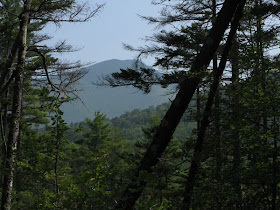
Approaching another beaver pond, there's a peek at West Bond up through the trees.

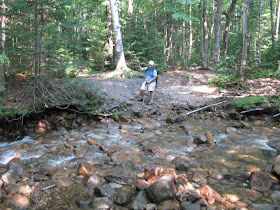
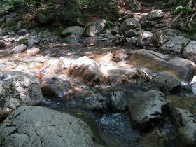
At 5.5 miles the trail crosses Hellgate Brook. The water level was down considerably from earlier this summer.

North of Hellgate Brook we bushwhacked down to Franconia Brook and found a wide rocky outwash, an ideal place to hang out for a while on a hot summer day. We spent some time sitting in the shade, then put on our Crocs and waded to midstream and sat on a well-placed rock, cooling our heels.

Next to the outwash was a small, mostly drained beaver pond with a look up at West Bond.

To the north was an outwash on the other (west) side of the brook. What a beautiful valley!

I waded across to it for a view up to SW Twin, a remote 4000-footer on the Trailwrights List that requires a long and difficult bushwhack to bag. That's one of three on that list I haven't done yet. Maybe someday...

Along the edge of the rocks there was a display of goldenrod and pearly everlasting.

Looking downstream I could see Carol reading her mystery novel.

When the sun made it too hot on the rocks, we packed up and returned to the trail. Nearby was J.E. Henry's Camp 10.

Here is what may be the divergence of two Henry rail lines - on the right, the main Franconia Brook line continuing north (along the trail); on the left, the spur line that crossed Franconia Brook to meet the long line that wrapped around the east and south sides of Owl's Head.

Near the north end of the camp clearing Carol spotted this old pipe on the trail; perhaps it supplied water to the camp from a spring.

Farther north we ran into our good friends Ken and Ann Stampfer. They were on the third day of a heat wave hut-to-hut trip. On Sunday they'd climbed over Mt. Hale to Zealand Hut, and on Monday they had slogged over to Galehead. Now they were headed down the valley to Lincoln Woods.

At the crossing of Redrock Brook there's a prominent USGS benchmark.

Redrock is a sizeable stream that flows from the big valley between SW Twin, Guyot and West Bond. As usual, we had to go upstream to find the best crossing.

North of Redrock there is some magnificent hardwood forest, rich with sugar maples, on the slope below the trail. Hard to believe this area was largely clearcut from 1903-1909, with the devastation from the 1907 Owl's Head fire thrown in.

The last big crossing is Twin Brook. Only a half-mile to go to the falls!


The trail leaves the railroad grade at a spot where you look down on this waterfall. This area is called "13 Falls" not because there are that many waterfalls (though there could be in the general area), but due to the proximity of J.E. Henry's Camp 13 - the end of the Franconia Brook (or Franconia Branch, as it was sometimes called) railroad line. On Sundays tourists could sometimes purchase tickets for a ride out to Camp 13 to take in the scenery (which must have been rather desolate) and sample some of the logging camp grub.

Downstream is a gorgeous pool, though there is no easy access to it.

The sweetest spot at No. 13 Falls is the big sunny, south-facing ledge slab on the east branch of Franconia Brook, with the north end of Owl's Head looming above.

It's an ideal place to snooze or read. No highway noise here!

At the base of the slab is this cascade.

Down here there is a series of iron pins in the rock. Perhaps there was a bridge or trestle of some sort across the brook.

What a peaceful backcountry scene...

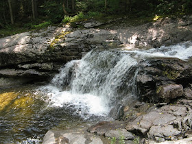
A short distance up the west branch of the brook is a fine waterspout falls.

Near where the two brook branches join you can get a glimpse of distant Bondcliff through the trees.

After an hour and a half visit, it was time to start the long but easy walk home.

A look at the lower waterfall from a different angle.

On the south side of Twin Brook was Camp 12.

Poking around here, I found a couple of sled runners...

...a piece of rail...

...and an unidentified container of some sort.

The 8-mile walk back from No. 13 Falls is mostly a gentle downhill stroll, such as this nice hardwood stretch south of Camp 12.

We took a break at Hellgate Brook, a peaceful spot in the evening.

At the northernmost beaver pond along the trail, the sun lit up the talus on the western spur of Bondcliff.
 Interesting views can be found up there, though the footing is loose and treacherous. These photos are from October 2006. Flume and Liberty...
 ...Owl's Head across the valley, with the beaver pond below...
...and Mt. Garfield at the head of the Franconia Brook basin.

Along the beaver swamp relocation I made a short side trip to the edge of the eastern swamp for a view up to Bondcliff and its southern spur.

In the five miles from No. 13 Falls to the Franconia Brook bridge, we saw only one other hiker. I dunked my head in the brook below the bridge, then whacked one of the biggest deerflies I've seen, a nuclear mutant that gave me a nasty welt on my back. The three-mile stroll out was uneventful, and I kept good on my promise to Carol that we would not come out by headlamp!
Steve . . . wonderful report, as usual!
ReplyDeleteI’m curious about the “divergence of two Henry rail lines” that you mentions. You mention a spur that would’ve went to your left (on your way in). You indicate this spur line would’ve met “the long line that wraped around the east and south sides of Owl’s Head. Am I correct in assuming that this is that the rail bed that we came across on our hike to “Owl’s Ear” this past winter?
Lastly, it’s good to read that you made good on your promise to Carol not to come out by headlamp. Sorry to say, but that isn’t one of my favorite things to do either!
John
1HappyHiker
John,
ReplyDeleteThat is indeed the rail bed we crossed last winter. According to the logging RR maps, the spur that went left led NW across Franconia Brook in a fairly short distance. On the west side of the brook the Owl's Head line then diverged off to the south, running along the east flank of the mountain, then swinging around the south side, where we crossed it.
Hey Steve,
ReplyDeleteYou have got to stop posting trip reports like this. Now June "demands" that we do the Lincoln Brook - Franconia Brook loop.
The Queen of Rust got all excited when she saw the rust in your pictures and she needs to redline a couple of sections of those trails. Actually it will be great to get back out there and do some exploring.
We were on Hale last Sunday and ran into Ken and Ann on the summit. It was definitely a heat wave hike weekend for them. Yowsa.
Great informative TR as usual Steve.
John & June