Late afternoon/evening hike (the day before the storm) into Tunnel Brook
Notch from the north, with a visit to the biggest of the several slides
on Mt. Clough.
Ever
since part of Tunnel Brook Road was washed out by Tropical Storm Irene
in 2011, the Tunnel Brook Trail has started here, 1.4 miles from Rt.
112.
The power of the storm on display.
Wildflowers abound on the decommissioned section of the road.
After
0.7 mile the road is in use for logging during the winter, but provides
pleasant walking in summer. The actual Tunnel Brook Trail becomes a
footpath at its former trailhead, 2.3 miles from parking.
The trail crosses the rubbly outwash of the brook that drains slide-scoured Tunnel Ravine.
Cairn art.
This beaver pond in Tunnel Brook Notch has filled in as a meadow. Looking north, with spurs of Mt. Clough on the left.
Looking south.
I ran into a mess of blowdown on the short but intense bushwhack to the slide.
This
is the largest of at least a half-dozen slides on the steep eastern
face of Mt. Clough. These originally fell in a big 1927 storm, and slide
activity was renewed in a 1942 cloudburst.
Varied vegetation on the slide.
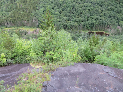
Down-look from a perch on the lower part of the slide.
I scrambled up a little higher.
Peering down at the beaver ponds.
The South Peak of Mt. Moosilauke, which has a great view down into this notch.
View
of the slide from the floor of the notch. Back in 1990 I ascended this
slide to its top. The bushwhack from there to the summit of Mt. Clough I
would not care to repeat.


Your last line of the post made me laugh out loud! Always enjoy your posts!
ReplyDeleteThanks, Dave! That was one gnarly bushwhack.
Delete