On a cold day with highs in the teens in the valley I undertook a long snowshoe excursion into the Gale River valley, ending with a bushwhack up to the largest remaining open patch on a narrow landslide that fell during the 1938 hurricane.
I approached the Gale River Trail via the longer route starting at "Five Corners" on Route 3, rather than the shorter route using the Beaver Brook ski trails, which had ski tracks and no snowshoe tracks. The gated Gale River Loop Road was plowed for the first 0.6 mile (for access to the Bethlehem water supply) and then was groomed for snowmobiling for the remaining mile to the trailhead.
The lack of snowshoe tracks at Beaver Brook suggested that the Gale River Trail would be unbroken since the snowstorm earlier in the week, and that proved to be the case. I would be breaking trail right from the start.
There was about 6" of nice powder at the start and that soon increased to 8", and even 10" farther up the valley.
Long gentle straightaways through hardwood forest are the rule in the lower 1.4 miles of the Gale River Trail.
Looking back. There would be no reinforcements this day.
The North Branch of the Gale River, getting locked in.
The snow got deeper and the woods more wintry on the mile-long 2011 relocation that starts at 1.7 miles.
Silence and solitude out in the valley today.
A fresh snowshoe track is a thing of beauty.
An occasional peek of sun along the way.
Garfield Stream was pretty well-frozen and I carefully navigated a snow bridge route across.
The next section of trail ascends easily through a beautiful open forest.
Blue blazes indicate that this trail connects with the Appalachian Trail.
There are three double log bridges that are awkward to cross in snowshoes.
An inviting corridor along the final approach to the bushwhack, three miles in from the Gale River Loop Road.
Angling up towards the old slide through mostly open woods.
There was probably a foot of powder out here, with a nice firm crusty base beneath.
Beautiful backcountry.
Hello hobblebush, my old friend.
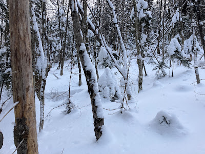
Snow-draped softwoods just waiting to dump a load of powder onto a meandering bushwhacker.
A natural line through the forest.
I emerged on the slide at the top of a steep gnarly pitch that might have proved troublesome to ascend.
As luck would have it, from here up to the big open patch the slide was a wonderful low-angle snowy highway.
Pure backcountry delight snowshoeing up through here.
Reaching the bottom of the open patch at 2700+ ft.
A winding route.
Deep powder atop a crusty base. This slide is low-angle (average 21 degrees) and broken-up, and the Mt. Washington avalanche report was for low danger, so an avalanche was not a concern.
I ascended to the upper end of the open patch, where I took a half-hour break and admired the wintry vista across the valley to a wild spur ridge of North Twin.
Snow-capped clusters of mountain ash berries.
Looking back up as I descended the slide.
Back down through the hobblebush.
Back on the Gale River Trail, descending on my partly broken, powdery track was the best snowshoeing of the season so far.
Recrossing the snow bridge over Garfield Stream.
A stair-like formation on the North Twin spur ridge. It was amazing that on this nice winter day I was the only wanderer in the Gale River valley.


No comments:
Post a Comment