I love snowshoeing on the Carter Range in late winter, when the snow piles deep in the beautiful fir forest on these high wooded ridges. The March snowpack allows for good views when there is merely a tunnel of trees in summer. On this gorgeous sunny Friday - one of the finest days of the winter, if a tad on the warm side - I planned to ascend to Zeta Pass, between South Carter and Mt. Hight, and attempt a bushwhack to a slide on the headwall below the pass. After returning to the trail, I would head up the ridge to South Carter.
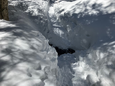
Nineteen Mile Brook Trail was pretty well packed, but I wore snowshoes from the start for stability and traction. With three feet of snow even at this low elevation, Nineteen Mile Brook was buried.
On to the Carter Dome Trail, which had a good snowshoe track. Thanks to those who broke it out!
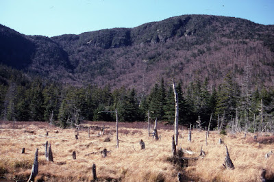
A spacious beaver meadow complex sprawls on the floor of the southern cirque. Back in late October 1996 my good friend, the late Creston Ruiter, and I bushwhacked up the long Cypress Brook valley and visited these meadows, then cut over to the northern cirque and climbed to a small slide (now mostly overgrown) on its headwall. We then headed back out to the Wild River Trail, doing the last part of the whack by headlamp. The woods in the upper valley were thick. At 8 to 9 miles round trip it was probably the longest bushwhack I've ever done.
The view from the beaver meadow in 1996, looking up at Zeta Pass and South Carter.
Side view of the slide.
Frosted firs.
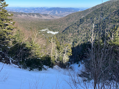
Partway up the ridge I followed a snowshoe track that diverged from the trail corridor and led up into a large blowdown area with deep firm snow and terrific views, the main feature being this look back at Mt. Hight and Carter Dome. There are several of these blowdown patches on the south side of South Carter, a legacy of the 2017 Halloween storm.
A zoom on its big NW slide, which apparently fell in the mid-1960s.
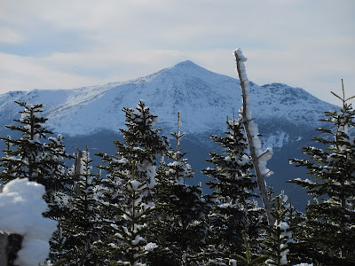
West to Mt. Washington.
After climbing through some dense woods, the diverging track rejoined the trail corridor, and I made the fairly steep climb to the little wooded bump that is the true summit of South Carter.
Mt. Adams.
On the east side of the summit the deep snowpack opened distant views.
Looking north to the ledgy SE ridge of Mt. Moriah, Shelburne Moriah, and far-off high peaks in the Rangeley, Maine area.
On the SE side of the summit a short path leads to a little clifftop where there is a view even in summer, looking across the NE shoulder of Mt. Hight to the Baldfaces.
Zoom on the snow cones of the Baldfaces. In the foreground are the vestiges of a 1927 slide on the NE shoulder of Mt. Hight.
The clifftop opens another nice view of Hight and Carter Dome.
Shadows falling across the trail while heading back down the ridge.
Last look at the evening sun on Mt. Hight before dropping down to Zeta Pass and enjoying an excellent snowshoe descent along the Carter Dome Trail.


So bizarre. I was just up Mt. Kinsman Trail on Sunday and started wondering about the slide brook and copper mine ravines and searched your blog for info. Was so suprised to see this today. I was looking over on the traverse between S. and N. Kinsman and the eastern spur of N. Kinsman looks pretty interesting, but hard to get too with all the private property around. Ever been?
ReplyDeleteHi Bob, Those ledges on the flank of North Kinsman are hard to get to from below because of the private land. I went to them once by whacking across the slope from Mt. Kinsman Trail just above the Bald Peak spur. 1HappyHiker and I once went up into Slide Brook by whacking across from Reel Brook Trail. Amazing cascades in there and we went partway up an old slide on the south side of the valley.
DeleteGreat post Steve. What snow shoes were you wearing? thanks
ReplyDeleteThanks - I was using MSR Evo Ascents with the 6" tails, since I was going off trail.
DeleteNice adventure, Steve. Just thinking about those spruce traps makes me nervous!
ReplyDeleteThanks, BC - I was proceeding very carefully in areas with small conifers!
Delete