Continuing a series of off-trail rambles in the ravines of Mt. Moosilauke, I bushwhacked into Tunnel Ravine, the huge glacial basin on the NW side of the mountain. Along the way I passed Tunnel Cascade and found traces of the long-abandoned Dartmouth Outing Club's Tunnel Ravine Trail (aka Tunnel Slide Trail) and Tunnel Ravine Shelter. From the floor of the ravine I climbed the slide that fell on the east wall in the mid-1980s and continued up through steep, dense woods to the Benton Trail, which I used for the descent. It was a full and rewarding day!
Among the many wildflowers along the overgrown road followed by the first section of Tunnel Brook Trail were these bottled gentians.

A pleasant section of the logging road followed by Tunnel Brook Trail farther to the south.
Along the footpath section of Tunnel Brook Trail, where the brook meanders out of a wetland.
I started the whack in this maple glade that is strewn with rocky outwash from the nameless brook that drains Tunnel Ravine. Fine hardwood forest extends up to the mouth of the ravine.
In some places the route of the old Tunnel Ravine Trail could be discerned, but in many other places there was no trace of the trail.
A partly hidden cascade along the brook.
There is a choke point in the lower ravine between a massive blowdown from 2017 on the east side and a very steep sidehill on the west side. It is not an easy place to pass.
Above the chokepoint is Tunnel Cascade, the largest of several waterfalls in the ravine.
Another angle. In a 1930 DOC guide to Moosilauke, the description of the then-new Tunnel Slide Trail noted this "long chute in the brook bed, the rock worn smooth
with the water."
View from above.
For a while above Tunnel Cascade the route involves either tedious sidehilling on the slopes or rock-hopping along the brook, as shown here.
Higher up the floor of the ravine broadens, providing some nice whacking through ferny woods.
The DOC opened the Tunnel Ravine Trail and built the Tunnel Ravine Shelter in 1930. Both were abandoned in the 1940s. The remains of the shelter can still be found at the site, though they are not as visible as they were when I first visited this ravine in 1996.
An old arrow is still attached to its tree.
Taking a break by the brook at the shelter site.
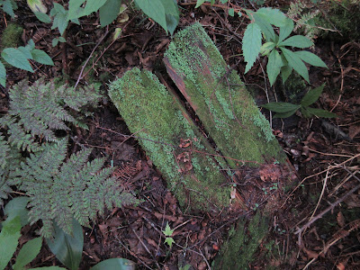
Mossy boards from the shelter.
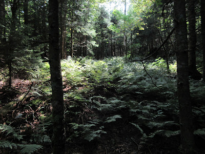
Continuing up the valley through more ferny forest.
A dry stretch of the brookbed provides an open route, though many of the rocks are slick.
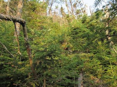
I angled up to the lower end of the mid-1980s slide; after nearly half a century, dense conifer growth is crowding the ledges here. When I first climbed this slide in 1996, tiny firs were just starting to establish a foothold, along with scrub birch and moss.
It was a bit of a struggle to push up through this lower section, as it was hard to locate stable footing under the dense shroud of conifers.
Steep ledges in profile.
Heading up towards the more open middle and upper sections of the slide.
Opening up.
Down-look.
A view across the ravine to the upper end of the huge 2011 Irene slide.
Views opening out to the west, muted by smoke haze from Canadian wildfires. One of several small white pines is seen in the foreground. I've seen these on several slides in locations where there are no mature white pines within miles. Wonder how the white pine seeds are transported to these slides.
Ledgy Black Mountain is seen nearby, with Vermont's humpy Signal Mountain Range faintly outlined on the horizon.
Fun scrambling up the ledges.
Some of the ledges are steep.
Fine bedrock exposures.
Found a good perch to hang out for a while in the hazy sun.
View from the perch.
Continuing up to the top of the slide.
A long way back down.
Perhaps the steepest pitch on the slide. The overall slope is ~33 degrees, but the upper section is 35+ degrees.
Top of the slide, at~3780 ft. The steep climb through the woods from here to the Benton Trail, at ~4330 ft., promised to be a workout.
I pushed through a dense growth of alders to get into the woods.
The whack up to the trail was slow and tiring, with lots of squeezing and pulling. This was one of the better sections.
There was a lot of this.
It paid to look back once in a while to see that I was making progress.
A rare open spot beckoned for a break.
Back to it, heading up into a fir wave.
A bonus view of the headwall and the Irene slide.
The only open woods on this whack greeted me where the slope leveled out on the final approach to the trail.
My favorite spot on the Benton Trail, where it traverses a 4100-ft. shoulder.
Passing through another fir wave on the Benton Trail.
Hazy dusk view of the Kinsmans from the Little Tunnel Ravine outlook.
Many slides have scored the walls of Tunnel Ravine over the years.


No comments:
Post a Comment