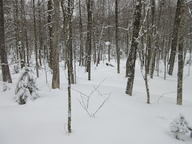
I enjoyed the 12" of fresh powder in Waterville Valley with a snowshoe up
the groomed Tripoli Road to Thornton Gap, making several trail-breaking
side forays to points of interest.
Tripoli Road was winter wonderland material today. It was interesting to experience it from a pedestrian's perspective.
A broken-down groomer heads slowly back with a snowmobile escort.
About two miles up the road, a short bushwhack led to an old beaver bog down off the south side.
Absolute silence reigned up here.
On the north side I bushwhacked through some fine open hardwoods.
This clearing may be the site of a logging camp from the 1930s/1940s. A camp is shown in about this location on the 1955 revision of the A.L. Goodrich Waterville Valley map. The clearing is found along FR 153. Will have to re-visit sometime after the snow is gone.
Deep tracks today.
Town boundary along Tripoli. The other side is Waterville Valley.
Approaching the height-of-land in Thornton Gap.
Beautiful, Catskill-like open hardwoods on the Tecumseh side of the Gap.
Never been here in winter before.
Breadtray Ridge crags seen from the trailhead. Many years ago I tried and failed to get down to these inacessible ledges.
A single set of fresh snowshoe tracks led up the Mt. Osceola Trail. Later I saw on newenglandtrailconditions.
I went a half-mile up the Mt. Osceola Trail just for fun, to see what it was like without its notorious rocks. Even with the deep snow I scraped on a few boulders.
Twisted yellow birches.
Crossing of a steep rocky stream on the trail.
On the Mt. Osceola Trail.
Heading back down Tripoli towards the beacon of Tripyramid's North Slide.
I broke trail through the woods to the Osceola Vista Campground. A Waterville XC trail goes through here, but a trail pass is required. (Trail passes are not required for Tripoli Road.) There was an impressive snowpack in the open area at the campground.
One campsite does give a fine view of Mt. Osceola. The ridge descending to the left was the route of the original trail up the mountain, dating back to the 1850s and abandoned by the mid-1900s.
The prominent slide fell during Hurricane Carol in 1954. Last winter Mark Klim and I bushwhacked to it on a spectacular sunny day.
Another side bushwhack brought me to the site of a driving dam on the West Branch of the Mad River from the early 1900s. The A.L. Goodrich maps from 1915 and 1925 show a pond here, it's now a clearing.
Boards from the old dam.
A timber and spike.
Looking up the West Branch.
My tracks coming up from the river and dam site. All told it was an interesting eight-mile snowshoe excursion.


No comments:
Post a Comment