Carol suggested we head over to Wild River for our last hike together in Summer 2010, before the school year starts. I'm always up for a trip to what has long been one of my favorite haunts in the Whites. Our destination was a nameless 3100-ft. ledge along the Kenduskeag Trail, on the easternmost knob of Shelburne Moriah Mountain. This expanse of rock has perhaps the finest view one can obtain looking south up the broad Wild River Valley and out to the high ridges that guard it on either side. I like to call it the "Zeacliff of Wild River" - its expansive backcountry vista is similar in character to that famed viewpoint overlooking the eastern Pemigewasset Wilderness.
With water levels still low despite some rain the day before, we chose the approach via the southern section of the Shelburne Trail, which requires a ford of the Wild River right at the start. The northern approach via Shelburne Trail off Rt. 2 has no difficult brook crossings, but the first two miles are on a recently active logging road and are not very appealing.
There is room for a couple of cars to park across from the sign marking the south trailhead, 5 miles up the gravel Wild River Rd. from Rt. 113.

In 0.1 mi. you reach the crossing of the Wild River. It could have been rock-hopped if you scouted around, but we had brought our Crocs, and it seemed easier just to put them on and wade across.

Looking downstream to an eastern spur of Howe Peak.

The water was relatively warm and not too deep. I'm always pleased by how well my Crocs grip on the underwater rocks.

After drying our feet in the sun on the riverbank, we continued a short distance to a rock-hoppable brook crossing.

Cairns marked the way through a confusing outwash area.
 Next the trail crossed a big dry brookbed.
 We clambered up a bank and immediately hit the junction with the Highwater Trail. If the Wild River is too high to cross, you can reach this point by starting at the Wild River Campground, walking 0.4 mi. south on the Wild River Trail, turning R on the Moriah Brook Trail and crossing the river on a suspension bridge (which is just outside the Wilderness), then turning R again on Highwater Trail and following it north to the Shelburne Trail; just before the junction you must cross Bull Brook without a bridge, but it's easier than the Wild River. This is 1.6 mi. longer each way than the direct route on the Shelburne Trail.
 For the next 0.7 mi. the Shelburne Trail provided delightful walking up an old railroad grade, a spur of the Wild River Railroad used at the turn of the 20th century.
After crossing a northern tributary of Bull Brook, we entered the Wild River Wilderness.

In another 0.1 mi. the trail turned R off the railroad bed and began a long, easy climb through a fine hardwood forest, following an ancient logging road up the valley of the tributary. Fine walking out here.


There were some interesting mushrooms along the trail. I'm pretty helpless with mushroom ID, please feel free to ID in the comments.


We followed moose tracks for a long way, including one spot where it made a little slide down a bank.

We were impressed by this pair of towering sugar maples.

Higher up in the valley, the woods became sprucier, the grade steeper and the footing rougher.
 In the upper mile there were quite a few overgrown sections, including this spot leading into the narrow col between Howe Peak and Shelburne Moriah.
 We reached the Kenduskeag Trail in a little clearing at the height-of-land.
The Kenduskeag is a neat ridgecrest trail that originally extended E over Howe Peak and lesser knobs and eventually down to the Wild River. The section east of the Shelburne Trail was abandoned in the 1950s. We followed this birchy section westward towards the knob with the view ledge.
 We had to pick our way along the edge of this mucky sedge meadow.
 A level stretch led beneath some small cliffs.
This steep, slippery ledge scramble presented a challenge just below the view ledge.
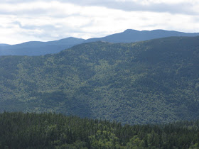
 Where the trail reaches its highest point on this knob (the summit is up to the R), you must scramble L up a steep ledge to access the flat outlook perch. It is well worth the effort! There's no better place from which to appreciate the expansive Wild River Valley. The Baldfaces on the L, Carter Dome/Hight on the R, and little Black Mountain way out at the head of the valley. Nearly all of this mountainscape is now within the Wild River Wilderness.
Nearby to the SW is Mt. Moriah and its loooong SE ridge, with the Carters peering over.
 The Royces are to the SE, with more ledges in the foreground.
 Shelburne Moriah looms to the W.
What a great place to hang out - we spent two hours plus here and no one came by until we were getting ready to leave.

There was, of course, time for a snooze.
 A zoom on Carter Dome and Hight.
The great rock knob at 3500 ft. on the SE ridge of Moriah.

While Carol finished her mystery novel, I made a short, thick bushwhack to a higher ledge.
 Parting shot, looking toward the Baldface-Meader ridgeline. Old logging roads (probably from a 1950s selective cut) can be seen on the lower slope in the foreground.
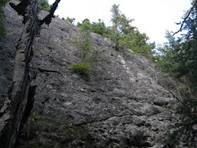
 Looking up at one of the cliff faces along the Kenduskeag Trail.
This mini-meadow was just off the Shelburne Trail down in the hardwoods. Several of these wet grassy spots could be seen.
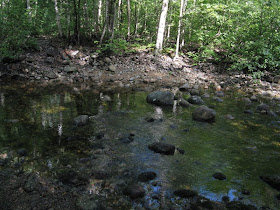
 A look down the dry brookbed as we approached the crossing of the Wild River.
 A successful crossing, with boots held high and dry! Another great day in a "wild" corner of the Whites. If you're interested in the Wild River area - its human and natural history, and how it became a Wilderness - I highly recommend the recently published book, Nature and Renewal: Wild River Valley & Beyond, by Dean B. Bennett. The hike described here is about 7.2 mi. round trip with 2000 ft. of elevation gain.
I've recently finished the book "Nature & Renewal~~Wild River Valley & Beyond" that you suggested a few months ago.
ReplyDeleteIt definately makes you want to explore this beautiful area,
Soooo we have it in our plans to check it out a bit when we're up there for a week around Labor Day, I esp want to see the Old Hemlock too.
Your wonderful trip w/ Carol sounded so beautiful and the pictures looked so peaceful!
I can't wait to get out there & trek around this Wild River area.
Thanx so much!
Tricia
Thanks, Tricia - Wild River has a unique feeling, unlike any other place in the Whites. I think "Nature & Renewal" does a good job of conveying that. Have fun exploring!
ReplyDeleteSteve
I'd forgotten to check your blog over the last few months, so now I am spoiled with all this great reading! The Wild River area is one of my favorite places - I am more than ever looking forward to visiting that ledge! Looks like it was taken from what my Grandfather labeled "Unknown Peak" on the old Moriah Skyline trail. Thanks for the great photos and descriptions!
ReplyDeleteThanks Chris - Wild River sure is one of the best areas for ledge-hunting. That's some great sleuthing you did on the "Moriah Skyline Trail." Unknown Peak it is!
ReplyDeleteSteve