It's been a great year for foliage, and right about now is the proverbial "peak" in the southern White Mountains. The loop over Mt. Tripyramid from the Waterville (west) side is a favorite of mine at this time of year - you walk through hardwood forest for miles to and from the mountain, and up top you have great views over the colorful valleys.
I got an early start from the Livermore Trail parking area. There had been a few morning showers, but North Tripyramid had emerged from the clouds as I crossed the Depot Camp clearing.

About a mile in the trail crossed a clearing, with a colorful hillside ahead.

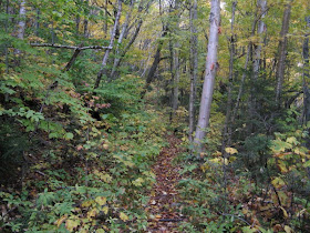
The leaf-strewn, winding Livermore Trail is an easy approach and it shines at this time of year.

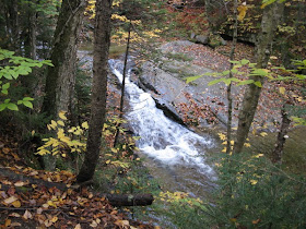
A cascade on Avalanche Brook.
 Three miles in the trail passes the site of Avalanche Camp, an old logging camp, on the left.
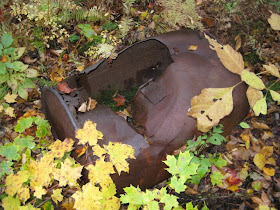
I spent a few minutes poking around the area and found what looks like an old boiler of some sort.

A bunch of bed frames had been dumped over a bank.

After 3.8 mellow miles, I turned right on the Scaur Ridge Trail. This provides a much easier approach than the steep and difficult North Slide. The lower slabs of the slide would have been wet and very tricky today, and Scaur Ridge is one of my favorite woods walks, especially in the fall. (The prevailing wisdom on the Tripyramid slides loop is that you go up the North Slide, which has very steep, slippery slabs in its lower part, and go down the looser, gravelly South Slide. The North Slide fell in 1885; the first South Slide came down in 1869, and a second parallel slide cut loose in 1885.)

At the start the Scaur Ridge Trail passes through a fine stand of sugar maples.

Farther up there were several octopus-like beech trees to the right of the trail.

"Mellow" is an apt description for the Scaur Ridge Trail.

From one spot you get a peek at the imposing North Slide.
 At five generally easy miles from the start, you meet the Pine Bend Brook Trail on the level crest between North Tripyramid and Scaur Peak.
After traversing the shoulder, the Pine Bend Brook Trail wanders through nice woods to the base of North Tripyramid.

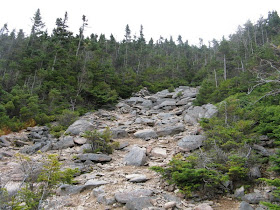
Then there's a steep, rough, winding climb with a number of ledge slabs and steps to negotiate. This north-facing slope is always damp, and the rocks were cold and wet on the hands today.

The summit of North Tripyramid offers only limited views. The best is found via a short beaten path on the NE side, a stand-up vista looking across the Albany Intervale. Church Pond sparkles on the flats, with Bartlett Haystack and Bear Mountain beyond.
 By far the best view from North Tripyramid is at the top of the North Slide. It's well worth the steep (almost 300 ft. in less than 0.2 mile) descent from the summit via the Mount Tripyramid Trail. Here's the view towards Mt. Osceola upon emerging at the top of the slide. I made my way down to the boulder seen below on the left, a fine spot to take in the scenery.
 Looking back up at the top of the slide. The trail exits left at the large cairn.
 Looking down, the slope seems to fall off the edge. Two young guys - the only hikers I met on the mountain - came up and advised me not to go down that way. I assured them that was not in the plan!
Looking north, Mt. Carrigain had a tail of fire.

For a minute the sun lit up the slopes of Osceola. It was cold and windy on the slide, prompting me to add all my layers plus hat and gloves.
 You look down on Scaur Peak, with Hancock and the Bonds beyond. Some of the higher summits to the north were socked in all day.
Mt. Kancamagus is seen from an interesting angle, with its southern arms enclosing the isolated basin of Kancamagus Brook.

After enjoying these views, I climbed back to North Tripyramid and continued across the ridge to Middle Tripyramid. The summit of Middle is an uplifted ledge with a good standing view east to Passaconaway and Chocorua, with some color bursts down in the Sabbaday Brook valley.

I took a long break at the west outlook, where you can sit and enjoy the vistas. As I had hoped, there was a bonanza of color in the Waterville Valley.

Mt. Moosilauke is perfectly framed by Thornton Gap.
 From this ledge you peer down into the broad lower basin of Cold Brook, which spreads out between spurs of North and South Tripyramid. The lower valley is almost pure hardwood, good for both foliage viewing and snowshoe wandering.
There was good color on the low ridge leading across to "The Scaur," with Osceola beyond.

Heading south, you drop down through a rocky chute off Middle Tripyramid.

Cozy fir woods along the ridge.

Near the top of the short, steep climb up South Tripyramid, I looked back for a vista of North (left) and Middle (right), with Mts. Carrigain and Willey between them.

From the top of South Tripyramid I bushwhacked down to a ledge with some unusual views. This may be the same ledge referred to in Moses Sweetser's classic 1876 guidebook, The White Mountains: A Handbook for Travellers. In those days there was only the first of the two South Slides, referred to as "The Great Slide," and Sweester noted that the South Peak was the only Tripyramid summit that was regularly climbed. "There is no view from the peak itself," he wrote, "except for such as may be pleased to clamber up a tree and hold on.... On the S. side of the S. peak is a projecting ledge which commands a fine view over the lake-valleys."
Through a break in the trees I found this view of Flat Mountain Pond and Mt. Israel.

A profile of Passaconaway and the Rollins Trail ridge leading across to Whiteface.

A view east to the Moats and distant Pleasant Mountain.

A look down into a DEEP hole between parts of the ledge - like a natural well.

Lake Winnipesaukee seen over the long SW arm of East Sleeper.

The wild heart of the Sandwich Range: Whiteface (left) and its West Spur (right) seen over the broad domes of The Sleepers.

Peering down into the valley of Sabbaday Brook.

Back on the trail, I made a very steep descent to the South Slide.

Near the top a great rock seat beckons.
 Unique to the South Slide is a wonderful vista over the remote area of Lost Pass and the northern Flat Mountain, with Sandwich Dome presiding above. Tough lighting late in the day.
 Distant visibility was excellent - Mt. Monadnock is clearly visible on the right, over the shoulder of Sandwich Dome.
Descending the South Slide.

Looking back at the upper part of the slide.

Partway down, a view of the long SW arm of East Sleeper.

A fairly tricky scramble in between the upper and lower parts of the slide.

The walk out from the base of the slide is one of my favorites - easy to moderate grades, good footing, and gorgeous hardwood glades.

Farther down, there was a tantalizing glimpse back at Black Cascade.

I paused briefly at this favorite rest stop beside Slide Brook, but had to keep moving. For once, I made it out - barely - without breaking out the headlamp.

No comments:
Post a Comment