A trip into the Great Gulf Wilderness is always a special treat. This huge glacial scoop between Mt. Washington and the Northern Presidentials presents hikers with some of the grandest alpine scenery in the East. As the AMC White Mountain Guide has noted through its many editions, "The views from its walls and from points on its floor are among the best in New England." The Great Gulf was the first designated Wilderness in the Whites, created under the Wilderness Act of 1964. The photo below was taken from the Gulfside Trail on a previous hike. Diminutive Spaulding Lake can be seen on the broad floor of the valley.

Of the seven maintained steep trails that shoot up from the floor of the Gulf to the craggy ridges on its rim, the only one I hadn't hiked was the Chandler Brook Trail, which shadows its namesake brook up through a wild ravine on the north side of Mt. Washington's Chandler Ridge. This trail, like most of the other "steep seven" routes, was cut in a trail-building spree in 1908 to 1910 led by stalwart AMC trailman Warren Hart.

June 4th promised to be a fine cool day of sun and puffy clouds, perfect for a ramble into the Gulf. As luck would have it, two friends - Allen Koop and John Compton - were planning to drive up the Auto Road to the summit of Mt. Washington and wander some of the trails in search of alpine flowers and historic sites. If I timed it right, I could poke along through the valley, then scramble up Chandler Brook Trail and catch a ride down off the mountain. Sure, it's sorta cheating, but why not take advantage of a lucky break?
I parked at the Great Gulf trailhead off Route 16 and set off about 9 am.

In a short distance the trail crosses the Peabody River on an impressive suspension footbridge.

In the next half-mile there's some easy walkin' through a fine spruce and hemlock forest.

The ladyslippers were in peak form.

About 0.7 mile in the trail passes by an idyllic ledgy spot on the West Branch of the Peabody, the river that drains the Gulf. A great reward for a short walk.

Bluets were abloom in crevices amidst the ledges.

Aaahhh... Wilderness, shortly before the junction with the Osgood Trail.

Instead of the direct approach to the viewpoint called The Bluff on the Great Gulf Trail, I made a longer loop up over the lower section of the Osgood Trail and the Osgood Cutoff. John Compton happens to be the trail adopter for both of these sections. Both trails were in great shape. Along the way there was evidence that the AMC trail crew had made their annual spring blowdown patrol.

There was some deep leafy forest along the Osgood Trail.

This is a major junction along the Appalachian Trail.

I made a short side trip to check out the Osgood Tentsite, which has five tent platfroms.


On the way across Osgood Cutoff, I visited a favorite spot - an opening atop an old slide, just 25 yards off the trail and reached by a beaten path - with a neat view of the Gulf and its enclosing ridges.
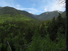
Mt. Jefferson, with its lingering snow patches, dominates from this angle.

From here I dropped down the Cutoff to the gravelly opening of The Bluff. To get the best view, you must scramble up this boulder.

From the top of the rock you can gaze up at Mt. Adams...

...and the massive flank of Washington's Chandler Ridge.

Continuing on the Great Gulf Trail, there was an easy rock-hop across Parapet Brook.

Just above here the Madison Gulf Trail splits off to the right and rides the crest of an interesting small hogback. The trail was relocated here about 20 years ago and I had never walked this part, so a side trip was in order. I followed Mad Gulf up until the old route joined from the right, then returned to the Great Gulf Trail.
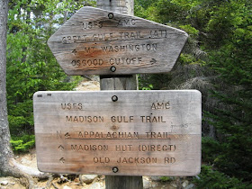
On the other side of the Great Gulf Trail a spur leads down to the end of the hogback and a great tent site perched high above and between the West Branch and Parapet Brook.
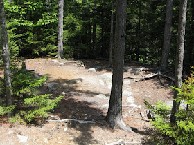
The Great Gulf Trail next crosses the West Branch on a very bouncy suspension bridge.

The trail soon comes close to the tumbling, boulder-strewn river, with a view upstream to Adams. From here up to Weetamoo Falls is one of the finest riverside walks in the Whites.

A little farther there's another tentsite next to aptly-named Clam Rock. While looking at the rock, I thought of bushwhacker extraordinaire J.R. Stockwell, who this March completed his goal of climbing each of the 48 4000-footers by a bushwhack route in winter, almost always solo. Many he has done by multiple routes. This winter, he told me, he made a direct ascent of Adams starting at Clam Rock. That's 3400 feet of elevation gain, straight up. On another trip he made a beeline ascent of Mt. Jefferson from the floor of Jefferson Ravine. My goodness.
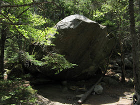
In another quarter mile there's a wonderful spot on the river with rock seats where you can gaze upstream at Jefferson's Knee.

This wild arete is the ridiculously steep route of the Six Husbands Trail.

The Great Gulf Trail isn't steep as it follows the river, but the footing is often rough and rocky, and the whole area has a primeval feel.

The Chandler Brook Trail breaks off the Great Gulf Trail at the 3.8 mile mark. Time to get ready for 1300 feet of up in 0.9 mile. The first part of the trail was actually quite mellow.

The guidebook description notes that there are numerous cascades on this trail. The first one appeared within a quarter-mile, and they kept coming and coming - sort of a Mt. Washington version of Moosilauke's Beaver Brook Trail.


The trail itself is narrow, mossy and wild.

The second brook crossing, like the first, is made at the top of a cascade. This one has a bit of tricky footing as you step out on a sloping ledge.

Out in the middle of this crossing, you look up at another cascade.

And looking down the open brookbed, you see this...

This unexpected base-to-summit frame of Mt. Adams literally stopped me in my tracks. Holy cow!

From the far side Mt. Madison joins in the fun. Even if you go no farther up, this spot, about 0.4 mile and 500 feet in elevation up from the Great Gulf Trail, is more than worth the price of admission.

A stubborn snowbank provided the backdrop for yet another waterfall.

And this one could only be glimpsed through the trees...too bad.

The third crossing is made at the edge of a pretty cascade.
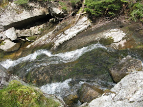
Above here the trail veers away from the brook with some classic Great Gulf steep-and-rough stuff.

Then you break out onto open talus with views back to Mt. Adams and Jefferson Ravine.

Another angle on that stupendous Jefferson's Knee.

The upper part of the trail is a steep talus scramble.

And then, at last, the top and the Auto Road. From here you can walk 100 yards down the road to the parking area at "The Horn."

Adjacent to the parking area are ledges with wide views northeast to the Mahoosucs and western Maine....

...north to Mt. Madison and Osgood Ridge...

...and east to Carter Dome and Mt. Hight. It being midweek in June, traffic on the Auto Road was very light and hanging out here was very enjoyable. In 40 minutes only one car pulled in to this parking area.

I was a little later than I wanted getting to the road, and feared I had missed my possible ride down. I had left it open-ended with John and Allen that I might be there, but implored them not to wait if I wasn't. But just as I was about to pack up for the five-mile return through the Gulf, I saw what might be Allen's car kicking up dust as it descended one of the switchbacks high above. A couple of minutes later Allen pulled in and I happily accepted his offer of a trip down what John has dubbed the "Chandler Ridge Trail." It was an enjoyable ride down chatting with Allen and John, and Rick B., who had joined them for their Mt. Washington meander. A great ending to a spectacular day in the Gulf.

Steve, it’s a real challenge to rank one of your blog reports as better than the other. They are all superb. I don’t know, perhaps it’s because of the subject matter (I love the Great Gulf area). But regardless of the reason, I would rank this particular report as one of your very best.
ReplyDeleteJohn
1HappyHiker
Thanks so much for this report, Steve. I stumbled upon it while looking for pictures of the Six Husbands Trail, which I was hoping to climb on Tuesday, August 19, 2014. The water was too high for me to cross. I guess I could have made it if I’d been more daring — two young guys made it across — but I chickened out. I guess there was a lot of rain the day before, which I hadn’t been aware of.
ReplyDeleteAnyway, I tried the Sphinx Trail, but turned back at its third crossing, right above the tall waterfall. I didn’t trust the soles of my boots to not slip.
I climbed Chandler Brook Trail when I got back to that point, figuring I could still salvage the hike. Unfortunately, I wasn’t able to see the full-length view of Mount Adams that you had, because I had to concentrate on the log I was using to cross the brook, and the view wasn’t as good from either bank as I guess it was in the middle.
Still, it was a worthwhile climb, and I would never have done it if I hadn’t seen this report from four years ago, so thanks again.
This was just my second-ever trip into the Great Gulf — the first came 11 days earlier when I climbed Madison via Madison Gulf Trail — so I’ll definitely be back to try again for Six Husbands and the other yet-explored trails.
Thanks, Raymond. I was surprised at how scenic Chandler Brook Trail was. All the trails in the Great Gulf are certainly rough but highly rewarding. Enjoy your explorations!
DeleteSteve
Hi Steve! I know this post is a little old but if you could give me a little more information about the location of the viewpoint off of Osgood Cutoff that would be much appreciated.
ReplyDeleteAs I recall, it was at a spot where the trail makes a fairly sharp turn. It may be a bit overgrown by now...
Delete