One of my favorite local backcountry haunts is the remote Gordon Pond area on the east side of Kinsman Ridge, south of Mt. Wolf, and the beautiful valley below it drained by the various branches of Gordon Pond Brook. The best-known attraction of this region is Gordon Pond itself, one of the most serene mountain ponds in the Whites, nestled on a high plateau at the base of Mt. Wolf. Here's the pond seen in its bowl from a ledge (off-trail) on Mt. Wolf.

And here is a look up at Wolf from the shore of Gordon Pond, reached by a side path off the Gordon Pond Trail. The first night of my first hike ever in the Whites, in 1972, was spent encamped near the shore of this pond.

Explorations in the valley of Gordon Pond Brook have revealed other, more hidden treasures, including waterfalls...


...views from an obscure ledge on a nameless ridge...


...and many acres of fine hardwood forest, featuring some good-sized specimens.

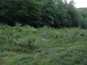
Last year from that viewpoint on Mt. Wolf my friend John and I spotted an intriguing boggy area on a plateau under a southeastern arm of Kinsman Ridge (seen on the left in the picture below). On June 10, with an afternoon free and clouds obscuring any chance of summit views, I decided to return to the Gordon Pond Brook valley and try to bushwhack to that bog to see what it was like. If the clouds lifted, perhaps there would be a view of Mt. Wolf.

I used a local's approach to the Gordon Pond Trail, which I won't describe here. The magic of this trail begins after you make the final crossing of the powerline at the 2-mile mark. On occasion I've picked up as many as a dozen wood ticks within this hundred feet of brush. But on this cool, murky day I didn't see a single tick.

Beyond the powerline you enter the 11,000-acre Mt. Wolf-Gordon Pond "roadless area," which is currently protected from road-building and logging under the Forest Service's national "Roadless Rule." I hope it stays that way. (For maps and photos of White Mountain National Forest roadless areas, visit www.roadlessland.org). Within a quarter-mile you cross the good-sized Gordon Pond Brook, not easy in high water.

For the next mile and a half the Gordon Pond Trail ascends at an easy to moderate grade through one of the most beautiful hardwood stands in the Whites. It's not old growth, but the trees are reaching the mature stage, and the canopy is lofty indeed. On the lower section there are some towering white ash trees.


After climbing up an old logging road high up on the side of the valley, you cross a side brook that dances down the rocks in a chain of small cascades. You have to slip over a steep ledge to make this crossing.

In another half-mile the trail crosses at the top of Gordon Falls, which drops into a tall rocky chute. Watch your footing here!

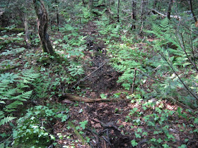
A short distance above the falls, I left the trail in search of the bog. At first the woods were reasonably open, with an occasional moose path to help me along.

Then came a wide band of dense young conifers littered with blowdown. There appeared to be no reasonable way around it, so I slowly pushed my way through the wet brush, stepping carefully on the slippery old logs underfoot.

In a while I came to the branch of Gordon Pond Brook that drains out of the bog. This was the ticket!

Soon I was following a grassy swath out to the bog. From here across, I tried to step on grassy hummocks and old logs as much as possible to minimize damage to vegetation and maybe keep my feet a little drier.

As I emerged into a more open area, a nameless spur of Kinsman Ridge could be seen to the south through the stark stands of dead trees.

On this boggy flat the brook was barely moving.

This was one of the most wild and desolate places I've seen in the Whites. It was even more haunting as the sad whistle of a White-throated Sparrow drifted across the bog. Other songsters here included Magnolia, Blackpoll and Nashville Warblers, Olive-backed Thrush and Yellow-Bellied Flycatcher.

From one open area I caught a glimpse of the spur of Mt. Wolf known as the "Wolf Cub," familiar mostly to a handful of 3000-footer peakbaggers.

The clouds parted for some breaks of sun, and from the south end of the bog I was treated to nice a view of Mt. Wolf, the 3500-ft. peak that rules over this southern part of Kinsman Ridge.

Seeking a less dense route back to the trail, I struck off into the woods on the south side of the bog and found a nice birch glade. While taking a break here (there was no place to sit out on the bog), I heard a Bicknell's Thrush sing several times. This was startling, as they normally inhabit the stunted growth at higher elevations, mostly above 3000 ft. The bog is only at 2350 ft., but perhaps the scrubby growth around its edges suits the Bicknell's.

The woods going back were a mix of the good, the bad and the ugly. There seems to be no easy way to get to or from this place. But one moose path provided good walking for a short way.

Eventually I crossed the brook that flows from the bog, now become a mossy, rocky mountain stream.

On the far side was a particularly lush forest glade.

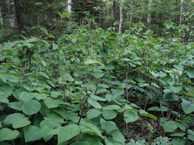
There was a few hundred feet of hobblebush wallowing.

I popped out right at the base of Gordon Falls, where you get a view of it not obtainable from the trail.

It was too late to head up for a look at Gordon Pond, and the trail from the falls to the pond can be a mud pit in places, so I turned my boots homeward. The stroll back down through the Gordon Pond Trail hardwoods was a fine way to conclude this enjoyable afternoon and evening jaunt.

Steve, my buddy Nate and I just spent the day bushwacking in the area bounded by the Kinsman Ridge, the Gordon Pond Trail and Rte 112. I checked your blog after getting back since you seem to be the only person that a good google suggested was very familiar with the area. We originally were following the correct trail but left "The Guide" in the car, erred, and spent the rest of the day exploring. It is a REMARKABLE region. Our best guess at our route is posted on my blog at http://muthaz.blogspot.com/ but more to the point I posted a link to your blog in my post on this latest trek. Can I also post a permanent link to your blog in my linklist?
ReplyDeleteLastly, thanks for all the great work on The Guide. We've all hammered out the 48 numerous times and over the last few years have been exploring in the backcountry with the help of the book.
Muthaz,
ReplyDeleteNice exploration you guys did through the Kinsman Ridge hinterlands! A lot of interesting country out there, and not much traffic beyond the moose. Looks like you went up the steep-faced ridge south of Gordon Falls. Last year John and I found some good views east from a couple of random ledges there. Then it looks like you went over one of the bumps of "Lost River Mountain," as it's named in an old guide to the North Woodstock area. Some good ledges on that peak, including the so-called "Monkey Cliffs" that can be seen from 112 heading up towards the notch. Be happy to have a link - thanks! Enjoyed looking at your blog and will keep checking back.
Steve
Any areas close to the AT near the pond, one could set up a camp? Looking to hike a section of the AT in August this year 2018.
ReplyDeleteI imagine you could find sites
Deletenear the AT/Gordon Pond Trail junction, and also down near the pond, which isn't far off the AT at all.
Steve
The third picture down from the top, a series of slides/ cascades, I would like to hike in and find it. Curious if you would reveal its proximity, is it closer to AT side or closer to Woodstock side in terms of entry point. Thanks for your help.
ReplyDelete